


This post was updated on November 16 at 9:20 am
11/16 Update at 9 am
Acres: 208,913
Containment: 92%
Date Started: August 13, 2020
Cause: Under Investigation
Personnel: 407
Yesterday, despite the issued wind advisory, it was deemed safe for firefighters to enter the field. In the northwest section of the fire, snow was cleared off the roads by ground support and excavators worked along the 86 Road. It was a very successful day as crews launched repair of the equestrian trail south of Red Feather Lakes Road, continued road repair on Mt. Clover, and resumed private land dozer line restoration. The dozer line on the 68C Road has been repaired and is ready for inspection. Crews also worked on equipment backhaul. In the southeast section, in the Dunraven Trail and The Retreat area, crews continued work on repair and chipping in order to decrease fuel loads. Crews completed repair on three sections of handline in Lazy B Ranch off Pingree Park Road. In the Bobcat Ridge area, crews continued dozer repair work. Throughout the day, crews patrolling the fire perimeter reported a slight haze and smell of smoke in the Pingree Park area. Fire managers are confident these pockets of fuel and large logs will simply smolder beneath the snow over a period of time posing little threat to the community. A Multi Mission Aircraft (MMA) completed an Infrared (IR) flight and some scattered heat was found in the interior of the fire. These areas will continue to be monitored and patrolled and resources are available to respond if needed.
Today, the wind is forecast to subside allowing firefighters to safely engage in suppression repair. Many of today’s tasks are comparable to yesterday’s. On the 86 Road, crews will work on rehabilitation of hand line cut into the ground during suppression activity. In addition, crews will repair dozer lines along Red Feather Lakes Road, work on the equestrian trail and continue slash dispersal in the area. Rehabilitation of handline and dozerline will also include the Glen Echo area, Upper Manhattan and the area near the Buckhorn Road.
As of today, crews have repaired 60.5 miles of fire line and 64 miles of roads.
CLOSURES: Some National Forest System lands on the Canyon Lakes Ranger District have reopened, please know before you go.
- Arapaho and Roosevelt National Forests closures: https://www.fs.usda.gov/alerts/arp/alerts-notices/
- Some areas of Rocky Mountain National Park have reopened: https://www.nps.gov/romo/learn/fire-information-and-regulations.htm
- Larimer County evacuations and road closures: https://nocoalert.org
RESOURCES: 5 Crews, 1 Helicopter, 10 Engines, 1 Dozer
WEATHER: Today less wind is predicted, with 40mph gusts. Throughout the week the area will experience a drying trend, with warmer temperatures and lighter winds. The next chance of precipitation is on Saturday.
For information on smoke and air quality visit: https://www.colorado.gov/airquality/colo_smoke.aspx.
As of November 14, 2020, the Temporary Flight Restriction was lifted over the Cameron Peak Fire.
11/15 Update at 6:25 pm
From: Larimer County Sheriff’s Office
On Monday, November 16, 2020, Northwest Incident Management Team 10 (IMT) will delegate command of the Cameron Peak Fire on state and private lands to the Larimer County Sheriff’s Office. The IMT will remain in place and continue their efforts on federal lands.
This week, LCSO will work to delegate command of the fire to the respective fire districts. LCSO will maintain command in areas on state and private lands not covered by a fire district. See the attached map that shows federal, state, and private land ownership within the fire perimeter.
The IMT will not have completed all suppression repairs on state and private lands by the time this transition takes place. Larimer County will assume responsibility for the remaining repairs and will assess those areas in Spring 2021. This will be coordinated through the Larimer County Office of Emergency Management. Questions regarding needed suppression repairs on state and private lands should be sent to [email protected].
LCSO Emergency Operations Director Justin Whitesell said, “This has been a very long and difficult fire season for Larimer County. Without the support of National Incident Management teams, firefighters, and numerous others who traveled to Larimer County, we would not have been able to fight the aggressive wildland fires. These personnel spent many days helping Larimer County, spending time away from their families and work. Their efforts are greatly appreciated.”
This morning, the IMT reported the Cameron Peak Fire remains at 208,913 acres with 92% containment. LCSO will continue to update our website with new information regarding the fire and resources available to those impacted by the fire. Visit https://www.larimer.org/cameron-peak-fire for details.
11/15 Update at 9 am
Acres: 208,913
Containment: 92%
Date Started: August 13, 2020
Cause: Under Investigation
Personnel: 415
Yesterday, the blizzard like conditions in the northern portion of the fire nearly halted all suppression repair efforts on the ground. This provided crews an opportunity to update GPS data and plan for coordinated efforts in the upcoming weeks when the incident management team transitions. In the Red Feather Lakes area, crews pre-positioned heavy equipment to begin future work. The southeast section of the fire area near Masonville experienced better weather conditions and crews were able to utilize dozers for repair work near Bobcat Ridge. In areas west of Pingree Park and the CSU Campus, the predicted 4-8 inches of snow fell with the weather service predicting the possibility of more.
Today, there was a wind advisory issued for winds 30 to 40 mph with gusts up to 75 mph. Prior to sending crews into the field, supervisors are scouting out the areas for safety and visibility. If it is deemed safe today, firefighters will launch repair of the equestrian trail south of Red Feather Lakes Road, continue road repair on Mt. Clover, and will resume private land dozer line restoration. On the southeast section, the Dunraven Trail area and The Retreat area will be repaired and branches will be chipped in order to reduce fuel loads. In the Bobcat Ridge area, crews will continue dozer repair work, which should be finalized within the next three days. Crews will continue hiking and cutting their way into the area in Pingree Park by the CSU campus, the area that was putting up smoke prior to the snow fall. The many “little campfires” that remain will be scattered by crews in a ‘fuels dispersion mission’. A Multi Mission Aircraft (MMA) was ordered for an infrared flight to check for any lingering heat signatures after the recent snowfall. Throughout the day, crews will remain on patrol checking for hotspots and potential flare-ups.
CLOSURES:Some National Forest System lands on the Canyon Lakes Ranger District have reopened, please know before you go.
- Arapaho and Roosevelt National Forests closures: https://www.fs.usda.gov/alerts/arp/alerts-notices/
- Some areas of Rocky Mountain National Park have reopened: https://www.nps.gov/romo/learn/fire-information-and-regulations.htm
- Larimer County evacuations and road closures: https://nocoalert.org
RESOURCES: 7Crews, 1 Helicopter, 10 Engines, 1 Dozer
WEATHER:Today as a storm system moves out of the area, the sun will return and the area will experience a drying trend throughout the week, with warmer temperatures and lighter winds.
For information on smoke and air quality visit:https://www.colorado.gov/airquality/colo_smoke.aspx.
As of November 14, 2020, the Temporary Flight Restriction was lifted over the Cameron Peak Fire.
11/14 Update at 10 am
Acres: 208,913
Containment: 92%
Date Started: August 13, 2020
Cause: Under Investigation
Personnel: 444
Today, the National Weather Service has issued a winter weather advisory for areas above 9000 feet and a severe wind advisory for areas below 9000 feet. It is forecasted there will be 4-8 inches of snow in areas west of Pingree Park and the CSU Campus. Due to the wind, there is a small potential for single tree torching, but there is not concern for a rapid rate of fire spread due to patchy snow. The bitter wind and whipping snow forecasted for today will be challenging for firefighters to work in while doing suppression and repair work. Firefighter safety is our top priority and they will not be engaging in suppression repair due to the risk of frostbite and driving our high profile vehicles in such dangerous wind conditions, but we have ground troops ready and available to engage flare ups do occur. In the upcoming days, when crews are able to safely reengage firefighters will continue processing on the 86 and 523 roads in the northwest section. They will launch repair of the equestrian trail south of Red Feather Lakes Road, continue road repair on Mt. Clover, and will continue private land dozer line restoration. On the southeast section, the Dunraven Trail area and The Retreat area will be repaired and branches will be chipped. Throughout the day, crews will remain on patrol checking for hotspots and potential flare-ups.
According to Steven North, Operations Section Chief, “Yesterday was one of those days we really had our foot on the gas and we got a lot of work done.” Throughout the day, firefighters effectively and efficiently continued the suppression repair efforts. On the northwest section of the fire, crews continued processing timber on the 523 and 86 roads. On the 86 Road, they also worked on rehabbing hand line cut into the ground during suppression activity. Crews also rehabilitated dozer lines along Red Feather Lakes Road and continued slash dispersal in the area. Near Glen Echo, hand line and dozer line repair activities were productive. In the Upper Manhattan area, hand line repair activities continued. Crews made great headway cutting the access line into the pocket of smoldering fuels that is putting up smoke in Pingree Park near the CSU campus. Line rehab continued near Buckhorn Road. The dozer line near Bobcat Ridge has now been repaired. Chipping operations have been completed on the southeast portion of the fire and on Storm Mountain, the dozer line on the Galuchie Gulch has been successfully repaired. During the midday hours, high winds stirred up quite a bit of dust and ash within the fire area, especially near Masonville. Crews patrolling the area reported no increase of fire activity due to the wind gusts.
CLOSURES: Some National Forest System lands on the Canyon Lakes Ranger District have reopened, please know before you go.
- Arapaho and Roosevelt National Forests closures: https://www.fs.usda.gov/alerts/arp/alerts-notices/
- Some areas of Rocky Mountain National Park have reopened: https://www.nps.gov/romo/learn/fire-information-and-regulations.htm
- Larimer County evacuations and road closures: https://nocoalert.org
RESOURCES: 7 Crews, 3 Helicopters, 12 Engines, 1 Dozer
WEATHER: A high wind warning was in effect last night and will continue into today as a storm system is moving into the area. Today, the National Weather Service has issued a winter weather advisory for areas above 9000 feet and a severe wind advisory for areas below 9000 feet. Northwest winds 30-40 mph with gusts up to 75 are expected. It is forecasted there will be 4-8 inches of snow in areas west of Pingree Park and the CSU Campus. As this storm moves out on Sunday, the Rocky Mountains will experience a drying trend throughout the week, with warmer temperatures and lighter winds in the area early next week.
For information on smoke and air quality visit: https://www.colorado.gov/airquality/colo_smoke.aspx.
11/13 Update at 9 am
Join us at 7:30pm for a Virtual Community Meeting on Facebook Live.
Yesterday, weather limited the ability of fighters to cut in a check line and fuel break in the Pingree Park area, southwest of the CSU Mountain Campus. This fuel break line will allow safe entry and exit into the steep pocket of smoldering fuels that is putting up smoke. Fire personnel worked to repair dozer and hand lines near Cedar Park. Crews worked to disperse slash near Glen Echo. In the northern areas of the fire, near Deadman Hill, suppression repair and the processing of timber continued, but the 60 MPH wind and accompanied windchill curbed our efforts.
Today, firefighters will continue the suppression repair efforts. In the Masonville area an excavator is being used to repair dozer lines. On Storm Mountain chipping work is being done and the dozer lines are being repaired. Crews will continue to monitor the area of the North Fork slop over. They will also be using the new access line, once completed,to approach the inner smoldering pocket in Pingree Park southwest of the CSU campus that was previously inaccessible. Crews will continue to process timber in the northern areas of the fire and repair roads and fire lines, given the winds cooperate.
As a reminder, Thompson Zone was transitioned to East Troublesome Fire, November 8th. Due to lack of fire activity, some resources were released. However, a local management team and resources continue to patrol the fire area. If anything changes, updates for East Troublesome Fire will be found on their Facebook page, or here: https://inciweb.nwcg.gov/incident/7242/
CLOSURES: Some National Forest System lands on the Canyon Lakes Ranger District have reopened, please know before you go.
Arapaho and Roosevelt National Forests closures: https://www.fs.usda.gov/alerts/arp/alerts-notices/
Some areas of Rocky Mountain National Park have reopened: https://www.nps.gov/romo/learn/fire-information-and-regulations.htm
Larimer County evacuations and road closures: https://nocoalert.org
RESOURCES: 9 Crews, 3 Helicopters, 12 Engines, 1 Dozer, 1 Skidder
WEATHER: On Saturday, some flurries may be seen across the fire as a cold front moves in and 2 inches or less of snow accumulation is predicted. Winds will be 60-65 MPH with gusts of 70 MPH possible, resulting in extremely cold windchills, especially in the high country. As the cold front moves out of the area on Sunday, temperatures will rise and fuels will dry out throughout the upcoming week.
For information on smoke and air quality visit: https://www.colorado.gov/airquality/colo_smoke.aspx.
Temporary Flight Restriction (TFR): A TFR is in place over the Cameron Peak and East Troublesome Fires. Wildfires are a No Drone Zone. If you fly, we can’t. Whenever a drone is spotted near the fire all aircraft are grounded until we can be sure the drone is clear of the area. For more information, visit http://knowbeforeyoufly.org.
11/12 Update at 9:00 am
Alan Lawson Incident Commander
| Fire Information: 970-541-1008 | |
| Email: [email protected] | |
| YouTube: www.youtube.com/channel/UCPNA6qSJC2UYKz68rp9etvA | |
| InciWeb: https://inciweb.nwcg.gov/incident/6964/ | |
| Facebook: https://www.facebook.com/CameronPeakFire | |
Cameron Peak Fire Size: 208,913 acres
Containment: 92%
Start Date: Aug. 13, 2020
Cause: Under Investigation
Personnel: 424
NOTE: Map has yesterday’s date, no changes were made today.
Yesterday, firefighters scouted the Pingree Park area, southwest of the CSU Mountain Campus, to assess future resource needs, access, and safety. Fire personnel worked to repair dozer and hand lines near Cedar Park. In the northern areas of the fire, suppression repair and the processing of timber continued.
Today, crews will be heading into the Pingree area to begin fire line construction. Suppression repair activities continue across the fire today, on both private and public lands. Chipping operations will be taking place along County Road 43 to disperse removed fuels. Traffic control measures will be in place for safety, so you may experience delays. Crews will continue to process timber in the northern areas of the fire and repair roads and fire lines.
As a reminder, Thompson Zone was transitioned to East Troublesome Fire, November 8th. Due to lack of fire activity, some resources were released. However, a local management team and resources continue to patrol the fire area. If anything changes, updates for East Troublesome Fire will be found on their Facebook page, or here: https://inciweb.nwcg.gov/incident/7242/
Some forest closures were lifted November 10th across the Arapaho and Roosevelt National Forests.
Please respect the closures still in place for everyone’s safety, the efficiency of suppression and suppression repairs, and to minimize the start of any new fires.
CLOSURES: Some National Forest System lands on the Canyon Lakes Ranger District have reopened, please know before you go.
Arapaho and Roosevelt National Forests closures: https://www.fs.usda.gov/alerts/arp/alerts-notices/
Some areas of Rocky Mountain National Park have reopened: https://www.nps.gov/romo/learn/fire-information-and-regulations.htm
Larimer County evacuations and road closures: https://nocoalert.org
RESOURCES: 8 Crews, 3 Helicopters, 12 Engines, 1 Dozer, 1 Skidder
WEATHER: Some flurries may be seen across the fire, but no significant precipitation or accumulation is predicted. Winds will be seen through the week, with gusts of 50mph possible, resulting in extremely cold windchills. Temperatures will only be in the upper 20s to 30s through most of the week. For information on smoke and air quality visit: https://www.colorado.gov/airquality/colo_smoke.aspx.
Temporary Flight Restriction (TFR): A TFR is in place over the Cameron Peak and East Troublesome Fires. Wildfires are a No Drone Zone. If you fly, we can’t. Whenever a drone is spotted near the fire all aircraft are grounded until we can be sure the drone is clear of the area. For more information, visit http://knowbeforeyoufly.org.
11/11 Update at 10:54 am from Crystal Lakes Volunteer Fire Department
1 – Larimer County Office of Emergency Management is asking all area fire departments to make certain residents know that if your property was impacted by suppression work (specifically dozer lines and hand lines), you have until tomorrow night (Wednesday the 11th) to sign the agreement giving permission to the team to enter your property to do repair work to mitigate the damage caused by fire suppression efforts. We’re not aware of any Crystal Lakes properties directly impacted by suppression efforts, but are sharing this in case there are people receiving these emails who have been.
For more information about what suppression repair entails and to access both the agreement form and a list of the properties eligible for repair work, please see the Recovery Resources page on the Larimer County website, here: https://www.larimer.org/wildfire-resources#tab8.
2 – While we haven’t yet had that “season ending” event that’ll put the Cameron Peak Fire out once and for all, we’ve had a series of season-slowing events in the recent snowfall and ongoing cold. As a result, most of the firelines are fairly solid and holding well, and the primary hazard from the fire is now the hot spots in the interior. These are mostly a problem in the areas of the fire further south, where it made its third long run. In the areas near us, the danger potential of the fire has been greatly reduced. For the numbers, it’s at 208,913 acres and 92% contained.
|
Fire Information: 970-541-1008 |
|
|
Email: [email protected] |
|
|
|
|
|
Facebook: https://www.facebook.com/CameronPeakFire |
|
Join the Cameron Peak Fire virtual community meeting tonight at 7:30pm on Facebook Live.
Despite adverse weather conditions, firefighters in the northern parts of the fire were able to continue suppression repair activities. Resources began snow removal on roads so that crews can regain access to continue their work. In the southern area of the fire, crews were unable to safely engage in work on the fireline due to hazardous weather and road conditions.
With the increased winds this week, resources will be monitoring the Pingree Park and North Fork slopover areas. Crews will take advantage of favorable weather windows to continue supression repair work. As weather permits, chipping will begin on County Road 43 to disperse removed fuels and repair work will begin on private lands.
Suppression repair is the naturalizing of hand and dozer lines, roads, trails, staging areas, safety zones, and drop points used during fire suppression efforts. Landowner approval is required before suppression repair work can begin on private land. The deadline to request suppression repair work is Wednesday November 11th at midnight. Please fill out the electronic form by visiting: https://www.larimer.org/wildfire-resources#tab8
Some forest closures were lifted yesterday across the Arapaho and Roosevelt National Forests.
Please respect the closures still in place for everyone’s safety, the efficiency of suppression and suppression repairs, and to minimize the start of any new fires.
CLOSURES: Some National Forest System lands on the Canyon Lakes Ranger District have reopened, please know before you go.
Arapaho and Roosevelt National Forests closures: https://www.fs.usda.gov/alerts/arp/alerts-notices/
Some areas of Rocky Mountain National Park have reopened: https://www.nps.gov/romo/learn/fire-information-and-regulations.htm
Larimer County evacuations and road closures: https://nocoalert.org
RESOURCES: 7 crews, 10 engines, 3 helicopters, 10 excavators, 2 dozers, and various other pieces of equipment
WEATHER: Some flurries may be seen across the fire, but no significant precipitation or accumulation is predicted. Winds will be seen through the week, with gusts of 50mph possible, resulting in extremely cold windchills. Temperatures will only be in the upper 20s to 30s through most of the week. For information on smoke and air quality visit: https://www.colorado.gov/airquality/colo_smoke.aspx.
Temporary Flight Restriction (TFR): A TFR is in place over the Cameron Peak and East Troublesome Fires. Wildfires are a No Drone Zone. If you fly, we can’t. Whenever a drone is spotted near the fire all aircraft are grounded until we can be sure the drone is clear of the area. For more information, visit http://knowbeforeyoufly.org.
|
Fire Information: 970-541-1008 |
|
|
Email: [email protected] |
|
|
|
|
|
Facebook: https://www.facebook.com/CameronPeakFire |
|
Varying amounts of widespread snow were seen across the entire fire area yesterday, helping to decrease fire activity. Due to adverse weather and road conditions in the southern portions of the fire, personnel were pulled from the line yesterday afternoon. However, work and suppression repair were able to continue across northern parts of the fire, including the processing of timber in the Red Feather Lakes area.
Due to increased winds and very low windchills, resources will be standing by this morning. Supervisors will be assessing conditions throughout the day and firefighters will head back to the line to continue work and suppression repair activities once safe to do so.
Suppression repair is the naturalizing of hand and dozer lines, roads, trails, staging areas, safety zones, and drop points used during fire suppression efforts. Landowner approval is required before suppression repair work can begin on private land. The deadline to request suppression repair work is Wednesday November 11th at midnight. Please fill out the electronic form by by visiting: https://tinyurl.com/yydrehxg
More forest closures are being lifted across the Arapaho and Roosevelt National Forests as all Stage 3 restrictions are rescinded beginning at 6 a.m. Tuesday, Nov. 10.
Please respect the area closures still in place for everyone’s safety, the efficiency of suppression and suppression repairs, and to minimize the start of any new fires. Stage 2 fire restrictions remain in place.
CLOSURES: Some National Forest System lands on the Canyon Lakes Ranger District have reopened, please know before you go.
Arapaho and Roosevelt National Forests closures: https://www.fs.usda.gov/arp/alerts-notices/?aid=60887
Some areas of Rocky Mountain National Park have reopened: https://www.nps.gov/romo/learn/fire-information-and-regulations.htm
Larimer County evacuations and road closures: https://nocoalert.org
RESOURCES: 6 crews, 12 engines, 4 helicopters, 10 excavators, 2 dozers, and various other pieces of equipment
WEATHER: Some snow showers were seen across the fire yesterday. Winds will be increasing today, gusts of 50mph have already been seen this morning resulting in extremely cold windchills down into the negatives. Temperatures will only be in the upper 20s through most of the week.For information on smoke and air quality visit: https://www.colorado.gov/airquality/colo_smoke.aspx.
Temporary Flight Restriction (TFR): A TFR is in place over the Cameron Peak and East Troublesome Fires. Wildfires are a No Drone Zone. If you fly, we can’t. Whenever a drone is spotted near the fire all aircraft are grounded until we can be sure the drone is clear of the area. For more information, visit http://knowbeforeyoufly.org.
11/9 Update at 9:45 am
Rob Allen, Incident Commander
| Fire Information: 970-541-1008 | |
| Email: [email protected] | |
| YouTube: www.youtube.com/channel/UCPNA6qSJC2UYKz68rp9etvA | |
| InciWeb: https://inciweb.nwcg.gov/incident/6964/ | |
| Facebook: https://www.facebook.com/CameronPeakFire | |
Cameron Peak Fire Size: 208,913 acres
Containment: 92%
Start Date: Aug. 13, 2020
Cause: Under Investigation
Personnel: 554
Commander Dan Gleason. Information for the Thompson Zone can be found here: https://inciweb.nwcg.gov/incident/7242/.
Increased winds were observed across the entire fire area yesterday, but no growth was seen. Firefighters monitored and patrolled all areas of concern. Crews completed suppression repair near Sawmill Creek and relocated equipment to aid other areas of the fire.
As weather allows today, firefighters will continue to strengthen containment lines in the Pingree Park area and around the North Fork Trail slopover. Across all areas of the fire, crews will patrol and monitor firelines, backhaul equipment, and continue the hard work of suppression repair. Smoke will continue to be visible as interior pockets of unburned fuel smolder until there is a significant season ending event. The number one priority always remains firefighter and public safety.
Some portions of Roosevelt National Forest in northern Larimer County opened yesterday as a result of increased containment. Open areas on the Canyon Lakes District are located generally north of the West Branch Trail and CR 80C; west of CR 103; east of the west side of the largest unit of the Cherokee Park Wildlife Area and north of CR 74E and Highway 14 from east of the Narrows Campground. Areas open include the northern portion of the Rawah Wilderness, the Roach Area and trails north of Highway 14 in the lower Poudre Canyon. All land south of Highway 14 remains closed. All campgrounds also remain closed.
Please respect these closures fore everyone’s safety, the efficiency of suppression and suppression repairs, and to minimize the start of any new fires.
CLOSURES: Some National Forest System lands on the Canyon Lakes Ranger District have reopened, please know before you go.
Arapaho and Roosevelt National Forests closures: https://www.fs.usda.gov/arp/alerts-notices/?aid=60887
Some areas of Rocky Mountain National Park have reopened: https://www.nps.gov/romo/learn/fire-information-and-regulations.htm
Larimer County evacuations and road closures: https://nocoalert.org
RESOURCES: 10 handcrews, 11 engines, 2 helicopters, 2 dozers, and various other pieces of heavy equipment
WEATHER: Some precipitation was seen across the fire yesterday, with most accumulations (3-5 inches) at higher elevations. Another system moves through today, bringing widespread light snow showers across the fire area (1-3 inches). Temperatures will only be in the upper 20s into the 30s through most of the week.For information on smoke and air quality visit: https://www.colorado.gov/airquality/colo_smoke.aspx.
Temporary Flight Restriction (TFR): A TFR is in place over the Cameron Peak and East Troublesome Fires. Wildfires are a No Drone Zone. If you fly, we can’t. Whenever a drone is spotted near the fire all aircraft are grounded until we can be sure the drone is clear of the area. For more information, visit http://knowbeforeyoufly.org.
11/8 Update at 9:00 am
From: Pacific Northwest Type 1 Incident Management Team
Fire Information: 970-541-1008
InciWeb: https://inciweb.nwcg.gov/incident/6964/
Email: [email protected]
Facebook: https://www.facebook.com/CameronPeakFire
Larimer County Joint Information Center: 970-980-2500
YouTube: www.youtube.com/channel/UCPNA6qSJC2UYKz68rp9etv
Cameron Peak Fire Size: 208,913 acres
Containment: 92%
Start Date: Aug. 13, 2020
Cause: Under Investigation
Personnel: 599
Thompson Zone Size: 4,889 acres
Containment: 48%
Start Date: Oct. 22, 2020
Cause: Spot Fire
Yesterday, firefighters focused fire suppression efforts near Pingree Park with the help of aviation resources. Air support dropped approximately 6,100 gallons of water on hotspots to dampen fire activity. Handcrews patrolled between Glen Haven and Cedar Park to improve containment lines. In the Thompson Zone, fire personnel monitored areas of heat around Beaver Mountain. Across Cameron Peak Fire and Thompson Zone, suppression repair resources continued repairing over 105 miles of dozer line, 20 miles of handline and 72 miles of road.
Crews will focus on the Pingree area, southwest of the CSU Mountain Campus today. The terrain in this area poses many overhead hazards to ground resources; however, aviation resources will be available to aid as weather permits. Suppression repair will continue along contained lines of both fire areas. As a reminder, smoke will to be visible until a season-ending event occurs, due to smoldering interior pockets of fuel.
The Pacific Northwest National Incident Management Team 2 will be transitioning command of the Cameron Peak Fire to the Northwest Incident Management Team 10 November 9th at 6:00 am. Members of the Northwest Team 10 will be “shadowing” the Pacific Northwest Team 2 today so that insight and knowledge can be passed on for a smooth transition. Starting tomorrow, the Thompson Zone will be transitioned to the East Troublesome Fire. After today, information for the Thompson Zone will be found here: https://inciweb.nwcg.gov/incident/7242/.
Some portions of Roosevelt National Forest in northern Larimer County will open today as a result of increased containment. Open areas on the Canyon Lakes District located generally north of the Tunnel Campground and CR 80C; west of CR 103; east of the west side of the largest unit of the Cherokee Park Wildlife Area and north of CR 74E and Highway 14 from east of the Narrows Campground. Areas open include the northern portion of the Rawah Wilderness, the Roach Area and trails north of Highway 14 in the lower Poudre Canyon. All land south of Highway 14 remains closed. All campgrounds also remain closed.
Please respect these closures for everyone’s safety, the efficiency of suppression and suppression repairs, and to minimize the start of any new fires.
CLOSURES: Some National Forest System lands on the Canyon Lakes Ranger District have reopened, please know before you go.
Arapaho and Roosevelt National Forests closures: https://www.fs.usda.gov/arp/alerts-notices/?aid=60887
Some areas of Rocky Mountain National Park have reopened: https://www.nps.gov/romo/learn/fire-information-and-regulations.htm
Larimer County evacuations and road closures: https://nocoalert.org
RESOURCES: 11 handcrews, 17 engines, 4 helicopters, 2 UAS (unmanned aircraft systems), 2 dozers, and various other pieces of heavy equipment
WEATHER: Some precipitation was seen across the fire area last night continuing into this morning, with most accumulations (3-5 inches) at higher elevations. Winds will be around 20mph with gusts up to 30mph in the valleys and gusts up to 50mph on the ridges this morning, decreasing some this afternoon. Another system moves through tomorrow, bringing another chance of light snow. Temperatures will only be in the upper 20s into the 30s through most of the week.For information on smoke and air quality visit: https://www.colorado.gov/airquality/colo_smoke.aspx.
Temporary Flight Restriction (TFR): A TFR is in place over the Cameron Peak and East Troublesome Fires. Wildfires are a No Drone Zone. If you fly, we can’t. Whenever a drone is spotted near the fire all aircraft are grounded until we can be sure the drone is clear of the area. For more information, visit http://knowbeforeyoufly.org.
11/7 Update at 9:30 am
From: Pacific Northwest Type 1 Incident Management Team
Fire Information: 970-541-1008
InciWeb: https://inciweb.nwcg.gov/incident/6964/
Email: [email protected]
Facebook: https://www.facebook.com/CameronPeakFire
Larimer County Joint Information Center: 970-980-2500
YouTube: www.youtube.com/channel/UCPNA6qSJC2UYKz68rp9etv
Cameron Peak Fire Size: 208,913 acres
Containment: 92%
Start Date: Aug. 13, 2020
Cause: Under Investigation
Personnel: 1,091
Thompson Zone Size: 4,889 acres
Containment: 48%
Start Date: Oct. 22, 2020
Cause: Spot Fire
Yesterday, firefighting efforts focused on the areas west of Cedar Park near Galuchie Gulch. Crews successfully improved the fire’s edge where hot spots were detected. The North Fork Trail slopover has shown minimal heat after three days of persistent aviation work. The Pingree area saw increased activity and some single tree torching. Crews monitored the area and will continue to assess for the need of helicopter water drops. In the Buckhorn Ridge area, fire personnel patrolled the fire perimeter and extinguished hotspots. In the Thompson Zone, hand crews accessed areas of concern to strengthen the containment line and monitored for any fire progression near Beaver Mountain. Resources in the north area of Cameron Peak Fire and on the east side of the Thompson Zone continued to patrol and monitor lines, backhaul equipment, and carry on suppression repair efforts.
Today as gusty winds continue, smoke may be visible in areas where heavy concentrations of fuel continue to burn within both fire perimeters. Smoke will be visible until a season-ending event occurs, as interior pockets of fuel continue to smolder. Aviation resources will be available to perform reconnaissance flights and drop buckets of water on hot spots, if needed and as weather conditions allow. Crews will focus suppression efforts where heat is being detected in the Pingree Park area. 
Fire personnel will be expanding suppression repair efforts into new areas as more fire line becomes secured. There are currently 21 pieces of heavy equipment working on suppression repair efforts naturalizing over 105 miles of dozer line, 20 miles of handline and 72 miles of roads across both fires.
CLOSURES: National Forest System lands on the Canyon Lakes Ranger District are closed, but changes are expected tomorrow.
Arapaho and Roosevelt National Forests closures: https://www.fs.usda.gov/arp/alerts-notices/?aid=60887
Some areas of Rocky Mountain National Park have reopened: https://www.nps.gov/romo/learn/fire-information-and-regulations.htm
Larimer County evacuations and road closures: https://nocoalert.org
RESOURCES: 10 handcrews, 15 engines, 4 helicopters, 2 UAS (unmanned aircraft systems), 2 dozers and 3 water tenders
WEATHER: Wind continues today as a storm system approaches that will bring potential for light rain and some snow late Saturday night into Sunday morning. Best chances of snow will be near the divide (3-5 inches at higher elevations), but there is potential for at least some snow across most of the fire. Another system moves through Monday bringing another chance of light snow. Temperatures will only be in the upper 20s into the 30s starting tomorrow, through most of the week. For information on smoke and air quality visit: https://www.colorado.gov/airquality/colo_smoke.aspx.
Temporary Flight Restriction (TFR): A TFR is in place over the Cameron Peak and East Troublesome Fires. Wildfires are a No Drone Zone. If you fly, we can’t. Whenever a drone is spotted near the fire all aircraft are grounded until we can be sure the drone is clear of the area. For more information, visit http://knowbeforeyoufly.org.
|
Fire Information: 970-541-1008 |
|
|
Email: [email protected] |
|
|
|
|
|
Facebook: https://www.facebook.com/CameronPeakFire |
|
Join the Cameron Peak Fire and Thompson Zone Fire virtual community meeting tonight at 7:30 p.m. on Facebook Live
Yesterday, helicopters were used near the North Fork slop-over to cool several hotspots with both water and retardant. Unmanned Aircraft Systems (UAS) were also used to assess the fire activity for both firefighters and the Burned Area Emergency Recovery (BAER) team. UAS data specialists support the operation by gathering geo-referenced photos and videos which are interpreted and packaged for mapping. The larger drones also come with infrared (IR) cameras that have the ability to feed live information to the resources on the ground, which helps the firefighters identify heat near the fireline so it can be mopped up.
Today, a low-pressure system will bring gusty winds by the afternoon. Smoke may be visible in areas where the fire is smoldering in heavy, dead, and down fuels within both fires’ perimeters. Firefighters will continue to mop up and secure the fire’s edge today and will continue working to re-enforce and secure the North Fork slop-over. In Pingree area, monitoring and patrolling will occur, and contingency plans are in place in case the fire behavior changes. Across all areas of the fire, crews continue to patrol and monitor lines, backhaul equipment, and continue suppression repair efforts. Air support will be available to support firefighting efforts today through reconnaissance and water drops if needed and weather conditions allow.
Today, some areas in Rocky Mountain National Park will reopen after being closed due to the East Troublesome Fire. Roads, parking areas, and trails in Wild Basin, Longs Peak, Lily Lake, Twin Sisters, Lumpy Ridge and US 34 through the Fall River Entrance to Many Parks Curve as well as the Endovalley Road will reopen. Old Fall River Road will be open to bicycles, leashed pets, and walkers. The west side of Rocky Mountain National Park remains closed due to the level of fire impacts and ongoing safety assessments. Areas that remain temporarily closed on the east side of the park include US 36 past the Beaver Meadows Visitor Center to Deer Ridge Junction, including the Beaver Meadows Entrance. Bear Lake Road remains closed. The North Boundary Trail, the North Fork Trail, and Mummy Pass, Stormy Pass, Commanche Peak and Mirror Lake Trails remain closed. Park staff will continue to assess these areas for fire activity, safety and downed trees, being mindful of high winds that occur this time of year causing more trees to fall.
CLOSURES: National Forest System lands on the Canyon Lakes Ranger District are closed.
Arapaho and Roosevelt National Forests closures: https://www.fs.usda.gov/arp/alerts-notices/?aid=60887
Some areas of Rocky Mountain National Park have reopened: https://www.nps.gov/romo/learn/fire-information-and-regulations.htm
Larimer County evacuations and road closures: https://nocoalert.org
RESOURCES: 2 hotshot crews, 18 type 2 handcrews, 53 engines, 9 dozers, 5 helicopters, and 12 water tenders
WEATHER: Today winds will shift to the south-southwest at 25 to 30 mph with gusts up to 45mph. A system will move in to increase moisture Saturday (increased RHs). 3 to 5 inches of snow at higher elevations Saturday night into Sunday on west side of fire is possible, along with much colder temperatures Sunday. For information on smoke and air quality visit:https://www.colorado.gov/airquality/colo_smoke.aspx.
Temporary Flight Restriction (TFR): A TFR is in place over the Cameron Peak and East Troublesome Fires. Wildfires are a No Drone Zone. If you fly, we can’t. Whenever a drone is spotted near the fire all aircraft are grounded until we can be sure the drone is clear of the area. For more information, visit http://knowbeforeyoufly.org.
11/5 Update at 9:30 am
Rob Allen, Incident Commander
| Fire Information: 970-541-1008 | |
| Email: [email protected] | |
| YouTube: www.youtube.com/channel/UCPNA6qSJC2UYKz68rp9etvA | |
| InciWeb: https://inciweb.nwcg.gov/incident/6964/ | |
| Facebook: https://www.facebook.com/CameronPeakFire | |
Cameron Peak Fire Size: 208,913 acres
Containment: 92%
Start Date: Aug. 13, 2020
Cause: Under Investigation
Personnel: 1,103
Thompson Zone Size: 4,889 acres
Containment: 48%
Start Date: Oct. 22, 2020
Cause: Spot Fire
Across both the Cameron Peak and Thompson Zone of the East Troublesome Fires, firefighters remain engaged in the important work of mop-up, backhaul and suppression repair where access allows. On the North Fork Trail slop-over, firefighters will work to mop-up and secure the fire’s edge. Although some smoke and active fire is visible in a few areas, there is a low probability of fire behavior beyond single tree torching. Surface spread may accelerate moderately today due to stronger southwest frontal winds ahead of a cold front that may bring more moisture Sunday or Monday.
In the Thompson Zone of the East Troublesome Fire, crews continue work to secure and contain the fire edge. Aviation resources are being used to monitor high elevation areas of smoke in the interior of the burn and take suppression action on any heat near the perimeter if necessary.
The Incident Management Team will engage in repairing damage caused by fire suppression actions on all public and private lands. This work repairs the hand and dozer lines, roads, trails, staging areas, safety zones, and drop points used during fire suppression efforts. The repair activities will include pulling berms with topsoil, litter, and duff back across control lines with the goal of re-covering the surface with the material that was removed. With the compacted soil loosed, and the removed topsoil replaced, the seedbank should respond quickly to precipitation. If your private land has been disturbed by suppression action and you don’t do not wish to have repair done on your land, call Larimer County Office of Emergency Management at 970-498-7120 or visit [email protected].
CLOSURES: National Forest System lands on the Canyon Lakes Ranger District are closed.
Arapaho and Roosevelt National Forests closures: https://www.fs.usda.gov/arp/alerts-notices/?aid=60887
Rocky Mountain National Park is closed.
Rocky Mountain National Park closures: https://www.nps.gov/romo/learn/fire-information-and-regulations.htm
Larimer County evacuations and road closures: https://nocoalert.org
RESOURCES: 2 hotshot crews, 21 type 2 handcrews, 62 engines, 11 dozers, 7 helicopters, and 14 water tenders
WEATHER: A high-pressure system will build over the fire area today bringing clear skies with warmer and drier condition and calm winds. Another weather system will begin approaching from the west on Friday bringing with it slightly warmer and drier conditions but higher winds. This will continue through Saturday with a chance of rain Saturday night with the potential to turn to snow and cold temperature at the beginning of next week. The warm windy conditions on Friday are not expected to lead to a marked increase if fire behavior, however, the threat of fire weakened trees falling in the gusty winds remains a hazard to firefighters and anyone in the burned area. For information on smoke and air quality, visit: https://wildlandfiresmoke.net/outlooks/CentralColoradoFrontRange
Temporary Flight Restriction (TFR): A TFR is in place over the Cameron Peak and East Troublesome Fires. Wildfires are a No Drone Zone. If you fly, we can’t. Whenever a drone is spotted near the fire all aircraft are grounded until we can be sure the drone is clear of the area. For more information, visit http://knowbeforeyoufly.org.
11/4 Update at 9 am
Rob Allen, Incident Commander
Fire Information: 970-541-1008
InciWeb: https://inciweb.nwcg.gov/incident/6964/
Email: [email protected]
Facebook: https://www.facebook.com/CameronPeakFire
Larimer County Joint Information Center: 970-980-2500
YouTube: www.youtube.com/channel/UCPNA6qSJC2UYKz68rp9etv
East Troublesome – Grand Zone: 970-445-2910
Cameron Peak Fire Size: 208,913 acres
Containment: 92% Start Date: Aug. 13, 2020
Cause: Under Investigation Personnel: 1,097
Thompson Zone Size: 4,889 acres
Containment: 48%
Start Date: Oct. 22, 2020
Cause: Spot Fire
Yesterday, firefighters used helicopter retardant drops strategically to manage isolated fire activity in the interior of the Cameron Peak and Thompson Zone fires. In the Pingree area, line was secured around the CSU Mountain Campus area and smoke was diminished there. Crews completed backhaul operations on parts of the eastern edge of the fire perimeter removing hose lays, sprinklers, and pumps.
Today, crews will continue implementing suppression repair work where access allows. In the Pingree area firefighters will monitor for intermittent smokes, mop-up, and continue to secure containment lines. Around Cedar Park and Glen Haven suppression repair will continue, and crews will monitor and patrol the area. Fire managers are building a suppression repair plan for areas in Rocky Mountain National Park and the YMCA. Crews will continue to assess trigger points and remain ready to re-engage in suppression activities as conditions remain dry and winds increase.
Fire suppression repair is a series of immediate post-fire action taken to repair damages and minimize potential soil erosion and impacts resulting from fire suppression activities. This work repairs the hand and dozer lines, roads, trails, staging areas, safety zones, and drop points used during fire suppression efforts. In the repair plan there are 105 miles of dozer line, 20 miles of handlines and 72 miles of road crews will return to pre-fire conditions. So far crews have repaired 24 miles of the nearly 200 miles of suppression repair work needing to be done. If you do not want to have suppression repair work done on your private property, please contact Larimer County OEM at 970-481-7120.
EVACUATIONS: None
CLOSURES: Rocky Mountain National Park is closed.
National Forest System lands on the Canyon Lakes Ranger District are closed.
Larimer County evacuations and road closures: https://nocoalert.org
Arapaho and Roosevelt National Forests closures: https://www.fs.usda.gov/arp/alerts-notices/?aid=60887
Rocky Mountain National Park closures: https://www.nps.gov/romo/learn/fire-information-and-regulations.htm
RESOURCES: 2 hotshot crews, 22 type 2 handcrews, 64 engines, 9 dozers, 7 helicopters, and 13 water tenders
WEATHER: A weak cold front will bring an increase in cloud cover and some gusty conditions. Wind gusts may reach 35 to 40mph through Wednesday evening. For information on smoke and air quality, visit: https://wildlandfiresmoke.net/outlooks/CentralColoradoFrontRange
Temporary Flight Restriction (TFR): A TFR is in place over the Cameron Peak and East Troublesome Fires. Wildfires are a No Drone Zone. If you fly, we can’t. Whenever a drone is spotted near the fire all aircraft are grounded until we can be sure the drone is clear of the area. For more information, visit http://knowbeforeyoufly.org.
Yesterday, Larimer County officials lifted all mandatory and all voluntary evacuations for the Cameron Peak Fire and the Thompson Zone of the East Troublesome Fire. All residents and business occupants that were under evacuations for both fires may now return to their homes and businesses with no restrictions. We sympathize with those who have been affected by these fires, and remind you to watch out for any hazards including fire weakened trees, downed lines, and smoldering materials of any sort. Firefighters remind you to “Look Up, Look Down, and Look All Around.” Smoke will be visible within the interior of the fire area until inclement weather arrives. The Larimer County Joint Information Center has closed; however, you can visit https://www.larimer.org/wildfire-resources for information.
Although firefighters have and continue to address hotspots and other hazards, remember to use caution when re-entering a burned area. Avoid hot ash, charred trees, smoldering debris, and live embers. Check the grounds for hot spots and smoldering stumps. Be sure to take the time to document your property in photographs and check your home for fire damage. Before turning on your main breaker, turn off appliances and check for damage.
Today, crews will continue repair work in areas where the fire is contained. They will be working to complete suppression repair on dozer lines and other impacts from fire suppression activities in the next several days. Crews will mop up smokes and continue to secure the fire’s edge where necessary, and monitoring heat in South Pingree. In the Thompson Zone, line improvement will be done to secure the fire edge in preparation for warming and drying conditions. Crews will also be working to identify suppression repair areas adjacent to the YMCA. If you do not want to have suppression repair work done on your private property, please contact Larimer County Office of Emergency Management at 970-481-7120.
Tomorrow, a very weak cold front will be arriving to the area, causing breezy west winds that could increase surface spread and try to move the fire eastin uncontained areas. This may result in elevated potential for increasing fire activity, particularly in areas around Pingree, Glen Haven, the Retreat, North Fork and Cedar Park. However, the firefighters, engines, helicopters, and heavy equipment will remain in the area as they continue to increase containment, address remaining hotspots, and complete suppression repair throughout the fire area.
EVACUATIONS:None
CLOSURES: Rocky Mountain National Park is closed. National Forest System lands on the Canyon Lakes Ranger District are closed.
Arapaho and Roosevelt National Forests closures: https://www.fs.usda.gov/arp/alerts-notices/?aid=60887
Rocky Mountain National Park closures: https://www.nps.gov/romo/learn/fireinformation-and-regulations.html
Larimer County evacuations and road closures: https://nocoalert.org
RESOURCES:2 hotshot crews, 22type 2 handcrews,74engines, 10 dozers, 8helicopters, and 16watertenders
WEATHER:High temperatures will once again range from near 60 to around 70 at lower elevations. A cold front will move across the fire Tuesday night into Wednesday, with slightly cooler temps and increased cloudiness. For information on smoke and air quality, visit: https://wildlandfiresmoke.net/outlooks/CentralColoradoFrontRange
Temporary Flight Restriction (TFR): A TFR is in place over the Cameron Peak and East Troublesome Fires. Wildfires are a No Drone Zone. If you fly, we can’t. Whenever a drone is spotted near the fire all aircraft are grounded until we can be sure the drone is clear of the area. For more information, visit http://knowbeforeyoufly.org.
10/2 Update at 9 am
From NOCO Alerts on 11/2 at 10:49 am: This email contains 3 updates
Cameron Peak and Troublesome Evacs lifted:
– This is the Larimer County Sheriff’s Office with information for all evacuation areas in Larimer County. The Cameron Peak Fire officials have lifted all mandatory and all voluntary evacuations for the Cameron Peak fire and the East Troublesome fire. All residents and business occupants that were under evacuations for both fires may now return to their homes and businesses with no restrictions. Thank you for your cooperation during this large-scale event. Please do not call 9-1-1 unless you are in danger. Thank you.
Cameron Peak Fire Damage Assessment Update:
– The damage assessment team was not able to find contact info for all properties with confirmed damage. If you discover structure damage when you return to your property and you were not officially notified, email Larimer Office of Emergency Management at [email protected] with your name, address, and current phone number.
East Troublesome Fire Damage Assessment Update:
– The damage assessment team was not able to find contact info for all properties with confirmed damage. If you discover structure damage when you return to your property and you were not officially notified, email Larimer Office of Emergency Management at [email protected] with your name, address, and current phone number.
Update on Saturday, October 31 at 8 am
Rob Allen, Incident Commander
Fire Information: 970-541-1008
Email: [email protected]
Larimer County Joint Information Center: 970-980-2500
East Troublesome – Grand Zone: 970-445-2910
Inciweb: https://inciweb.nwcg.gov/incident/6964/
Facebook: https://www.facebook.com/CameronPeakFire
YouTube: www.youtube.com/channel/UCPNA6qSJC2UYKz68rp9etvA
Cameron Peak Fire
Size: 208,663 acres
Containment: 64%
Start Date: Aug. 13, 2020
Cause: Under Investigation
Thompson Zone
Size: 4,346 acres
Containment: 0%
Start Date: Oct. 22, 2020
Cause: Spot fire from East Troublesome Fire
Total Personnel on both fires: 1,459
Yesterday’s warm, sunny conditions contributed to increased snow melt over the fire area, improving access for firefighter engagement. On the Thompson Zone of the East Troublesome Fire in Rocky Mountain National Park, firefighters continued to improve firelines on the southern perimeter, prepared indirect line to the north that will tie into the Bear Lake Rd, monitored the snow melt for opportunities to get to the fire edge and pulled out equipment that is no longer needed.
On the south side of the Cameron Peak Fire, fire managers continued to evaluate areas along the southern perimeter to determine access options and containment strategies. This includes Cedar Park, Storm Mountain, The Retreat, Glen Haven, the North Fork Trail slop-over, and the Pingree Park and CSU Mountain Campus areas. Assessment of containment lines on the east perimeter and around the Otter spot fire north of Masonville is ongoing to determine and begin necessary repair work. A drone was flown over the fire perimeter along the Buckhorn Rd (44H) to assess conditions and showed a lot of snow on the north-facing slopes in that area. The fireline that was in question near Bellaire Lake has been confirmed contained.
A cold front moved into the area in the pre-dawn hours this morning with gusty winds up to 50 mph. Unlike previous wind events on this fire, the duration will be shorter and the overall conditions – temperatures, relative humidities, fuels receptive to burning – are less severe. The winds will accelerate snow melt and drying, which will improve firefighter access. It will also expose more of the fire edge and show where heat remains. This will be an advantage to fire managers as they prioritize where to focus resources to build direct and indirect fireline and reinforce existing lines during today’s activities on the Thompson Zone and the southern fire perimeter of the Cameron Peak Fire.
EVACUATIONS: For updates, text the word LCEVAC to 888777 from your cell phone for the Cameron Peak Fire and TFIRE to 888777 for the Thompson Zone of the East Troublesome Fire. Emergency information will be forwarded as needed. This is the best way to get information about the situation in your area. Call the Red Cross at 800-417-0495(enter #1) if you have been evacuated and need shelter. You can also visit http://cowyredcrossblog.org/cpf/ for updates.
CLOSURES: All of Rocky Mountain National Park is closed. All National Forest System lands on the Canyon Lakes Ranger District are closed.
Larimer County evacuations and road closures: https://nocoalert.org
Arapaho and Roosevelt National Forests closures: https://www.fs.usda.gov/arp/alerts-notices/?aid=60887
Rocky Mountain National Park closures: https://www.nps.gov/romo/learn/fireinformation-and-regulations.html
RESOURCES: 2 Hotshot crews, 29 Type 2 Hand crews, 91 Engines, 13 dozers, 13 helicopters, and 24 water tenders
WEATHER: Mostly sunny with temperatures in the low to upper 50s and relative humidity from 27-35%. Gusty winds will continue through the morning then start to decrease to 20-25 mph this afternoon and into the early evening. For information on smoke and air quality, visit: https://wildlandfiresmoke.net/outlooks/CentralColoradoFrontRange
Temporary Flight Restriction (TFR): A TFR is in place over the Cameron Peak and East Troublesome Fires. Wildfires are a No Drone Zone. If you fly, we can’t. Whenever a drone is spotted near the fire all aircraft are grounded until we can be sure the drone is clear of the area. For more information, visit http://knowbeforeyoufly.org.
From NOCO Alerts on 10/30 at 3:18 pm:
– This is the Larimer County Sheriff’s Office with updated evacuation information. Cameron Peak Fire officials have downgraded the evacuation status from mandatory to voluntary for County Road 44H from Moody Hill west to Pennock Pass. Residents in this area may return home under the voluntary evacuation status. Please remain prepared for mandatory evacuations in the event fire conditions change. Be sure to have proper identification with you when returning home, as only residents will be allowed to enter. We ask that you use caution when driving through the area, as emergency crews are still present. To view a map of these changes, please visit nocoalert.org. Please do not call 911 unless you are in danger. Thank you.
10/30 Update at 9 am
Rob Allen, Incident Commander
| Fire Information: 970-541-1008 | Inciweb: https://inciweb.nwcg.gov/incident/6964/ |
| Email: [email protected] | Facebook: https://www.facebook.com/CameronPeakFire |
| Larimer County Joint Information Center: 970-980-2500 | YouTube: www.youtube.com/channel/UCPNA6qSJC2UYKz68rp9etvA |
| East Troublesome – Grand Zone: 970-445-2910 |
| Cameron Peak Fire | Size: 208,663 acres | Containment: 64% | Start Date: Aug. 13, 2020 | Cause: Under Investigation | Personnel: 1,490 |
| Thompson Zone | Size: 4,346 acres | Containment: 0% | Start Date: Oct. 22, 2020 | Cause: Spot Fire |
Yesterday, improved road conditions allowed firefighters to get out to assess the snow effects on both the Cameron Peak Fire and the Thompson Zone of the East Troublesome Fire in Rocky Mountain National Park. Firefighters were able to access the southern perimeter of the Thompson Zone and began constructing fireline directly along the fire edge.
Road conditions were still poor and prevented access to the area below Storm Mountain. Pingree Park reported 27 inches of snow but the snow accumulation was far less in the area to the northwest due to the forest canopy that diminished the amount of snow reaching the ground. This is an area where the fire is smoldering and producing smoke. Firefighters accessed the Buckhorn Rd area to check firelines and hope to have that area contained over the next few days.
Today, firefighters will continue to improve indirect firelines north of the Thompson Zone fire perimeter that were initiated previously. Fire managers will continue to look at options for direct line construction on the east perimeter to prevent the fire from spreading into Estes Park.
On the Cameron Peak Fire, fire managers will try to get into the area south of Storm Mountain and around The Retreat to look at options for direct and indirect fireline to secure that section of the perimeter. The fire perimeter north of Cedar Park is looking good and will likely reach containment later today. Fire managers will assess the fire above Glen Haven and the slop-over across the North Fork Trail to look at direct and indirect options to secure the fire edge. Air operations will continue to monitor the area above Pingree Park and to the west in the Comanche Reservoir area. For the rest of the fire, firefighters will continue to patrol the fire edge and start hauling out equipment that is no longer needed and begin suppression repair work.
EVACUATIONS: For updates, text the word LCEVAC to 888777 from your cell phone for the Cameron Peak Fire and TFIRE to 888777 for the Thompson Zone of the East Troublesome Fire. Emergency information will be forwarded as needed. This is the best way to get information about the situation in your area. Call the Red Cross at 800-417-0495(enter #1) if you have been evacuated and need shelter. You can also visit http://cowyredcrossblog.org/cpf/ for updates.
CLOSURES: All of Rocky Mountain National Park is closed. All National Forest System lands on the Canyon Lakes Ranger District are closed.
Larimer County evacuations and road closures: https://nocoalert.org
Arapaho and Roosevelt National Forests closures: https://www.fs.usda.gov/arp/alerts-notices/?aid=60887
Rocky Mountain National Park closures: https://www.nps.gov/romo/learn/fireinformation-and-regulations.html
RESOURCES: 2 Hotshot crews, 29 Type 2 Hand crews, 111 Engines, 14 dozers, 13 helicopters, and 28 water tenders
WEATHER: Mostly sunny with temperatures in the low to upper 50s, relative humidity from 27-35%, and winds 5-15 mph with gusts 20-30 mph depending on elevation. Strong winds after midnight into early Saturday with gusts 40-50 mph, then diminishing in the afternoon. For information on smoke and air quality, visit: https://wildlandfiresmoke.net/outlooks/CentralColoradoFrontRange
Temporary Flight Restriction (TFR): A TFR is in place over the Cameron Peak and East Troublesome Fires. Wildfires are a No Drone Zone. If you fly, we can’t. Whenever a drone is spotted near the fire all aircraft are grounded until we can be sure the drone is clear of the area. For more information, visit http://knowbeforeyoufly.org.
10/29 Update at 10 am
From: Pacific Northwest Type 1 Incident Management Team
Fire Information: 970-541-1008
Email: [email protected]
Larimer County Joint Information Center: 970-980-2500
East Troublesome – Grand Zone: 970-445-2910
Inciweb: https://inciweb.nwcg.gov/incident/6964/
Facebook: https://www.facebook.com/CameronPeakFire
YouTube: www.youtube.com/channel/UCPNA6qSJC2UYKz68rp9etvA
Cameron Peak Fire:
Size: 208,663
Containment: 64%
Start Date: Aug. 13, 2020
Cause: Under Investigation
Thompson Zone:
Size: 4,346
Containment: 0%
Start Date: Oct. 22, 2020
Cause: Under Investigation
Total Personnel: 1,558
There will be Virtual Community Meeting for the Cameron Peak Fire and Thompson Zone Fire on Facebook Live tonight at 7:30 p.m.
Yesterday, good weather provided another opportunity for fire managers to perform on-the-ground and aerial reconnaissance of the Cameron Peak Fire and the Thompson Zone of the East Troublesome Fire. During the aerial reconnaissance a decrease in smoke was noted in the Thompson Zone while increased smoke was detected in the Pingree Park and Comanche Reservoir area.
Access roads to the fire in the Thompson Zone are starting to clear but the fire edge is still snow covered so firefighters will not be able to engage until the fire edge is exposed. Roads providing access to the fire north of Cedar Park, The Retreat and Glen Haven areas are very slick in the early morning and evenings and wet and mushy during the day. It will take at least a few more days before the roads are accessible to engine and heavy equipment use.
Today, fire managers will continue to scout road conditions to determine when and where firefighters will be able to re-engage. Fire managers are working with Rocky Mountain National Park and Estes Park officials on potential direct and indirect suppression options for the Thompson Zone. Air reconnaissance of the fire area above the CSU Mountain Campus and Comanche Reservoir will continue today as well as the North Fork Trail and Thompson Zone areas.
New smokes may appear as temperatures continue to rise and the snow melts. Smoldering will continue with the potential to slowly spread as fuels begin to dry out along exposed ground.
EVACUATIONS: For updates, text the word LCEVAC to 888777 from your cell phone for the Cameron Peak Fire and TFIRE to 888777 for the Thompson Zone of the East Troublesome Fire. Emergency information will be forwarded as needed. This is the best way to get information about the situation in your area. Call the Red Cross at 800-417-0495. Press #1 if you have been evacuated and need shelter. You can also visit http://cowyredcrossblog.org/cpf/ for updates.
CLOSURES: All of Rocky Mountain National Park is closed. All National Forest lands on the Canyon Lakes Ranger District are closed.
Larimer County evacuations and road closures: https://nocoalert.org
Arapaho and Roosevelt National Forests closures: https://www.fs.usda.gov/arp/alerts-notices/?aid=60887
Rocky Mountain National Park closures: https://www.nps.gov/romo/learn/fireinformation-and-regulations.html
RESOURCES: 2 Hotshot crews, 30 Type 2 Hand crews, 112 Engines, 14 dozers, 13 helicopters, and 28 water tenders
WEATHER: Today, skies will be mostly clear with temperatures ranging in the low 40s to mid 50s, relative humidity from 30-40% depending on elevation, and continued light winds at 5-15 mph. For information on smoke and air quality, visit:https://wildlandfiresmoke.net/outlooks/CentralColoradoFrontRange
Temporary Flight Restriction (TFR): A TFR is in place over the Cameron Peak and East Troublesome Fires. Wildfires are a No Drone Zone. If you fly, we can’t. Whenever a drone is spotted near the fire all aircraft are grounded until we can be sure the drone is clear of the area. For more information, visit http://knowbeforeyoufly.org.
From NOCO Alerts on 10/29 at 11:51 am:
– This is the Larimer County Sheriff’s Office with updated evacuation information. Cameron Peak Fire officials have downgraded the evacuation status from mandatory to voluntary for the area along County Road 43 from Streamside Drive east to Storm Mountain Road. Residents in this area may return home under the voluntary evacuation status. Please remain prepared for mandatory evacuations in the event fire conditions change. Be sure to have proper identification with you when returning home, as only residents will be allowed to enter. We ask that you use caution when driving through the area, as emergency crews are still present. To view a map of these changes, please visit nocoalert.org. Please do not call 911 unless you are in danger. Thank you.
From NOCO Alerts on 10/29 at 11:27 am:
– This is the Larimer County Sheriff’s Office with updated evacuation information. Cameron Peak Fire officials have downgraded the evacuation status from mandatory to voluntary for the west side of County Road 27 from the Bobcat Ridge Natural Area north to County Road 44H. Residents in these areas may return home under the voluntary evacuation status. Please remain prepared for mandatory evacuations in the event fire conditions change. Be sure to have proper identification with you when returning home, as only residents will be allowed to enter. We ask that you use caution when driving through the area, as emergency crews are still present. To view a map of these changes, please visit nocoalert.org. Please do not call 911 unless you are in danger. Thank you.
From NOCO Alerts on 10/28 at 2:04 pm:
– This is the Larimer County Sheriff’s Office with updated evacuation information. Cameron Peak Fire officials have downgraded the evacuation status from mandatory to voluntary for the Paradise Park and Moody Hill areas off of County Road 44H west of County Road 27. Residents in these areas may return home under the voluntary evacuation status. Please remain prepared for mandatory evacuations in the event fire conditions change. Be sure to have proper identification with you when returning home, as only residents will be allowed to enter. We ask that you use caution when driving through the area, as emergency crews are still present. To view a map of these changes, please visit nocoalert.org. Please do not call 911 unless you are in danger. Thank you.
10/28 Update at 10 am
| Cameron Peak Fire | Size: 208,663 acres | Containment: 64% | Start Date: Aug. 13, 2020 | Cause: Under Investigation | Personnel: 1,471 |
| Thompson Zone | Size: 4,346 acres | Containment: 0% | Start Date: Oct. 22, 2020 | Cause: Spot Fire |
Fire managers performed an aerial reconnaissance of the fire yesterday and despite a foot or more of snow on the ground, heat and pockets of smoke were visible in three different areas: west of Pingree Park and the CSU Mountain Campus area; within the North Fork Trail slopover northwest of Glen Haven; and within the west side of the Thompson Zone of the East Troublesome Fire west of Bear Lake Rd inside Rocky Mountain National Park.
Fire personnel were able to get into the area near the northeast fire perimeter of the Thompson Zone of the East Troublesome Fire to assess the area for potential direct and indirect suppression efforts. Roads are starting to clear but the snow melt has made roadbeds soft so vehicle travel will be limited until they dry out enough to prevent significant damage. Hazardous road conditions still exist and many of the areas remain inaccessible.
Today, firefighters will continue to scout road conditions to determine access to the fire. Once temperatures rise, roads clear and frozen portable water tanks and hose thaw, firefighters will again resume mopping up hotspots, constructing direct and indirect firelines, and assessing the need for structure protection in communities and outlying areas. Air support will continue to provide aerial reconnaissance over the fire area to monitor for heat and any fire activity on the ground.
EVACUATIONS: For updates, text the word LCEVAC to 888777 from your cell phone for the Cameron Peak Fire and TFIRE to 888777 for the Thompson Zone of the East Troublesome Fire. Emergency information will be forwarded as needed. This is the best way to get information about the situation in your area. Call the Red Cross at 800-417-0495. Press #1 if you have been evacuated and need shelter. You can also visit http://cowyredcrossblog.org/cpf/ for updates.
CLOSURES: All of Rocky Mountain National Park is closed. All National Forest lands on the Canyon Lakes Ranger District are closed.
Larimer County evacuations and road closures: https://nocoalert.org
Arapaho and Roosevelt National Forests closures: https://www.fs.usda.gov/arp/alerts-notices/?aid=60887
Rocky Mountain National Park closures: https://www.nps.gov/romo/learn/fireinformation-and-regulations.html
RESOURCES: 2 Hotshot crews, 31 Type 2 Hand crews, 113 Engines, 14 dozers, 13 helicopters, and 30 water tenders
WEATHER: A warming and drying trend continues with mostly clear skies, temperatures ranging from 41o-49o, relative humidity from 18-26% depending on elevation, and mild winds. For information on smoke and air quality, visit:https://wildlandfiresmoke.net/outlooks/CentralColoradoFrontRange
Temporary Flight Restriction (TFR): A TFR is in place over the Cameron Peak and East Troublesome Fires. Wildfires are a No Drone Zone. If you fly, we can’t. Whenever a drone is spotted near the fire all aircraft are grounded until we can be sure the drone is clear of the area. For more information, visit http://knowbeforeyoufly.org.
From NOCO Alerts on 10/28 at 11:07 am:
– This is the Larimer County Sheriff’s Office with updated evacuation information. Cameron Peak Fire officials have downgraded the evacuation status from mandatory to voluntary for the Monument Gulch and Pingree Park area. Residents from the Poudre Springs Subdivision and those north along the Pingree Park Road to Highway 14, including Monument Gulch, may return home under the voluntary evacuation status. Please remain prepared for mandatory evacuations in the event fire conditions change. Be sure to have proper identification with you when returning home, as only residents will be allowed to enter. We ask that you use caution when driving through the area, as emergency crews are still present. To view a map of these changes, please visit nocoalert.org. Please do not call 911 unless you are in danger. Thank you.
From NOCO Alerts on 10/27 at 3:16 pm:
– Cameron Peak Fire Damage Assessment Update: Message for Crystal Mountain residents who are planning to go up to the area Wednesday (10/28). Meet at the Masonville Mercantile at 8am. There is a nearby church with a parking lot if more space is needed. Try to take as few vehicles as possible per property to limit traffic into the area and plan extra time for the escort in. Prepare for winter driving conditions, 4×4 vehicles, chains if available. The LCSO and Fire Crew will escort people in and ensure the way is cleared. Trees continue to fall across the roads that need to be cleared daily. Once in the area, people will be able to visit properties without escort and leave the area as they wish.
10/27 Update at 10 am
From: Pacific Northwest Type 1 Incident Management Team
Fire Information: 970-541-1008
Email: [email protected]
Larimer County Joint Information Center: 970-980-2500
East Troublesome – Grand Zone: 970-445-2910
Inciweb: https://inciweb.nwcg.gov/incident/6964/
Facebook: https://www.facebook.com/CameronPeakFire
YouTube: www.youtube.com/channel/UCPNA6qSJC2UYKz68rp9etvA
Cameron Peak Fire:
Size: 208,663
Containment: 64%
Start Date: Aug. 13, 2020
Cause: Under Investigation
Thompson Zone:
Size: 4,346
Containment: 0%
Start Date: Oct. 22, 2020
Cause: Under Investigation
Total Personnel: 1,541
Today, the Pacific Northwest Type 1 Incident Management Team took command of the Cameron Peak Fire and the East Troublesome-Thompson Zone Fire. We recognize this has been a long and trying time for the local and surrounding communities impacted by these fires and we will continue the aggressive suppression efforts through direct attack where it is safe to do so and implementing indirect tactics where there is the highest probability of success. We have several objectives, but our highest priority is the safety of our firefighters and the public.
The winter snowstorm that started Sunday and continued through mid-day yesterday brought 15”-20” of snow over both fires.The snow was not a season ending event, but a season slowing event. Fire activity decreased in the past few days but could become more active as temperatures increase later in the week. Inaccessible and hazardous road conditions are still a factor so overhead fire personnel will continue to assess the effects of the fire to focus our priorities when we resume fire suppression and evaluate our ability to start suppression repairs.
EVACUATIONS: For updates, text the word LCEVAC to 888777 from your cell phone for the Cameron Peak Fire and TFIRE to 888777 for the Thompson Zone of the East Troublesome Fire. Emergency information will be forwarded as needed. This is the best way to get information about the situation in your area. Call the Red Cross at 800-417-0495. Press #1 if you have been evacuated and need shelter. You can also visit http://cowyredcrossblog.org/cpf/ for updates.
CLOSURES: All Rocky Mountain National Park is closed. All National Forest lands on the Canyon Lakes Ranger District are closed.
Larimer County evacuations and road closures: https://nocoalert.org
Arapaho and Roosevelt National Forests closures: https://www.fs.usda.gov/arp/alerts-notices/?aid=60887
Rocky Mountain National Park closures: https://www.nps.gov/romo/learn/fireinformation-and-regulations.html
RESOURCES: 2 Hotshot crews, 32 Type 2 Hand crews, 116 Engines, 14 dozers, 13 helicopters, and 29 water tenders
WEATHER: Temperatures will be warming into the 30s as we move into a warming trend the rest of this week. For more information on smoke and air quality, visit: https://wildlandfiresmoke.net/outlooks/CentralColoradoFrontRange
Temporary Flight Restriction (TFR): A TFR is in place over the Cameron Peak and East Troublesome Fires. Wildfires are a No Drone Zone. If you fly, we can’t. Whenever a drone is spotted near the fire all aircraft are grounded until we can be sure the drone is clear of the area. For more information, visit http://knowbeforeyoufly.org.
From NOCO Alerts on 10/26 at 3:55 pm:
– This is the Larimer County Sheriff’s Office with updated evacuation information. Cameron Peak Fire officials have downgraded the evacuation status from mandatory to voluntary for the east side of County Road 27 from Masonville to the Stove Prairie School. Residents in that area may return home. Please be sure to have proper identification, as only residents will be allowed to enter. We ask that you use caution when driving through the area, as emergency crews are still present. To view a map of these changes, please visit nocoalert.org. Please do not call 911 unless you are in danger. Thank you.
10/26 Update at 9 am
Rocky Mountain Type 1 Incident Management Team
Special Note: The Rocky Mountain Type 1 Incident Management Team will be transitioning command of the Cameron Peak Fire and the East Troublesome Fire – Thompson Zone to the Pacific Northwest Area Team 2 on Tuesday morning, October 27th. Members of the Pacific Northwest Team began to arrive yesterday, and today will be a “shadow day” where members of both teams work closely together to ensure an efficient and thorough transition.
Cameron Peak Fire and East Troublesome Fire – Thompson Zone
Current Situation:
A winter storm progressed from north to south across the region on Sunday and overnight. It snowed across the entire fire area “which is a huge plus for all of the firefighters who have been engaged for the past 76 days,” stated Operations Section Chief Paul Delmerico. Due to the weather, fire managers did not see any fire growth or activity yesterday and expect that to continue today.
Wind chills, road conditions and safety of firefighters continue to delay fire suppression actions this morning. Fire management officials are continuing to monitor the situation and patrol the fire’s edge where access is safe. Snow accumulations varied across the Cameron Peak Fire with the higher elevations receiving over 18 inches and similar amounts across the Thompson Zone. Fire supervisors will scout for safe work opportunities today as conditions allow. Firefighters will resume engagement when it is safe to do so, but that likely will not be today.
Once normal operations begin, firefighters will focus on structure protection on the west side of Estes Park and also evaluate and reinforce contingency lines. On the Cameron Peak Fire, crews will continue to focus on securing containment lines and structure assessments along the southern perimeter, 44H Buckhorn Road and the Otter Road Spot. Firefighters will also start to work on suppression repair of dozer lines in Branches I and II.
Precipitation received over the fire the past two days will significantly diminish fire behavior in the short term but may not be enough to end fire season for the year. Extended precipitation that stays on the ground and seeps into the fuels will be necessary to completely extinguish the fire. Fire activity may increase again as we move into another drying trend with moderate temperatures and no predicted precipitation in the extended forecast.
Weather & Fuel Conditions: The snow will end Monday morning, with mainly clear but cold conditions the rest of the day. Very cold conditions will continue Monday night, but a warmup will begin Tuesday afternoon, with highs in the mid to upper 30s. A drying trend is expected for the remainder of the week.
Evacuations and Closures: For updates, text the word LCEVAC to 888777 from your cell phone for the Cameron Peak Fire and TFIRE to 888777 for the Thompson Zone of the East Troublesome Fire. Emergency information will be forwarded as needed. This is the best way to get information about the situation in your area. Call the Red Cross at 800-417-0495. Press #1 if you have been evacuated and need shelter. You can also visit http://cowyredcrossblog.org/cpf/forupdates.
Larimer County evacuations and road closures: https://nocoalert.org
Arapaho and Roosevelt National Forests closures: https://www.fs.usda.gov/arp/alerts-notices/?aid=60887
Rocky Mountain National Park closures: https://www.nps.gov/romo/learn/fireinformation-and-regulations.html
Temporary Flight Restriction (TFR): A TFR is in place over the Cameron Peak and East Troublesome Fires.Wildfires are a No Drone Zone. If you fly, we can’t. Whenever a drone is spotted near the fire all aircraft are grounded until we can be sure the drone is clear of the area. For more information, visit http://knowbeforeyoufly.org.
Cameron Peak Fire Statistics: Size: 208,663 acres
Containment: 64%
Total Personnel: 1,864
Location: 2 miles SW of Red Feather Lakes, CO
Reported: August 13, 2020
Cause: Under investigation
E. Troublesome – Thompson Zone Statistics: Size: 4,346 acres
Containment: 0%
Location: Spotted in Spruce Creek 10 miles W of Estes Park
Reported: October 22, 2020
Cause: Spot from main East Troublesome Fire
For More Information: Cameron Peak Fire Info: 970-541-1008 8 am-8 pm
Email: [email protected]
Larimer County Joint Info Center: 970-980-2500
East Troublesome – Grand Zone: 970-445-2910
From: Crystal Lakes Volunteer Fire Department10/25 UpdateHope you’re all staying in and staying warm while we weather this extremely welcome winter storm!As of this morning, the Cameron Peak fire was at 208,663 acres and 61% contained. The Thompson Zone of the East Troublesome fire (the spotfire that got established across the Divide and is threatening Estes Park, which the Cameron Peak fire crew is managing) was more than 4,300 acres with no containment (overall, East Troublesome is 192,560 acres and 10% contained).The snow forecast over the fire area is for 6-10 inches today with the possibility of an additional 3-5 tonight. At this time, we’ve got more than fourteen inches in parts of Crystal, so there’s reason to hope that the fire area as a whole will at least get the minimum amount forecasted. As we’ve learned from previous storms, it’s unlikely that a single snowfall will put the fire out, but if the fire’s getting similar snow totals to what we’re receiving, there’s certainly hope for it being significantly slowed. Hopefully, this will give firefighters the chance to advance containment once they can safely work on the fireline again.The county has asked us to share a press release regarding the Larimer County Fire Recovery Fund. The Larimer County United Way is looking for donations and volunteer assistance to help those impacted by these fires.Switching gears… While the fire’s been primary in consuming our attention for more than two months now, the threat from COVID-19 hasn’t gone away. In fact, the number of cases in the county is on an upward trajectory, threatening our Safer at Home status. As a result, the Larimer County Health Department is implementing new restrictions to try to slow the spread of the virus and bring our infection levels back down (the order is available here). There are several provisions affecting sporting events and restaurants, but the one most likely to impact our plans is the following: Personal indoor and outdoor gatherings are limited to no more than ten people from no more than two separate households. If transmission rates cannot be brought down by these measures, Larimer County risks losing its Safer at Home variances and may be returned to the stricter restrictions we saw earlier in the pandemic.These kinds of measures are implemented to help protect everyone’s health and safety and are especially important for protecting the most vulnerable among us. Please wear a mask, practice social distancing, and wash your hands frequently. If 95% of Americans routinely wore masks, researchers project we could save over 130,000 lives between now and February. It’s such a small thing and has such a large impact. We’re all in this together and owe it to ourselves and each other to do whatever we can to stop this thing.Finally, on a more prosaic note… Winter’s finally shown up (at least for now). So keep yourselves warm. If you work up a sweat outside, change into dry clothing as soon as possible. Drive slowly and carefully. And if you get stuck in the snow, do not leave your car — you’re much safer and easier to find inside it than you are floundering around in a snowdrift.From NOCO Alerts on 10/26 at 5:39 pm:
CameronPeakFire Damage Assessment Update
– Property owners who have been contacted about known structure losses will be able to start bringing insurance adjusters to their properties later this week as conditions allow. Some areas will require firefighter escorts, and those will only be available at specific times. The Stringtown, Moondance, Windsong, Windy Ridge, Owl Hollow and Crystal Mountain areas will require escorted access. Crystal Mountain access will be on Wednesday, residents and adjusters should meet at the Masonville Mercantile parking lot by 8 a.m. Stringtown, Moondance, Windsong, Windy Ridge, and Owl Hollow access will be on Thursday, residents and adjusters should meet at the Masonville Mercantile parking lot by 8 a.m. People who own property in these specific areas who have not been contacted by the Damage Assessment Team should provide updated contact information to [email protected] with the subject Stringtown/Moondance/Crystal Mountain Contact Info. For all other areas, normal access procedures will continue.
Troublesome Evacuation update in Estes
– This is the Larimer County Sheriff’s Office with evacuation updates from the Estes Park Police. Fire officials have downgraded mandatory evacuations to voluntary evacuations for the following areas: the Estes Valley east of the Marys Lake Road corridor, east of the Elm Road corridor and east of the Fall River Road corridor. The snow has calmed but not extinguished the East Troublesome and Cameron Peak fires. Anyone on voluntary evacuation status who chooses to return to the Estes Valley should remain prepared for mandatory evacuations if fire conditions change. Services may be limited in the Estes Valley and while snowplows are working, road conditions are poor. We ask that you use caution when driving through the area, as emergency crews are still present. For a clear understanding of the downgrade changes, please visit nocoalert.org. Please do not call 911 unless you are in danger. Thank you.
From NOCO Alerts on 10/26 at 1:47 pm:
– Storm Mountain Road is closed for the day due to motor vehicle accidents / poor road conditions.
From NOCO Alerts on 10/26 at 12:46 pm:
– This is the Larimer County Sheriff’s Office with updated evacuation information. Cameron Peak Fire officials have lifted evacuations along both sides of County Road 27 from the Stove Prairie School north to Stove Prairie Landing. Residents in that area may return home and are no longer under any restrictions. To view a map of the evacuation areas, please visit nocoalert.org. Thank you for your cooperation during this large-scale event. Please do not call 9-1-1 unless you are in danger. Thank you.
From NOCO Alerts on 10/25 at 12:30 pm:
– A fire truck slid off the road on Storm Mountain delaying access to the area. Please wait an hour or so before heading that way to allow time to clear the road. Travel conditions are worsening on Stove Prairie Rd. & 4×4 vehicle is needed for access
-This is the Larimer County Sheriff’s Office with evacuation updates. Fire officials have downgraded mandatory evacuations to voluntary evacuations for the following areas: Highway 7 to Allenspark, the east side of Highway 7 east to Panorama Peak, and Highway 34 from Mall Road to Drake. Residents and business occupants in those areas may return to their homes and businesses. Please be sure to have proper identification to show residency in those areas, as only residents and business occupants will be allowed to enter. We ask that you use caution when driving through the area, as emergency crews are still present. For a clear understanding of the downgrade changes, please visit nocoalert.org. Please do not call 911 unless you are in danger. Thank you.
10/25 Update at 9 am
Rocky Mountain Type 1 Incident Management Team
Dan Dallas, Incident Commander
Special Note: A Winter Storm Warning is in effect today into Monday morning. Heavy snow is expected across the fire, with temperatures in the teens decreasing to near 0 degrees Sunday night. Weather conditions, road conditions and safety of firefighters has delayed fire suppression actions today. Fire supervisors are scouting for safe work opportunities this morning, and firefighters will continue to work where and when it is safe to do so. Precipitation received over the fire today will significantly diminish fire behavior in the short term. Extended precipitation will be necessary to completely extinguish the fire. Fire activity may increase again as we move into another drying trend next week.
Cameron Peak Fire
Current Situation:
On Saturday, Red Flag Warning winds challenged firefighters along the southern perimeter again. Considerable fire activity occurred west of Pingree Park, near Comanche Reservoir, the North Fork Trail and west of Glen Haven. Structure protection and assessment continues to be a priority in The Retreat, Storm Mountain, 44H Buckhorn Road, CR43, and other communities near the fire perimeter. Firefighters continue to hold and improve containment lines with a focus on the CR43 road and North Fork Trail. Heavy helicopters assisted crews with water drops as weather conditions allowed. A swing shift was initiated to ensure continuity of firefighting resources during day/night shift changes.
Branch I north and east of Highway 14 is in patrol status, and crews continue to remove equipment that is no longer needed. Firefighters in Division D continue to patrol the entire containment line. Highway 14 was opened to the public yesterday, but National Forest System lands remain closed at this time.
Containment lines continue to pass the test of strong west winds in Branch II. Division T crews made progress again securing containment lines and structures along the 44H Buckhorn Road. Firefighters were successful completing a burnout operation near the 407 Road to close the gap in line containment in the western corner. Crews in Division V are patrolling the eastern containment line and will continue to monitor and reinforce the fireline to the southeast corner. As a result of the hard work of firefighters, additional containment line was achieved in Division U and containment line around the Otter Road spot fire is expected to be completed in one more operational shift. Crews will continue to reinforce the line and protect structures.
Branch III experienced some fire growth on Saturday, and securing containment line along the difficult southern fire boundary remains a focus. Firefighters in Division Y continue to strengthen the combination of hand and dozer line from Storm Mountain to the southeast corner. Division X had fire activity south and west of the North Fork Trail yesterday. Crews, along with support from aviation, were successful in keeping the fire north of CR43. Fire activity was two miles west of Glen Haven, and there are no imminent threats to structures. Firefighters continue to monitor and mop up hot spots along with structure mitigation.
The fire was active in the unburned islands around Pingree Park on Saturday, reinforcing the priority of continued presence by the Structure Group. Engines will continue to monitor fire activity and protect structures against potential reburn. The D43 Structure Group was reallocated to assist in structure preparation and mitigation around Estes Park.
East Troublesome Fire – Thompson Zone
Current Situation:
As winds increased early Saturday morning, fire activity intensified, and the Thompson Zone of East Troublesome Fire made a significant run to the east resulting in additional mandatory evacuations for Estes Park. The fire split into two fingers with one moving northeast along the Big Thompson River and one east along Mill Creek. Additional crews, including resources from the Calwood Fire in Boulder County, were assigned to assist in structure protection and mitigation on the west side of Estes Park.
Due to the high winds and robust fire behavior Saturday morning, firefighters were in a defensive mode focusing on structure preparation and strengthening the indirect lines near the border of Rocky Mountain National Park and Estes Park. During the day as opportunities rose, forces took advantage of previous fuel treatments conducted by the National Park and were able to aggressively execute direct attack on the fire front. In the Upper Beaver Meadows area, crews took aggressive action including conducting firing operations off of existing roads, using fuel type changes such as wetlands, and other natural features to piece together three miles of fireline to deflect the fire from progressing further east. Due to these efforts, the fire is continuing to hold west of Bear Lake Road. Saturday evening, swing shift and night operations continued to patrol and implement structure protection as needed.
With the snow that fell across the fire on Saturday night, no active spread is anticipated today. Fire activity may increase again in the coming week as a drying trend resumes.
Weather & Fuel Conditions: A winter storm warning started last night and will continue through Sunday night. A foot or more of snow accumulation is likely at the higher elevations across the fire and 5-8 inches at the lowest elevations. Very cold temperatures will prevail Sunday through Monday, with lows near or slightly below zero. The snow will end Monday morning, with mainly clear but cold conditions the rest of the day. Very cold conditions will continue Monday night, but a warmup will begin Tuesday afternoon, with highs in the mid to upper 30s.
Evacuations and Closures: For updates, text the word LCEVAC to 888777 from your cell phone for the Cameron Peak f=Fire and TFIRE to 888777 for the Thompson Zone of the East Troublesome Fire. Emergency information will be forwarded as needed. This is the best way to get information about the situation in your area. Call the Red Cross at 800-417-0495. Press #1 if you have been evacuated and need shelter. You can also visit http://cowyredcrossblog.org/cpf/forupdates.
Larimer County evacuations and road closures: https://nocoalert.org
Arapaho and Roosevelt National Forests closures: https://www.fs.usda.gov/arp/alerts-notices/?aid=60887
Rocky Mountain National Park closures: https://www.nps.gov/romo/learn/fireinformation-and-regulations.html
Temporary Flight Restriction (TFR): A TFR is in place over the Cameron Peak and East Troublesome Fires.Wildfires are a No Drone Zone. If you fly, we can’t. Whenever a drone is spotted near the fire all aircraft are grounded until we can be sure the drone is clear of the area. For more information, visit http://knowbeforeyoufly.org.
Cameron Peak Fire Statistics:
Size: 208,663 acres
Containment: 61%
Total Personnel: 1,864
Location: 2 miles SW of Red Feather Lakes, CO
Reported: August 13, 2020
Cause: Under investigation
E. Troublesome – Thompson Zone Statistics:
Size: more than 4,346 acres
Containment: 0%
Location: Spotted in Spruce Creek 10 miles W of Estes Park
Reported: October 22, 2020
Cause: Spot from main East Troublesome Fire
For More Information:
Cameron Peak Fire Info: 970-541-1008 8 am-8 pm
Email:[email protected]
Larimer County Joint Info Center: 970-980-2500
East Troublesome – Grand Zone: 970-445-2910
From: Rocky Mountain Type 1 Incident Management Team on 10/24 at 11:05 am:
Current Situation:
After several days of minimal fire growth and progress on containment lines, the Cameron Peak fire is now 60% contained. Crews are continuing to reinforce firelines along the 44H Buckhorn Road, the Otter Spot, and along the southern perimeter. Firefighters continue structure protection and strengthening lines in areas of The Retreat, Storm Mountain, and Cedar Park. The fire remains staffed at night; crews are patrolling control lines and monitoring nighttime fire behavior. Night crews implement suppression and structure protection efforts as needed
Firefighters prepare for colder weather and a winter storm warning on Saturday night. Conditions will influence how firefighters approach suppression efforts, but those efforts will continue despite adverse weather.
Resources are spread out across the landscape in Branch I monitoring the containment lines and looking for hot spots. Crews is Division D continue to remove and refurbish equipment so that it can be used in other places on the fire. Infrastructure repair work by the power company is completed along Highway 14.
Crews in Branch II continue to focus on securing containment lines and structures along the 44H Buckhorn Rd. Division T crews were successful in tying the section that burned north of 44H Buckhorn Road back into the road. Firefighters are monitoring fireline along the road in several steep sections. Crews in Division V continue to monitor and reinforce the fireline down to the southeast corner. Fire managers are confident with the status of that line and do not expect the fire to move to the east. Division U firefighters continue to have a presence around the entire Otter Road spot fire. Crews are focusing on reinforcing the line around the spot fire, mopping up hot spots and protecting values at risk.
Forces in Branch III continue to monitor and secure the complicated southern fire boundary. This southern perimeter is a difficult piece of ground with steep rugged terrain. Firefighters in Division Y have been concentrating on securing the indirect dozer line around Storm Mountain. As a result of the hard work of firefighters, additional containment line was achieved in Division Y from CR27 west to just west of Sulzer Gulch. Division X crews continue to protect values at risk around The Retreat and utilize indirect tactics to control the fire as it backs down the hill towards CR43. Crews have also contained the slopover in Division X and it remains their priority to keep fire to the north of the North Fork Trail.
Engines will remain at Pingree Park for the foreseeable future to monitor fire activity and protect structures against potential reburn. Due to the rugged terrain there are limited suppression control features to construct containment lines so a continued presence by the Structure Group is essential. The D43 Structure Group continues to focus on values at risk along CR43 and is assisting with structure assessment around Crystal Mountain. A portion of this contingency remains in and around Estes Park assisting in structure protection.
East Troublesome Fire – Thompson Zone
Special Note:
For information on the portion of East Troublesome Fire west of the Continental Divide (Grand Zone), please refer to their Facebook page (www.facebook.com/EastTroublesomeFire/ ), InciWeb page (https://inciweb.nwcg.gov/incident/7242/ ), or call their information phone line (970-445-2910).
Current Situation:
During a major run on Wednesday, the East Troublesome Fire spotted on the east side of the Continental Divide in Rocky Mountain National Park approximately 1.5 miles from the head of Tonahutu Creek to the head of Spruce Creek. On Friday, this 1,700+ acre spot fire, named Thompson Zone and designated Division W, had limited growth due to the geographic location, moderate winds and humidity levels. It is in the same general area as the Fern Lake Fire of 2012.
On Friday evening, winds, topography and fuels aligned to significantly increase fire behavior and spotting distance on Thompson Zone. Currently, the fire is about one mile west of Bear Lake Road. Crews are in place on Bear Lake Road with a focus on holding the fire west of the road. Fire managers expect fire growth and pushes to the east to continue into mid-day on Saturday. Additional resources have been added to Division W and structure assessments, preparation, and protection in and around Estes Park is a high priority today.
Fuel treatments completed by the Park over the past several years will be utilized to help check the fire and slow or stop its movement towards the community of Estes Park if possible.
Day and night operations will continue structure assessments and protection near Kaley Cottage and Fern Lake as well as the YMCA and High Drive areas of Estes Park.
Weather & Fuel Conditions: A Red Flag Warning is in effect until late afternoon today. Gusty winds will continue pushing to east through much of Saturday with relative humidities in the lower 30% range. A cold front will move across the fire on Saturday with the winds turning to the northeast. As the cold air continues, the precipitation will turn to all snow overnight. Snow accumulations are predicated to be 8-12 inches at the highest elevations to around 4-6 inches at the lower elevations across the fire. Due to these factors, a Winter Storm Watch is in effect for Saturday night through Sunday. Temperatures will fall into the single digits and teens by Sunday morning.
Evacuations and Closures: For updates, text the word LCEVAC to 888777 from your cell phone for the Cameron Peak fire and TFIRE to 888777 for the Thompson Zone. Emergency information will be forwarded as needed. This is the best way to get information about the situation in your area. Call the Red Cross at 800-417-0495. Press #1 if you have been evacuated and need shelter. You can also visit http://cowyredcrossblog.org/cpf/for updates.
Larimer County evacuations and road closures: https://nocoalert.org
Arapaho and Roosevelt National Forests closures: https://www.fs.usda.gov/arp/alerts-notices/?aid=60887
Rocky Mountain National Park closures: https://www.nps.gov/romo/learn/fireinformation-and-regulations.html
Temporary Flight Restriction (TRF): A TFR is in place over the Cameron Peak and East Troublesome Fires.Wildfires are a No Drone Zone. If you fly, we can’t. Whenever a drone is spotted near the fire all aircraft are grounded until we can be sure the drone is clear of the area. For more information, visit http://knowbeforeyoufly.org.
For More Information:
Cameron Peak Fire Info: 970-541-1008 8 am-8 pm
Email: [email protected]
Larimer County Joint Info Center: 970-980-2500
East Troublesome – Grand Zone: 970-445-2910
Links:
InciWeb: https://inciweb.nwcg.gov/incident/6964
Facebook: https://www.facebook.com/CameronPeakFire/
YouTube:www.youtube.com/channel/UCPNA6qSJC2UYKz68rp9etvA
Cameron Peak Fire Statistics:
Size: 207,464 acres
Containment: 60%
Total Personnel: 1,903
Location: 2 miles SW of Red Feather Lakes, CO
Reported: August 13, 2020
Cause: Under investigation
Troublesome – Thompson Zone Statistics:
Size: more than 1,792 acres
Containment: 0%
Location: Spotted in Spruce Creek 10 miles W of Estes Park
Reported: October 22, 2020
Cause: Spot from main East Troublesome Fire
From NOCO Alerts on 10/24 at 10:50 am:
– This is the Larimer County Sheriff’s Office with updated evacuation information. Cameron Peak Fire officials have lifted evacuations for the following areas: All of Redstone Canyon and Otter Road, Highway 14 from Kelly Flats to the Larimer/Jackson County line, Highway 14 north to County Road 86, County Road 103 north to the Tunnel Campground, and Old Roach (from the Mullen Fire). Residents in these areas are no longer under any restrictions. Thank you for your cooperation during this large-scale event. Please do not call 9-1-1 unless you are in danger. Thank you
From NOCO Alerts on 10/23 at 4:22 pm:
– The JIC (970-980-2500) is open until 5p today to answer questions about evacs, shelter, animal evacs, etc. The JIC will open again tomorrow at 8am. See https://www.facebook.com/CameronPeakFire at 7:30p for a live update including TroublesomeFire.
Update on 10/23 at 9 am
Rocky Mountain Type 1 Incident Management Team
Special Note on East Troublesome Fire: Yesterday, it was determined that the East Troublesome Fire has spotted across the Continental Divide, and about 1,200 acres of fire has become established indrainages within Rocky Mountain National Park, between the Divide and Estes Park. Information on the spot(s) is limited at this time, and fire managers will be working to gain more intelligence today. As a consequence of this fire growth within Rocky Mountain National Park, and the threat to Estes Park, much of Estes Park was placed into mandatory or voluntary evacuations yesterday. For logistical efficiency, fire officials have determined that the spot(s) from East Troublesome Fire that lie east of the Divide will be managed by the Rocky Mountain Incident Management Team that is managing the Cameron Peak Fire. These spot(s) will be known as the East Zone of the East Troublesome Fire. Today, fire supervisors will be working to assess the spot fires, develop suppression strategies, and if possible initiate aggressive suppression actions to curtail further growth. Progress will be updated on the Cameron Peak Fire Facebook and InciWeb pages. For information on the portion of the East Troublesome Fire lying west of the Continental Divide, refer to that Fire’s Facebook and InciWeb pages or call their Information phone line at (970) 445-2910.
Current Situation on Cameron Peak Fire:
The Cameron Peak Fire experienced a weather shift with moist and cold air making its way across the fire last night. Firefighters were successful on Thursday adding more containment line in the eastern and southern portions of the fire. Crews and engines continue to construct, reinforce, and connect control lines along the southern fire boundary to secure that edge of the fire.
Firefighters prepare for colder weather, precipitation, and strong winds today. Colder temperatures and snow over the next few days should enhance firefighters’ suppression efforts.
Structure protection and reinforcing firelines will continue to be a primary focus today. Crews will continue structure assessment and preparation in The Retreat, Storm Mountain, Cedar Park, 44H Buckhorn Road, CR43 and other communities near the fire perimeter. Firing operations will be used as needed where and when weather conditions are favorable. Excellent progress was made Thursday on containment of the fire that crossed to the south of the North Fork Trail; those efforts will continue to today. The North Fork Trail along the south perimeter is a key containment line and crews continue to focus on keeping the fire north of the trail.
Branch I is in patrol status. Crews is Division D continue to patrol the entire ridge on the west side and remove equipment that is no longer needed so it can be reallocated to other places on the fire. Power poles and lines along Highway 14 continue to be repaired. Firefighters will continue to monitor and mop-up hot spots.
Firefighters were successful in Branch II adding containment line and securing structures. Division Tcrews constructed line and tied the 407 Road into the 44H Buckhorn Road securing an important anchor point. Crews in Division V added containment line along CR27 and the southeast corner and expect that progress to continue over the next several days. Division U firefighters accomplished containment line around the majority of the Otter Road spot fire and have secured the line around the NW corner. Crews continue to reinforce line around the spot fire and protect values at risk.
Branch III took advantage of the weather and made good progress on securing the southern perimeter. Firefighters in Division Y have been successful with heavy equipment reinforcing line from CR27 west towards Cedar Park and now towards Storm Mountain. Division X crews are constructing line to connect with Division Y. Forces also monitor the fire’s edge in The Retreat and the area around Storm Mountain. This area is steep with severe terrain where direct line is not possible, so firefighters have to use indirect tactics as the fire travels towards CR43. Crews have made good progress on containing the slopover in Division X and have tied that area back into the North Fork Trail. Day and night shift operations will continue work on the trail and take suppression actions as needed.
Division W and Z continue working directly with Rocky Mountain National Park to monitor fire activity and develop a coordinated plan for suppression within the National Park.
Engines remain at Pingree Park to monitor fire activity and continue to be successful protecting structures there against potential reburn. This area is in rough terrain with many unburned islands so a continued presence by the Structure Group remains a priority. The D43 Structure Group continues to focus on values at risk in Division X and Y to allow firefighting crews to concentrate on securing the fire’s edge. Members of the Structure Group were sent to Estes Park yesterday to begin structure assessment related to the East Troublesome Fire.
Weather & Fuel Conditions: Cold and windy conditions dominate the area. Higher relative humidities on Friday will moderate fire activity during most of the day. Winds will begin to increase out of the west at higher elevations Friday afternoon with gusts to 40 mph. West winds with gusts from 50 to 60 mph are possible Friday evening. Due to the strong winds, critical fire conditions go into effect Friday evening until Saturday afternoon.
Evacuations and Closures: For updates, text the word LCEVAC to 888777 from your cell phone. Emergency information will be forwarded as needed. This is the best way to get information about the situation in your area. Call the Red Cross at 800-417-0495. Press #1 if you have been evacuated and need shelter. You can also visit http://cowyredcrossblog.org/cpf/for updates.
Larimer County evacuations and road closures: https://nocoalert.org
Arapaho and Roosevelt National Forests closures: https://www.fs.usda.gov/arp/alerts-notices/?aid=60887
Rocky Mountain National Park closures: https://www.nps.gov/romo/learn/fireinformation-and-regulations.html
Temporary Flight Restriction (TRF): A TFR is in place over the Cameron Peak Fire. Wildfires are a No Drone Zone. If you fly, we can’t. Whenever a drone is spotted near the fire all aircraft are grounded until we can be sure the drone is clear of the area. For more information, visithttp://knowbeforeyoufly.org.
Cameron Peak Fire Statistics: Size: 206,977 acres
Containment: 57%
Total Personnel: 1,804
Location: 2 miles SW of Red Feather Lakes, CO
Reported: August 13, 2020
Cause: Under investigation
From NOCO Alerts on 10/22 at 4:29 pm:
-This is the Larimer County Sheriff’s Office with updated evacuation information. Cameron Peak Fire officials have downgraded the mandatory evacuations to voluntary evacuations for those living on the east side of County Road 25E in Redstone Canyon, and also for the area from County Road 29 east to County Road 27. Please be sure to have proper identification to show residency in that area, as only residents will be allowed to enter. We ask that you keep yourselves informed of the fire activity and remain ready for a mandatory evacuation should it become necessary. To view maps of the evacuations, please visit nocoalert.org. Please do not call 9-1-1 unless you are in danger. Thank you.
10/22 Update at 2:50 PM
This is the Larimer County Sheriff’s Office with updated evacuation information for multiple areas. Cameron Peak Fire officials have lifted evacuations for the following areas: Pinewood Reservoir to Flatiron Reservoir, Glade Road on both the north and south sides of Mildred Lane to the Devils Backbone and south to Highway 34, the Masonville area south of County Road 38E from the east side of County Road 27 south to Highway 34, Horsetooth Mountain Park east to Rim Rock Valley Lane, County Road 52E (the Rist Canyon Road) from just east of County Road 27 to County Road 27E. Residences addressed on County Road 27 north of Masonville will remain on evacuation. Residents in these areas may return home and are no longer under any restrictions. Thank you for your cooperation during this large-scale event. Please do not call 9-1-1 unless you are in danger. Thank you.
10/22 Update at 9 am
Rocky Mountain Type 1 Incident Management Team
Special Note: Fire suppression takes the cooperation of many people, agencies, and organizations all working hand in hand. Federal, State, and local agencies, as well as non-government organizations and private businesses are all working cooperatively to suppress Cameron Peak Fire. The excellent public support we are experiencing is much appreciated and makes our work all the more successful.
Current Situation:
During the majority of the day Wednesday, helicopters were able to slow fire progression with water and retardant drops as firefighters worked to construct, reinforce, and connect control lines along the southern edge of the fire. Crews continued to prep around structures and set up additional pumps and hoselays in The Retreat and Storm Mountain communities. Smoke from the East Troublesome fire near Granby, CO is now present over the Cameron Peak fire, and due to low visibility, air support was grounded in the late afternoon yesterday. Fire officials from Cameron Peak Fire are communicating with the East Troublesome fire managers and will work together as necessary.
Areas the fire previously burned through continue to smoke, smolder and occasionally show open flames. This is expected until there is a season-ending weather event. Most of these areas do not pose a threat to structures or the containment lines. Firefighters continue to monitor within the entire burned area and take action where values at risk may be vulnerable. The fire remains staffed at night; crews are patrolling control lines and monitoring nighttime fire behavior. Night crews implement suppression and structure protection efforts as needed.
Firefighters will be taking advantage of the change in weather this afternoon to secure the fire’s edge, and fire managers expect containment to increase over the next several days.
Forces in Branch I have been combined into Division D and continue monitoring fire behavior. The fire here remains inside secure containment lines. Division D is in patrol status, and six crews continue to remove equipment that is no longer needed. The power company continues to repair power infrastructure along Highway 14. Firefighters continue to monitor and mop-up hot spots; visible smoke from interior fuels burning is expected in the Bellaire Lake Campground area.
Excellent progress has been made in Branch II on the 44H Buckhorn and CR27 roads, where containment lines are nearly complete. Crews in Division T have completed the western portion of fireline near Boogie Woogie Way and continue to secure line in the area that burned north of 44H Buckhorn Road. Division Vforces have been successful adding more containment line along CR27 and the southeast corner near Masonville. Aviation assisted Division U firefighters with water drops to reduce the interior heat of the Otter Road spot fire. Additional containment line has been constructed around the Otter Road spot fire, and crews continue to employ structure mitigation tactics.
Yesterday in Branch III, fire activity again increased across the southern perimeter. Firefighters inDivision Y continue their mission of building direct line from CR27 west towards Cedar Park. Division Xforces monitored the fire growth that occurred over the past several days from Bulwark Ridge towards CR43. Supervisors are scouting the best locations to construct direct line in the rough terrain to deflect fire from the Storm Mountain values at risk. Forces are working with aircraft on suppressing a thirty acre area of fire that crossed to the south of the North Fork Trail. Fire managers are evaluating the North Fork Trail as a key containment line and continue to focus on keeping the fire north of the trail. Night shift operations will continue work on the trail and take suppression actions as needed. The Incident Management Team continues to work with Rocky Mountain National Park fire managers to monitor fire activity in Divisions W and Z.
The Structure Group located at Pingree Park continues to monitor fire activity, mop-up, and protect against reburn potential around Pingree Park and the CSU Campus. A new Structure Group was designated to focus on values at risk along CR43. This allows other firefighting crews to focus on constructing line to secure the fire’s edge.
Weather & Fuel Conditions: The fire experienced relative humidity in the teen’s yesterday and last night. Near critical weather conditions will continue through the morning ahead of a cold front Thursday afternoon. Cold and windy weather is expected for the rest of the day with increased humidity. Active fire behavior is still present in the morning as the fuels are still dry but are expected to taper off in the afternoon.
Power Outages: For outage updates, visit https://www.pvrea.coop/outages to sign up for alerts and view outage maps; or contact Poudre Valley REA at 1-800-432-1012. Fire managers work closely with PVREA to monitor areas and turn power on when firelines are secure. Power is turned off within and near the fire for firefighter safety.
Evacuations and Closures: For updates, text the word LCEVAC to 888777 from your cell phone. Emergency information will be forwarded as needed. This is the best way to get information about the situation in your area. Call the Red Cross at 800-417-0495. Press #1 if you have been evacuated and need shelter. You can also visit http://cowyredcrossblog.org/cpf/for updates.
Larimer County evacuations and road closures: https://nocoalert.org
Arapaho and Roosevelt National Forests closures: https://www.fs.usda.gov/arp/alerts-notices/?aid=60887
Rocky Mountain National Park closures: https://www.nps.gov/romo/learn/fireinformation-and-regulations.html
Temporary Flight Restriction (TRF): A TFR is in place over the Cameron Peak Fire. Wildfires are a No Drone Zone. If you fly, we can’t. Whenever a drone is spotted near the fire all aircraft are grounded until we can be sure the drone is clear of the area. For more information, visithttp://knowbeforeyoufly.org.
Cameron Peak Fire Statistics:
Size: 206,977 acres
Containment: 55%
Total Personnel: 1,692
Location: 2 miles SW of Red Feather Lakes, CO
Reported: August 13, 2020
Cause: Under investigation
From NOCO Alerts on 10/21 at 5:23 pm
– This is the Larimer County Sheriff’s Office with updated evacuation information. Cameron Peak Fire officials have lifted the voluntary evacuations for Lory State Park as well as the area east of Rim Rock Valley Lane to Lakeview Drive at South Bay at Horsetooth. Residents in those two evacuation areas are no longer under any restrictions. Thank you for your cooperation during this large-scale event. Please do not call 9-1-1 unless you are in danger. Thank you
– This is the Larimer County Sheriff’s Office with updated evacuation information. Cameron Peak Fire officials have downgraded the evacuation status from mandatory to voluntary for County Road 52E (Rist Canyon Road) from County Road 27 east to County Road 27E. Please be sure to have proper identification to show residency in those areas that were mandatory evacs, as only residents will be allowed to enter. We ask that you use caution when driving through the area, as emergency crews are still present. To view a map of these changes, please visit nocoalert.org. Please do not call 911 unless you are in danger. Thank you.
Rocky Mountain Type 1 Incident Management Team
10/21 Update at 9 am
Dan Dallas, Incident Commander
Special Note: There will be a virtual public meeting livestreamed at 7:30 p.m. TONIGHT, Wednesday, October 21. Please go to the Facebook link near the end of this update to participate. A recording of the meeting will be posted on the Cameron Peak Fire YouTube channel after the event.
Current Situation:
Fire behavior will likely be active and challenging again today as winds continue to align with drainages and burn in areas containing critically dry fuels. A Red Flag Warning is issued for noon today until 8 a.m. Thursday. Resources that were temporarily reassigned for initial attack in Boulder County have returned and are now assigned to assist forces securing the southern edge of the fire. Firefighters continue to monitor and protect structures within the burned area in the event of reburn.
Crews were able to take advantage of favorable conditions in the early evening Tuesday to complete burnout operations needed along the 44H Buckhorn Road to secure the fireline. Crews made progress on containment lines along CR27, the southeast corner near Masonville, and the Otter Road spot fire. The fire remained active overnight; night operations focused on structure protection and fireline construction along the southern boundary, CR27, and the Otter Road spot fire.
Firefighters are continuing with point protection and structure preparation in Storm Mountain, The Retreat, Glen Haven and Cedar Park. The fire continues to be active in this area. Air resources will support firefighters as weather permits. Overall priorities remain on protecting values at risk and choosing control options that provide for the highest probability of success given expected fire behavior.
In Branch I on the west and north sides of the fire, there are solid containment lines. Crews in Division A/D continue to monitor the fireline and remove equipment that is no longer needed. Hazardous tree removal is completed on Highway 14; the power company continues to repair lines and replace damaged poles. Division F/L/R is in patrol status. Firefighters continue mop-up efforts near Bellaire Lake Campground and monitoring and securing the fire’s edge.
Firefighters’ work is proving effective in Branch II on the 44H Buckhorn and CR27 roads, where containment lines are nearly complete. Aviation and hand crews in Division T remain working on the western portion of 44H, constructing direct and indirect line near Boogie Woogie Way. Division V forces continue to patrol CR27 and are taking advantage of lighter fuels in the SE corner of the fire to secure containment lines. Division U firefighters completed line around the Otter Road spot fire, including the NW corner. Containment of the spot fire is nearly complete and is represented by additional black line on the map. Helicopters supported firefighters with water drops in Divisions U and V.
Active fire behavior persists in Branch III. Structure Protection Groups and surge engines are providing point protection of structures. Division Y crews continue to build direct and indirect line from the southwest corner toward Cedar Park. High wind and turbulence above the drainages near Storm Mountain and The Retreat prevented helicopters from safely providing water drops yesterday. Firefighters in Division X continue to focus on structure protection and assessing options to hold the fire along the North Fork Trail. The Incident Management Team continues to work with Rocky Mountain National Park fire managers to monitor fire activity in Divisions W and Z.
Weather & Fuel Conditions: Wednesday will be dry and gusty, creating critical fire weather conditions. Winds will increase throughout the day to 40-50 mph, with gusts in the evening up to 60 mph. The low relative humidity may increase spotting potential and extend the burn period into the evening.
Evacuations and Closures: For updates, text the word LCEVAC to 888777 from your cell phone. Emergency information will be forwarded as needed. This is the best way to get information about the situation in your area. Call the Red Cross at 800-417-0495. Press #1 if you have been evacuated and need shelter. You can also visit http://cowyredcrossblog.org/cpf/for updates.
Larimer County evacuations and road closures: https://nocoalert.org
Arapaho and Roosevelt National Forests closures: https://www.fs.usda.gov/arp/alerts-notices/?aid=60887
Rocky Mountain National Park closures: https://www.nps.gov/romo/learn/fireinformation-and-regulations.html
Temporary Flight Restriction (TRF): A TFR is in place over the Cameron Peak Fire. Wildfires are a No Drone Zone. If you fly, we can’t. Whenever a drone is spotted near the fire all aircraft are grounded until we can be sure the drone is clear of the area. For more information, visithttp://knowbeforeyoufly.org.
Cameron Peak Fire Statistics: Size: 206,009 acres
Containment: 52%
Total Personnel: 1,591
Location: 2 miles SW of Red Feather Lakes, CO
Reported: August 13, 2020
Cause: Under investigation
From NOCO Alerts on 10/20 at 5:16 pm:
– This is the Larimer County Sheriff’s Office with updated evacuation information. Cameron Peak Fire officials have downgraded the evacuation status from mandatory to voluntary for Lory State Park. Please be sure to have proper identification to show residency in that area, as only residents will be allowed to enter. We ask that you keep yourselves informed of the fire activity and remain ready for a mandatory evacuation should it become necessary. To view maps of the evacuations, please visit nocoalert.org. Please do not call 9-1-1 unless you are in danger. Thank you.
From NOCO Alerts on 10/20 at 5:08 pm:
– This is the Larimer County Sheriff’s Office with an update on evacuations. Cameron Peak Fire officials have downgraded the mandatory evacuation to voluntary for Highway 34 from the Dam Store to Soul Shine Road. Residents along the Highway 34 corridor may return home. We ask that you keep yourselves informed of the fire activity and remain ready for a mandatory evacuation should it become necessary. Highway 34 from Soul Shine Road to Mall Road will remain in voluntary evacuation status as well. To view maps of the evacuations, please visit nocoalert.org. Please do not call 9-1-1 unless you are in danger. Thank you.
From: Rocky Mountain Type 1 Incident Management Team
10/20 Update at 10:49 am
Current Situation:
Air support reported the busiest day since arrival on the incident with over 60 hours of flight time. Aviation supported firefighters with both water and retardant drops on the southern perimeter of the fire near Glen Haven, The Retreat, and Storm Mountain. Crews made progress on containment lines, and structure protection continues. Line construction along the 44H Buckhorn Rd was successful yesterday in preparation for a potential burnout operation (burning fuels between a control feature and the fire edge to remove fuels from the advancing path of the fire). Fire continues to be active in steep rugged terrain around Signal Mountain. Fire managers are assessing options to hold the fire along the North Fork Trail.
Over the next several days, the drying trend will continue. Aviation will aid firefighters building containment lines around the spot fire near Buckskin Heights where there is no imminent threat to structures. Completing containment objectives along the southeast corner of the fire near Masonville remains a priority. Night operations will continue progress attained by the day shift, taking advantage of the lower winds and higher nighttime humidities to achieve objectives. These carefully planned suppression tactics will be implemented while giving priority to the safety of firefighters and the public.
Branch I north and east of Highway 14 is in patrol status, and crews are identifying and removing equipment that is no longer needed. Crews in Division A/D continue to monitor the containment line, and the power company continues to repair lines and replace damaged poles on Highway 14. Division F/L/R isin patrol status. Firefighters continue to monitor the fire’s edge along the Manhattan Road. Interior fuel that continues to burn inside the fire perimeter is being monitored by firefighters with a Skidgine (similar to a skidder with a water tank and pump) near the Bellaire Lake Campground.
In Branch II, theobjective is to keep the fire south of 44H Buckhorn Road and west of CR27. Heavy equipment and hand crews remain working in Division T to complete the containment line and secure the area that burned north of 44H Buckhorn Road. Division V forces continue to patrol CR27 and protect values at risk. Crews completed almost two miles of line from the SE corner west towards Cedar Park along the edge of an old burn scar. Aviation resources assisted Division U firefighters to secure the line and look for opportunities to complete direct and indirect line around the steep terrain in and near the NW corner of the spot fire.
Branch III firefighters made excellent progress securing the southern edge of the fire near the communities of Glen Haven, Storm Mountain, The Retreat, and Cedar Park. Clear skies allowed aviation resources to assist crews inDivision X/Y to secure the southern edge of the fire. These water and retardant drops are key strategies in this steep terrain. The Incident Management Team continues to work with Rocky Mountain National Park fire managers to monitor fire activity in Divisions W and Z.
Structure Protection Groups are working to the south and east of the fire, assessing needs and establishing point protection on values at risk. This allows firefighting crews to focus on constructing line and securing the fire’s edge. This includes the areas and communities around CSU campus, Pingree Park, Glen Haven, The Retreat, Storm Mountain, Otter Road and Red Stone Canyon. On the CSU campus, crews are mopping up around buildings and other infrastructure.
Weather & Fuel Conditions: Fire activity may increase due to three consecutive days of dry weather and poor overnight humidity recovery. The weather today will be similar to yesterday; the strongest winds will prevail at higher elevations. An east wind is expected over the southeastern corner of the fire by late evening. A Red Flag Warning is issued for noon Wednesday until 8 a.m. Thursday morning. There is potential for active burning if the winds align with the terrain.
Special Notes: With the high level of large fire activity nationwide and an extended season into the fall, competition for firefighting resources is high. Fire managers prioritize needs each day and deploy firefighting resources to the areas of the fire with greatest need.
We receive many questions about the best way to help firefighters. Donating money to or volunteering time with local organizations and charities is the most effective way to contribute to the fire effort. Please see our Facebook and InciWeb pages for additional guidance on this topic.
Evacuations and Closures: For updates, text the word LCEVAC to 888777 from your cell phone. Emergency information will be forwarded as needed. This is the best way to get information about the situation in your area. Call the Red Cross at 800-417-0495. Press #1 if you have been evacuated and need shelter. You can also visit http://cowyredcrossblog.org/cpf/for updates.
Larimer County evacuations and road closures: https://nocoalert.org
Arapaho and Roosevelt National Forests closures: https://www.fs.usda.gov/arp/alerts-notices/?aid=60887
Rocky Mountain National Park closures: https://www.nps.gov/romo/learn/fireinformation-and-regulations.html
Temporary Flight Restriction (TRF): A TFR is in place over the Cameron Peak Fire. Wildfires are a No Drone Zone. If you fly, we can’t. Whenever a drone is spotted near the fire all aircraft are grounded until we can be sure the drone is clear of the area. For more information, visit http://knowbeforeyoufly.org.
For More Information:
Public Information: (970) 541-1008, 7 a.m. to 8 p.m.
Media Inquiries: (970) 541-0563
JIC Info Center: (970) 980-2500, 8 a.m. to 5 p.m.Email: [email protected]
InciWeb: https://inciweb.nwcg.gov/incident/6964/
Facebook: https://www.facebook.com/CameronPeakFire
Interactive StoryMap: https://arcg.is/1ayXeD0
Smoke Update: https://tinyurl.com/y2duao6r
YouTube: https://tinyurl.com/cameronpeakfire
Cameron Peak Fire Statistics:
Size: 205,004 acres
Containment: 51%
Total Personnel: 1,542
Location: 2 mi SW of Red Feather Lakes, CO
Reported: August 13
Cause: Under investigationFrom NOCO Alerts on 10/19 at 6:20 pm:
– This is the Larimer County Sheriff’s Office with an update on evacuations. Cameron Peak Fire officials have downgraded the mandatory evacuation to voluntary for Highway 34 from the Dam Store to Soul Shine Road. Residents along the Highway 34 corridor may return home. We ask that you keep yourselves informed of the fire activity and remain ready for a mandatory evacuation should it become necessary. Highway 34 from Soul Shine Road to Mall Road will remain in voluntary evacuation status as well. To view maps of the evacuations, please visit nocoalert.org. Please do not call 9-1-1 unless you are in danger. Thank you.
From: NOCO Alerts on 10/19 at 5:27 pm
– No changes to evacuation orders since yesterday. Fire is currently at 203,745 acres with 62 percent containment. Highway 34 from Loveland to Estes Park and Highway 36 from Lyons to Estes Park remain open at this time. To view current evacuation areas, please visit nocoalert.org.
From: Crystal Lakes Volunteer Fire Department
October 19, 2020 at 3:28 pm
Good morning —
The Cameron Peak fire is at 203,604 acres and 62% contained. Our northern area containment lines are looking pretty good still. We’re getting periodic smokes in the fire area near us (typically fire popping up in islands of unburned fuel inside the lines). Each time one is reported, firefighters from whichever local volunteer department is closest will go take a look to verify that what’s burning is inside the lines and unlikely to spread. If anything either isn’t inside the black (the burn area) or may have some spread potential, local crews respond to knock down the threat.
Unfortunately, we’re stuck in an ongoing period of dry, windy conditions. The fire weather forecast is for a drying trend over the next three days, culminating in critical fire weather on Wednesday. Winds this week will remain strong, with a consistent pattern of 25-35 mph, gusting to 55 mph. There is the possibility of some moisture late in the week, though the incident meteorologist isn’t holding out hope for much and has warned that all indicators suggest we’ll be moving right back into another drying trend afterwards. So even if we get some rain/snow, we’re likely to return to the same high fire danger level we’re currently experiencing.
I know it seems counterintuitive that we could get rain or snow (even four or five inches of snow, as we did in early September) and still have not only a high fire danger level in the area but a large fire continuing to burn nearby.
Shouldn’t that precipitation wet down the fuels and lower the fire danger?
The short answer here is that it would if it were an ongoing pattern. The problem is that a few days of higher humidity and precipitation only change the conditions on the ground for a short time. One of the drivers of fire behavior is the dead fuel moisture. This is a measurement of how dry the non-living fuels in an area are — dead trees (standing or fallen), dried grasses, etc. Fuels are split into a number of different types, but for simplicity, we’ll focus on the extremes — the one-hour fuels and the thousand-hour fuels. One-hour fuels gain and lose moisture the quickest — they’re the light fuels like dried grasses and pine needles, and they take about an hour to respond to a change in the relative humidity. Thousand-hour fuels are on the opposite end of the spectrum — they’re the heavy fuels, like trees, and take about a thousand hours to respond to a change in the relative humidity. So when we get precipitation, those one-hour fuels react quickly, suck up that extra moisture, and become less flammable and less able to spread fire. The thousand-hour fuels are sucking up moisture too, but they’ll need a thousand hours of increased humidity to become less flammable. The same process works in reverse when the relative humidity drops and we start drying out, with the light fuels drying out quickly and the heavy fuels doing so more slowly. When we receive only a day or two of rain or snow, those thousand-hour fuels, which are the primary driver of wildfire behavior, don’t get the chance to become much less flammable before they begin drying out again with the return of dry weather. In addition, wind strips moisture out of both dead and living trees at an elevated rate, making the whole situation worse.
Shouldn’t the rain/snow put the fire out?
After all, we grow up learning that water beats fire, right? As someone who’d never put out anything bigger than a campfire (and after it had nearly burned itself out, of course — no one wants to put out a campfire while they’re still enjoying it), before I joined Crystal Lakes VFD, I had no idea just how muchwater it takes to put out a fire. Water extinguishes fire primarily by removing the heat — the fire pushes the water past its boiling point, turning it to steam, and in the process loses some of its heat. The problem is that wildfires burn extremely hot (between 1500 and 2200°F) and cover a large area (in the case of the Cameron Peak fire, an extremely large area for much of its duration). Even if firefighters could get water to the fire, which is often impossible due to the terrain, it would require more water than can be brought to bear to make a significant impact. As a point of comparison, to extinguish a 1200-square-foot structure fire requires at least 400 gallons of water per minute. In general, mother nature can do a lot more than we can to apply water to a fire, but since we’re certainly not going to see (nor would we want) a 400 gpm deluge over the fire area, we have to hope for an ongoing, sustained change in the weather, where we receive significant rain or snow for days at a time. That way, the moisture has a chance to reach down through the tree canopy to where the fire’s burning on the ground and create enough of a drop in the fire’s temperature and burn rate to impact it. So far, the moisture we’ve received has succeeded only in slowing things down temporarily.
This is why we’ve been told from near the beginning of the fire’s run that it will take a season-ending event — an ongoing change in the weather pattern bringing days of rain or snow — to finally put this fire out. In the meantime, all firefighters can do is attack the edges of the fire, putting in containment lines that will hopefully hold against the fire’s advance across the ground and searching out and fighting spotfires where the wind carries burning embers out in advance of the flame front.
Those efforts have resulted in some containment in the area of the fire nearest us. Overall, things on our part of the fire are looking good, but I encourage you all to continue to stay alert, informed, and ready to go if necessary. We’d much rather you all stay ready to go than be caught unprepared if this fire once again does something unpredictable.
Thanks and stay safe!
Marian Kelly
Assistant Chief
Crystal Lakes Volunteer Fire Department
Rocky Mountain Type 1 Incident Management Team
Dan Dallas, Incident Commander
10/19 Update at 9 am
Current Situation:
Firefighters took advantage of the lighter winds and higher humidities on Sunday to concentrate on securing line on the eastern and southern edges of the recent fire growth. Four crews and heavy equipment built direct line along two flanks of the 2400-acre spot fire near Buckskin Heights with the goal of containment today. The cloud cover and smoke limited use of aircraft Sunday; helicopters were used for a three-hour period in the afternoon. “We had a good opportunity with the weather today; good work was done,” observed Incident Commander Dan Dallas.
Dry and windy conditions may increase fire activity in the afternoon today. The focus will remain on completing containment objectives on the southeast corner and around the spot fire. Fire officials are scouting for opportunities to create a fireline from The Retreat to Storm Mountain to protect values at risk. Night shift tonight will continue around the clock to progress towards completing suppression objectives.
Branch I north and east of Highway 14 is in patrol status. Coordination with the power company continues to replace lines and damaged power poles on Highway 14. Division A/D resources continue to monitor the direct line along the west and north perimeters. Division F/L/R is in patrol status. Firefighters continue to monitor the fire’s edge along Green Ridge, Bellaire Lake Campground, and mop-up around structures when safe. As the fuels dry out over the next several days, interior smoke will be visible.
In Branch II, the objective is to keep the fire south of 44H Buckhorn Road and west of CR27. Dozers are working toward the east inDivision T to meet crews building direct line from the Division T/V break. Heavy equipment and aviation assisted firefighters in Division V to construct fireline along 25E Road and Otter Road. Division Uforces were reassigned to Branch II to assist with line construction around the spot fire.
Branch III firefighters concentrated on securing the southern edge of the fire and assessment of values at risk for Glen Haven, Storm Mountain, The Retreat, The Fall River Corridor, Estes Park, and Rocky Mountain National Park. Crews in Division X/Y work to secure the southern edge of the fire in steep terrain by utilizing existing trails and roads. Engines and firefighters continue to provide structure protection by removing fuels and constructing line. A Structure Group is aiding with damage assessment. Divisions W and Z lookouts in Rocky Mountain National Park continue to monitor for fire spread to the south.
Weather & Fuel Conditions: A progressively dry and gusty weather pattern began Sunday evening. On the west side of the fire winds will steadily increase to 25-35 mph, gusting to 55 mph. On the eastern edge winds are light in the morning increasing to 15-25 mph with 30-40 mph gusts in the afternoon. The fuels drying process will begin today and by this afternoon the combination of sunny skies, high winds and low humidity will dry out fuels and increase fire activity and smoke.
Evacuations and Closures:For updates, text the word LCEVAC to 888777 from your cell phone. Emergency information will be forwarded as needed. This is the best way to get information about the situation in your area. Call the Red Cross at 800-417-0495. Press #1 if you have been evacuated and need shelter. You can also visit http://cowyredcrossblog.org/cpf/for updates.
Larimer County evacuations and road closures: https://nocoalert.org
Arapaho and Roosevelt National Forests closures: https://www.fs.usda.gov/arp/alerts-notices/?aid=60887
Rocky Mountain National Park closures: https://www.nps.gov/romo/learn/fireinformation-and-regulations.html
Temporary Flight Restriction (TRF): A TFR is in place over the Cameron Peak Fire. Wildfires are a No Drone Zone. If you fly, we can’t. Whenever a drone is spotted near the fire all aircraft are grounded until we can be sure the drone is clear of the area. For more information, visit http://knowbeforeyoufly.org.
Cameron Peak Fire Statistics: Size: 203,604 acres
Containment: 62%
Total Personnel: 1,464
Location: 2 miles SW of Red Feather Lakes, CO
Reported: August 13, 2020
Cause: Under investigation
3 updates from the Larimer County Sheriff
1 – 10/18 @ 2:45
This is the Larimer County Sheriff’s Office with updated evacuation information. A portion of County Road 27 was dropped to voluntary evacuation that needs to remain in mandatory evacuation status. The east side of County Road 27 south of Mildred Lane down to County Road 24H will remain on mandatory evacuation. We apologize for the confusion in our effort to get residents back home, however fire behavior warrants this change. The residents in the previously described area should evacuate immediately. To view a map of the evacuation areas, please visit nocoalert.org. Please do not call 9-1-1 unless you are in danger. Thank you.
2 – 10/18 @ 12:45
This is the Larimer County Sheriff’s Office with an update for several evacuation areas. Cameron Peak Fire officials have lifted the mandatory evacuations for the Manhattan Road, Shambhala Center and County Road 103 from the Tunnel Campground north. Residents may return home with no restrictions. Please be sure to have proper identification to get back into the area. We also ask that you use caution driving, as fire equipment and utility equipment will remain in the area. Please do not call 9-1-1 unless you are in danger. Thank you for your cooperation during this large-scale event.3 = 10/18 @ 12:45
This is the Larimer County Sheriff’s Office with evacuation updates. Cameron Peak Fire officials have downgraded from mandatory to voluntary evacuations for County Road 27 (south of Masonville) east to the Devils Backbone and Pinewood Reservoir to Flatiron Reservoir. Residents and business occupants returning to the area should have proper identification, as only residents will be allowed to enter. To view a map of the evacuation areas, please visit nocoalert.org. Please do not call 9-1-1 unless you are in danger. Thank you.Rocky Mountain Type 1 Incident Management Team
10/18 Update at 9 amCurrent Situation:
Wind aligned with terrain, low humidity and dry fuels produced extreme fire behavior on the eastern perimeter along the CR27 corridor. A 2400-acre spot fire approximately one mile east of the main fire near Buckskin Heights expanded towards Masonville. The weather and terrain on the southern edge did not align as predicted and created a backing fire that allowed firefighters to focus on structure mitigation and protection in and near the communities of Glen Haven, The Retreat, Storm Mountain, Drake, and Cedar Park. With the exception of the spot fire, the overall strategy of keeping the fire south of 44H Buckhorn Road, west of CR 27, north of CR 43 and north of US Highway 34 was attained. In anticipation of the fire advancing, crews and heavy equipment built contingency lines and focused on structure protection.
On Saturday evening winds were reduced and humidities recovered as a pressure system came across the front range. Fire managers will take advantage of this weather change to utilize aircraft and employ aggressive fire suppression actions. Although weather conditions are expected to moderate, significant fire activity along unsecured line will continue to be a concern. Night shift received more resources and worked on the southern perimeter and spot fire protecting values at risk.
The Larimer County Sheriff’s Office is conducting structure assessments in areas affected by the fire. Information on structure damage will be released once it is safe for teams to enter the burn area and make their assessments. Notifications to homeowners will be made by the Sheriff’s Office.
Branch I north and east of Highway 14 is in monitor status as crews continue to patrol the fire edge. Division A/D continues to be monitored and the containment has been well tested during heavy winds. Due to the low risk in this division, resources were temporarily allocated as initial attack for the new Calwood Fire start near Boulder, CO. Division F/L/R isin patrol status. Firefighters continue to patrol the Manhattan Rd to prevent the fire from moving to the east. Hazard tree mitigation work is continuing on Highway 14.
Branch II firefighters focused on holding fire south of the 44H Buckhorn Road. Division T crews will secure the section that burned north of 44H Buckhorn Road by building direct line with heavy equipment and tying into the old High Park fire scar. Structure protection, mitigation and assessment will continue as conditions allow. On the east side of the fire, crews in Division V will focus on structure protection and building indirect line along the 25E Road.
Branch III forces continue to work with local fire departments on structure assessments and point protection around the communities of Glen Haven, The Retreat, Cedar Park and Storm Mountain. The structure group is working on post fire assessments and mitigations. Additional structure engines are arriving in Division X. Firefighters were successful building dozer line and removing fuels to protect structures. Division U crews shifted to assist Division T as fire activity picked up. Crews will focus on values at risk near the spot fire and keeping the fire west of CR27. In Divisions W and Z where the fire encroached on Rocky Mountain National Park, lookouts continue to monitor for fire spread to the south.
Weather & Fuel Conditions: Red flag warnings ended Saturday evening at 8 pm. Winds reduced as a pressure system came across the front range. Sunday brings a chance of light rain/snow (less than 0.1 inches) and partly to mostly cloudy skies with moderate winds 20-30 mph over the west side of the fire. There is some relief on the eastern edge of the fire with 10-15 mph winds gusting to 20 mph.
Evacuations and Closures:For updates, text the word LCEVAC to 888777 from your cell phone. Emergency information will be forwarded as needed. This is the best way to get information about the situation in your area. Call the Red Cross at 800-417-0495. Press #1 if you have been evacuated and need shelter. You can also visit http://cowyredcrossblog.org/cpf/for updates.
Larimer County evacuations and road closures: https://nocoalert.org
Arapaho Roosevelt National Forests closures: https://www.fs.usda.gov/arp/alerts-notices/?aid=60887
Rocky Mountain National Park closures: https://www.nps.gov/romo/learn/fireinformation-and-regulations.htmlTemporary Flight Restriction (TRF): A TFR is in place over the Cameron Peak Fire. Wildfires are a No Drone Zone. If you fly, we can’t. Whenever a drone is spotted near the fire all aircraft are grounded until we can be sure the drone is clear of the area. For more information, visit http://knowbeforeyoufly.org.
From NOCO Alerts ib 10/17 at 4:29 pm
– This is the Larimer County Sheriff’s Office with an emergency message. Cameron Peak Fire officials have ordered Mandatory Evacuations for County Road 27 east to the Devils Backbone. Residents and business occupants should evacuate the area immediately and as quickly as possible. Do not delay leaving to gather belongings or make efforts to protect your home or business. Evacuating immediately not only supports your safety, but also allows emergency crews better access to the area. For updates, text the word LCEVAC to 888777 from your cell phone. We will communicate information to that key word as needed. Please do not call 9-1-1 unless you are in danger. Thank you.
-Cameron Peak Fire officials have ordered Voluntary evacuations for County Road 38E from Rim Rock Valley Lane to South Bay. Voluntary evacuations are advised for residents and business occupants if they are concerned for their safety, feel they need additional time to exit the area, or have health conditions that may be aggravated by this incident. You are encouraged to move livestock and pets out of the area and to prepare for mandatory evacuations. For updates, text the word LCEVAC to 888777 from your cell phone. We will communicate information to that key word as needed. To view a map of evacuations, please visit nocoalert.org. Please do not call 9-1-1 unless you are in danger. Thank you.
From NOCO Alerts on 10/17 at 2:07 pm:
– This is the Larimer County Sheriff’s Office with an emergency message. Cameron Peak Fire officials have ordered Mandatory Evacuations for the area on the east side of Glade Road from north of Mildred Lane to north of Spring Canyon Ranch Road. Mandatory evacuations have been ordered for residents and business occupants in the area due to immediate and imminent danger. Evacuate the area immediately and as quickly as possible. Do not delay leaving to gather belongings or make efforts to protect your home or business. Evacuating immediately not only supports your safety, but also allows emergency crews better access to the area. For updates, text the word LCEVAC to 888777 from your cell phone. We will communicate information to that key word as needed. To view maps of the evacuations, please visit nocoalert.org. Please do not call 9-1-1 unless you are in danger. Thank you.
– This is the Larimer County Sheriff’s Office with an emergency message. Cameron Peak fire officials have ordered mandatory evacuations for all of County Road 52E (Rist Canyon Road) from County Road 27 east to County Road 27E due to the current fire activity. Residents and business occupants should evacuate immediately and as quickly as possible. Do not delay leaving to gather belongings or make efforts to protect your home or business. Evacuating immediately not only supports your safety, but also allows emergency crews better access to the area. For updates, text the word LCEVAC to 888777 from your cell phone. We will communicate information to that key word as needed. To view maps of the evacuations, please visit nocoalert.org. Please do not call 9-1-1 unless you are in danger. Thank you.
Rocky Mountain Type 1 Incident Management Team
10/17 Update at 9 am
Current Situation:
Sustained high winds yesterday and throughout Friday night produced extreme fire behavior that pushed the southeast finger of the fire to the south towards Bulwark Ridge, Miller Fork, Storm Mountain, Cedar Park and Glen Haven. Aircraft were used for bucket drops and retardant along the 44H Buckhorn Road and the southeastern perimeter of the fire. Firefighters worked throughout the night, and additional day shift resources were added to night operations. Night operations focused on the communities threatened by the advancement of the fire and along the CR27 corridor, with an emphasis on structure protection.
Red Flag conditions will continue through the day with sustained winds of 50 mph; continued active fire behavior is expected. Strategies will be closely tied to the weather, minimizing fire spread where possible and keeping the fire south of 44H Buckhorn Road, west of CR 27, north of CR 43 and north of US Highway 34. Resources will continue to be shifted within the fire area to protect values at risk ahead of the fire’s expected advance.
Branch I north and east of Highway 14 is in monitor status as crews continue to patrol the fire edge. Division A/D continues to be monitored and watched for spot fires during the wind event. In Division F/L/R, firefighters continue to secure the edge and keep the fire from moving to the east. Engines from the northern Structure Protection group are assigned to remove hazard trees along Highway 14 inside the fire perimeter as conditions allow.
In Branch II, crews in Division T continue to focus on holding the fire south of 44H Buckhorn Road. Yesterday, hotshot crews built direct handline and used heavy equipment on the section that burned north of 44H Buckhorn Road. Work will continue to secure this area today. Structure protection and assessment along 44H Buckhorn Road, as well as in Paradise Park and Stove Prairie, is ongoing as conditions allow. On the east side of the fire, crews in Division Vare building direct line with heavy equipment in the area of Bear Gulch. Operations continue to develop primary and secondary contingency lines to the east beyond CR 27 in preparation for active fire behavior during the wind event.
Branch III is prepared for another challenging day of expected fire growth during the Red Flag warning. When winds align with terrain, the potential for fire spread and spot fires increase. InDivision X, firefighters worked on structure protection and applying fire retardant foam on homes before moving out for safety reasons in the Storm Mountain, The Retreat and Cedar Park areas yesterday. Additional surge engines and ground crews were allocated to assist with structure protection and mitigation. Crews in Division U are evaluating and developing strategies that will be implemented safely after the fire spread to the east and south. The Incident Management Team is working with Rocky Mountain National Park in Divisions W and Z by placing a lookout to monitor possible fire spread to the south and identify values at risk. There has been little movement of the fire within the National Park for several days.
Two Structure Protection Groups are being used where they are needed most depending on fire behavior. Firefighters in these groups are assessing needs, removing fuels, and establishing point protection where it is safe to do. This includes the areas between Friday’s fire growth and the communities to the south and east. Engines from fire departments across Colorado ordered through the Emergency Operations Center are being used by Structure Protection Groups to assist on the southeastern edge of the fire where it has progressed towards US Highway 34 and CR27.
Weather & Fuel Conditions: Critical fire weather conditions are expected again today with low humidity and west winds gusting up to 70 to 75 mph in the morning, sustaining 40 to 50 mph throughout the day. A Red Flag Warning remains in effect for today until 8 pm, which will fuel fire growth and produce heavy smoke.
Evacuations and Closures: For updates, text the word LCEVAC to 888777 from your cell phone. Emergency information will be forwarded as needed. This is the best way to get information about the situation in your area. Call the Red Cross at 800-417-0495. Press #1 if you have been evacuated and need shelter. You can also visit http://cowyredcrossblog.org/cpf/for updates.
Larimer County evacuations and road closures: https://nocoalert.org
Arapaho Roosevelt National Forests closures: https://www.fs.usda.gov/arp/alerts-notices/?aid=60887
Rocky Mountain National Park closures: https://www.nps.gov/romo/learn/fireinformation-and-regulations.htm
Special Notes: If you are in a mandatory evacuation area, please evacuate. Remaining in your home until the last minute compromises your safety and that of the firefighters. Firefighters must focus on getting you out rather than attacking the fire. Evacuating when ordered also helps keep roads open for firefighters to more safely move in and out of the area.
The Larimer County Sheriff’s Department is conducting structure assessments in areas affected by the fire when it is safe to do so. Notifications to homeowners will be made by the Sheriff’s Department.
Temporary Flight Restriction (TRF): A TFR is in place over the Cameron Peak Fire. Wildfires are a No Drone Zone. If you fly, we can’t. Whenever a drone is spotted near the fire all aircraft are grounded until we can be sure the drone is clear of the area. For more information, visit http://knowbeforeyoufly.org.
From NOCO Alerts on 10/16 at 6:30 pm:
– This is the Larimer County Sheriff’s Office with an emergency message. Cameron Peak Fire officials have ordered Voluntary evacuations for County Road 29 to the west side of County Road 27 north of Highway 34. Voluntary evacuations are advised for residents and business occupants if they are concerned for their safety, feel they need additional time to exit the area, or have health conditions that may be aggravated by this incident. You are encouraged to move livestock and pets out of the area and to prepare for mandatory evacuations. For updates, text the word LCEVAC to 888777 from your cell phone. We will communicate information to that key word as needed. To view a map of the evacuations, please visit nocoalert.org. Please do not call 9-1-1 unless you are in danger. Thank you.
From NOCO Alerts on 10/16 at 4:29 pm:
-This is the Larimer County Sheriff’s Office with an emergency message. Cameron Peak Fire officials have ordered Voluntary evacuations for Highway 34 from Soul Shine Road west to Mall Road. Voluntary evacuations are advised for residents and business occupants if they are concerned for their safety, feel they need additional time to exit the area, or have health conditions that may be aggravated by this incident. You are encouraged to move livestock and pets out of the area and to prepare for mandatory evacuations. For updates, text the word LCEVAC to 888777 from your cell phone. We will communicate information to that key word as needed. To view maps of the evacuation areas, please visit nocoalert.org. Please do not call 9-1-1 unless you are in danger. Thank you.
From NOCO Alerts on 10/16 at 2:02 pm:
– This is the Larimer County Sheriff’s Office with an emergency message. Cameron Peak Fire officials have ordered Voluntary evacuations for Pinewood Reservoir to Flatiron Reservoir. Voluntary evacuations are advised for residents and business occupants if they are concerned for their safety, feel they need additional time to exit the area, or have health conditions that may be aggravated by this incident. You are encouraged to move livestock and pets out of the area and to prepare for mandatory evacuations. For updates, text the word LCEVAC to 888777 from your cell phone. We will communicate information to that key word as needed. To view maps of the evacuation areas, please visit nocoalert.org. Please do not call 9-1-1 unless you are in danger. Thank you.
From NOCO Alerts on 10/16 at 12:50 pm:
– This is the Larimer County Sheriff’s Office with an emergency message. Cameron Peak Fire officials have ordered Mandatory Evacuations for Highway 34 from the Dam Store to just west of Soul Shine Road. Residents and business occupants in the area should evacuate the area due to immediate and imminent danger. Do not delay leaving to gather belongings or make efforts to protect your home or business. Evacuating immediately not only supports your safety, but also allows emergency crews better access to the area. For updates, text the word LCEVAC to 888777 from your cell phone. We will communicate information to that key word as needed. For maps of the evacuation areas, please visit nocoalert.org. Please do not call 9-1-1 unless you are in danger. Thank you.
10/16 Update at 12:24 pm
From: Northwest Incident Management Team 6
Current Situation:
Air resources were used yesterday to check the spread of the fire to the east; and as winds allow, air resources will be used again today. Red Flag Warnings today through Saturday will present challenging days for firefighters as they prepare for the possibility of further fire advancement. Carefully planned suppression strategies will be implemented while giving priority to the safety of firefighters and the public.Branch I north and east of Highway 14 is in patrol and monitor status. Firefighters contained a small spot fire in Division A/D. In Division F/L/R, suppression repair work has begun. Safety issues include beetle-killed and fire-weakened trees. Along Highway 14 through the middle of the fire, firefighters continue to patrol and monitor structures as safety concerns allow.
In Branch II, crews in Division T were able to hold the fire south of 44H Buckhorn Road for the most part today. About a 1,000-acre area that burned north of the 44H Buckhorn Road on Wednesday was worked by 3 large airtankers and 4 Type 1 helicopters. Structure protection along 44H Buckhorn Road is ongoing. Today’s objective is to continue to keep the fire south of 44H Buckhorn Road. Crews in Division V worked along CR 27 building direct line and continuing structure protection. Operations is identifying and developing primary and secondary contingency lines to the east beyond CR 27 in preparation for the possible increase in fire behavior during the Red Flag Warning today and Saturday.
Branch III is a new branch in the SW portion of the fire. In Division X, firefighters and engines are providing structure protection in areas such as The Retreat, Storm Mountain, and Cedar Park. Safety issues there include narrow roads with switchbacks where access with large engines is difficult. Fire managers are scouting farther to the south to identify additional contingency lines, should they be needed. Crews in Division U continued to work around the CSU Rocky Mountain Campus when safe. The area of the fire in Rocky Mountain National Park in Division W will be monitored from the ground and air as conditions permit. Division Z is unstaffed at this time as fire managers focus the workforce on the wildland urban interface needs to the east.
A Structure Protection Group is working to the north of the fire providing point protection in the Red Feather and Crystal Lakes areas as needed. Another Structure Protection Group is working to the south and east of the fire edge, assessing needs and establishing point protection where it is safe to do so. This includes the areas and communities between Wednesday’s fire growth and Glen Haven to the south. The recently-ordered surge engines are being used by Structure Protection Groups as they arrive to assist during the wind events and Red Flag Warning periods.
Weather & Fuel Conditions: Today we are expecting critical fire weather conditions with gusts 40-45 mph out of the west and humidities in the teens. High winds and low humidities will result in active fire behavior leading to possible crown fire runs when the wind is in alignment with terrain. A Red Flag Warning is issued for the fire beginning at 11 am Friday. Mountain wave activity followed by a strong and dry cold front is expected to bring strong winds similar to Wednesday’s wind event. The Red Flag Warning will continue until 8 pm Saturday.
Evacuations and Closures: For updates, text the word LCEVAC to 888777 from your cell phone. Emergency information will be forwarded as needed. This is the best way to get information about the situation in your area
Larimer County evacuations and road closures: https://nocoalert.org
Arapaho Roosevelt National Forests closures: https://www.fs.usda.gov/arp/alerts-notices/?aid=60887
Rocky Mountain National Park closures: https://www.nps.gov/romo/learn/fireinformation-and-regulations.htm
Temporary Flight Restrictions (TFR): It is illegal to operate a drone in the fire area. Wildfires are a No Drone Zone. If you fly, we can’t. Whenever a drone is spotted near the fire all aircraft are grounded until we are sure the drone is clear of the area. The use of drones is always prohibited in national parks. For more information please visit http://knowbeforeyoufly.org.
For More Information:
Public Information: (970) 541-1008, 7 a.m. to 8 p.m.
Media Inquiries: (970) 541-0563
JIC Info Center: (970) 980-2500, 8 a.m. to 5 p.m.Email: [email protected]
InciWeb: https://inciweb.nwcg.gov/incident/6964/
Facebook: https://www.facebook.com/CameronPeakFire
Interactive StoryMap: https://arcg.is/1ayXeD0
Smoke Update: https://tinyurl.com/y2duao6r
YouTube: https://tinyurl.com/cameronpeakfire
Cameron Peak Fire Statistics:
Size: 167,153 acres
Containment: 56%
Total Personnel: 1,119
Location: 2 mi SW of Red Feather Lakes, CO
Reported: August 13
Cause: Under investigationFrom: Crystal Lakes Volunteer Fire Department
October 15 at 7:24 pmGood evening —The Cameron Peak fire is 167,153 acres (the largest in Colorado history) and 56% contained. Yesterday, driven by dry conditions and high winds (gusting to 75 mph), it made a run of seventeen miles, increasing by more than 30,000 acres. All fire growth was on the southeast side of the fire. There was a spotfire in the area near Bellaire Lake, but firefighters, including from Red Feather and Crystal Lakes VFDs, were able to keep that contained to approximately six acres. Winds and fire behavior have been much improved today, but we’re in a sustained period of dry weather and high winds. There’s a slight chance of some moisture Sunday evening, but it’s not expected to amount to much or break the overall windy pattern.Because the containment lines on the north side of the fire were able to (mostly) hold during yesterday’s wind event, the sheriff’s department has lifted the evacuation orders for Crystal Lakes and Red Feather Lakes. This is good news, but please remember that we still have a large, unpredictable fire on our border and stay prepared to re-evacuate if conditions change. I was told by a fire manager who’s worked several of the big fires in this area that what we’re seeing with Cameron Peak is common to this part of Colorado — fires will lie low for ages, cooking away in the interior, until you think they’re all but done, then suddenly make huge runs. Please stay prepared.If you’re returning to properties along the south and west edges of the 1st, 7th, 9th, and 14th filings, where Crystal Lakes and Red Feather firefighters did some light-touch mitigation, and find, after you’ve returned, that you have any questions about what’s been done or why, please let me know.Thank you very much for all your support!Marian KellyAssistant ChiefCrystal Lakes Volunteer Fire DepartmentFrom NOCO Alerts on 10/15 at 3:11 pm:
– This is the Larimer County Sheriff’s Office with updated evacuation information. Cameron Peak Fire officials have downgraded the evacuation status from mandatory to voluntary for County Road 52E (Rist Canyon Road) from County Road 27 east to County Road 27E. Please be sure to have proper identification to show residency in those areas that were mandatory evacs, as only residents will be allowed to enter. We ask that you use caution when driving through the area, as emergency crews are still present. To view a map of these changes, please visit nocoalert.org. Please do not call 911 unless you are in danger. Thank you.
From NOCO Alerts on 10/15 at 3:03 pm:
– This is the Larimer County Sheriff’s Office with updated evacuation information. Cameron Peak Fire officials have lifted the voluntary evacuations for the following areas: Crystal Lakes, Red Feather Lakes, Lady Moon, Red Feather Highlands, and Hohnholz. Residents in these areas are no longer under any restrictions. Thank you for your cooperation during this large-scale event. Please do not call 9-1-1 unless you are in danger. Thank you
From: Northwest Incident Management Team 6
10/15 Update at 12:32 pm
Current Situation:
Yesterday, expected high winds and dry fuels created extreme fire conditions for firefighters and eliminated the opportunities to use air suppression resources. The Incident Management Team worked closely with the Larimer County Sheriff’s office to update evacuation orders as the fire pushed to the east. Firefighter and public safety remain our top priority as we work to protect the communities, businesses and infrastructure in the path of the fire.In Branch I, the west wind aligned to have a lesser effect on the fire area to the north and west of Highway 14. One small spot fire near Joe Wright Reservoir in Division A/D was caught and secured. The spot fire on the NE corner of the fire south of Bellaire Lake, in Division F/L/R, has been fully contained and mopped up. The rest of Branch I continues to be in monitor and patrol status. Along Highway 14 through the middle of the fire, firefighters will patrol and monitor structures as safety concerns allow.
In Branch II, south and east of Highway 14, the strong westerly winds during the last 24 hours aligned with terrain to push the fire east of Pingree Park Road along the Buckhorn drainage and across CR 27. In anticipation of this, Division T and Division V resources were moved in position, and as the fire reached finer fuels and the wind slowed a bit, firefighters were able to catch forward progress just east of CR 27. Today, firefighters will continue working to keep the fire south of 44 H Buckhorn Road and west of CR 27. Communities to the east saw large smoke plumes and reduced air quality. Yesterday, a surge of 64 Type 1 structure engines began arriving to assist with holding the fire, assessing structures and providing point protection.
In Division X, fire managers are scouting farther to the south and east to identify possible contingency lines. Division U forces continued to work around the CSU Rocky Mountain Campus when possible, as egress has become a safety issue. They will also be scouting and developing contingency lines to the south of Signal Mountain to prevent further fire movement towards the Glen Haven area. The area of the fire in Rocky Mountain NP in Division W/Z will be monitored by air today weather permitting.
A Structure Protection Group is working to the north of the fire assessing structures and conducting point protection. In Branch II, structure protection will assess, and if necessary protect, structures to the east of CR 27 and to the south in and near the communities of Glen Haven, Crystal Lakes and Estes Park.
Weather & Fuel Conditions: Although the winds will not be as strong as yesterday, they will again play a significant role in fire behavior. If winds align with terrain again today, fire behavior could challenge firefighters. The incident meteorologist is predicting a Red Flag Warning to begin at 11 am tomorrow. Please monitor Facebook and Inciweb as we provide real time updates from the fire line.
Evacuations and Closures: For updates, text the word LCEVAC to 888777 from your cell phone. Emergency information will be forwarded as needed. This is the best way to get information about the situation in your area
Larimer County evacuations and road closures: https://nocoalert.org
Arapaho Roosevelt National Forests closures: https://www.fs.usda.gov/arp/alerts-notices/?aid=60887
Rocky Mountain National Park closures: https://www.nps.gov/romo/learn/fireinformation-and-regulations.htm
Temporary Flight Restrictions (TFR): It is illegal to operate a drone in the fire area. Wildfires are a No Drone Zone. If you fly, we can’t. Whenever a drone is spotted near the fire all aircraft are grounded until we are sure the drone is clear of the area. The use of drones is always prohibited in national parks. For more information please visit http://knowbeforeyoufly.org.
For More Information:
Public Information: (970) 541-1008, 7 a.m. to 8 p.m.
Media Inquiries: (970) 541-0563
JIC Info Center: (970) 980-2500, 8 a.m. to 5 p.m.Email: [email protected]
InciWeb: https://inciweb.nwcg.gov/incident/6964/
Facebook: https://www.facebook.com/CameronPeakFire
Interactive StoryMap: https://arcg.is/1ayXeD0
Smoke Update: https://tinyurl.com/y2duao6r
YouTube: https://tinyurl.com/cameronpeakfire
Cameron Peak Fire Statistics:
Size: 164,140 acres
Containment: 56%
Total Personnel: 1,011
Location: 2 mi SW of Red Feather Lakes, CO
Reported: August 13
Cause: Under investigationFrom NOCO Alerts on 10/14 at 2:57 pm:
– The American Red Cross has opened an evacuation site at the Embassy Suites, 4705 Clydesdale Pkwy in Loveland for those needing shelter assistance.
– This is the Larimer County Sheriff’s Office with an emergency message. Cameron Peak Fire officials have ordered Voluntary evacuations for Highway 34 from Drake to just west of the Dam Store. Voluntary evacuations are advised for residents and business occupants if they are concerned for their safety, feel they need additional time to exit the area, or have health conditions that may be aggravated by this incident. You are encouraged to move livestock and pets out of the area and to prepare for mandatory evacuations. For updates, text the word LCEVAC to 888777 from your cell phone. We will communicate information to that key word as needed. To view a map of these areas, please visit nocoalert.org. Please do not call 9-1-1 unless you are in danger. Thank you.
From NOCO Alerts on 10/14 at 2:20 pm:
-This is the Larimer County Sheriff’s Office with an emergency message. Cameron Peak Fire officials have ordered Mandatory Evacuations for the following areas: Bobcat Ridge Natural Area, Masonville, Horsetooth Mountain Park/Overhill Dr/Milner Mountain, County Road 52E (Rist Canyon Road) from County Road 27 east to County Road 27E (all of Rist Canyon including Stratton Park). All residents and business occupants should evacuate the area immediately and as quickly as possible due to immediate and imminent danger. Do not delay leaving to gather belongings or make efforts to protect your home or business. Evacuating immediately not only supports your safety, but also allows emergency crews better access to the area. For updates, text the word LCEVAC to 888777 from your cell phone. We will communicate information to that key word as needed. To view a map of the evacuation areas, please visit nocoalert.org. Please do not call 9-1-1 unless you are in danger. Thank you.
From NOCO Alerts on 10/14 at 2:10 pm:
-This is the Larimer County Sheriff’s Office with an emergency message. Cameron Peak Fire officials have ordered Mandatory Evacuations for Redstone Canyon. Residents and business occupants in the Redstone Canyon area should evacuate immediately and as quickly as possible. Do not delay leaving to gather belongings or make efforts to protect your home or business. Evacuating immediately not only supports your safety, but also allows emergency crews better access to the area. For updates, text the word LCEVAC to 888777 from your cell phone. We will communicate information to that key word as needed. To view a map of these changes, please visit nocoalert.org. Please do not call 9-1-1 unless you are in danger. Thank you.
From NOCO Alerts on 10/14 at 12:15 pm:
– Credentials for those in Mandatory evac areas are available today, 12:30p-7p, at the Wingate Hotel (5360 Ronald Reagan Blvd, Johnstown). See larimer.org/cpf for specifics about credentials & an option if you do not need a credential right away.
From: Rocky Mountain Type 1 Incident Management Team
10/14 Update at 10:47 am
An Extreme Wind Event Will Challenge the Cameron Peak Fire Today
Yesterday, Northwest Incident Management Team 6 was shadowed by the Rocky Mountain Type 1 Incident Management Team (IMT) to ensure a safe and efficient transition. At 6 am today, the Rocky Mountain IMT, under the direction of Incident Commander Dan Dallas, assumed command of the Cameron Peak Fire.
Current Situation: High winds through the night have created extreme fire conditions for firefighters. There are two primary areas of concern today as winds are expected to continue. A spot fire has established on the northeast end of the fire, south of Bellaire Lake. Firefighters are using heavy equipment to contain the spot before it crosses Manhattan Road.
On the southeast side of the fire near the Colorado State University Mountain Campus, the fire has pushed to the east 5-10 miles. It has crossed Pingree Park Road and is established in the Buckhorn drainage moving towards Stove Prairie. In this area fire personnel will be working on structure protection to the extent that it’s safe to do so. The Incident Management Team is working closely with the Larimer County Sheriff’s office on identifying changing needs to evacuation status as the fire advances to the east.
This will be a rapidly changing situation today as winds will continue to be an issue. Please monitor Facebook and Inciweb as we provide real time updates from operations.
Weather & Fuel Conditions: There is a high wind warning today from 2:00 am to 12:00 pm, followed by a Red Flag Warning from 12:00 pm to 10:00 pm. Skies will be partly cloudy with maximum temperatures of 50-60 degrees. The minimum humidity will fall to 15-20%. Ridgetops and open slopes will have west winds from 45-60 mph with gusts of 75-80 mph. These winds in combination with the extremely dry fuels may bring active to extreme fire behavior. Interior pockets of fuels will continue to burn into the evening.
Temporary Flight Restrictions (TFR): It is illegal to operate a drone in the fire area. Wildfires are a No Drone Zone. If you fly, we can’t. Whenever a drone is spotted near the fire all aircraft are grounded until we are sure the drone is clear of the area. The use of drones is always prohibited in national parks. For more information please visithttp://knowbeforeyoufly.org.
For More Information:
Public Information: (970) 541-1008, 8 a.m. to 8 p.m.
Media Inquiries: (970) 541-0563
JIC Info Center: (970) 980-2500, 8 a.m. to 5 p.m.
Email: [email protected]InciWeb: https://inciweb.nwcg.gov/incident/6964/
Facebook: https://www.facebook.com/CameronPeakFire
Interactive StoryMap: https://arcg.is/1ayXeD0
Smoke Update: https://tinyurl.com/y2duao6r
YouTube: https://tinyurl.com/cameronpeakfire
Cameron Peak Fire Statistics:
Size: 135,556acres
Containment: 56%
Total Personnel: 951
Location: 2 mi SW of Red Feather Lakes, CO
Reported: August 13
Cause: Under investigationFrom NOCO Alerts on 10/14 at 9:17 am:
– This is the Larimer County Sheriff’s Office with an emergency message. Cameron Peak Fire officials have ordered Voluntary evacuations for Redstone Canyon. Voluntary evacuations are advised for residents and business occupants if they are concerned for their safety, feel they need additional time to exit the area, or have health conditions that may be aggravated by this incident. You are encouraged to move livestock and pets out of the area and to prepare for mandatory evacuations. For updates, text the word LCEVAC to 888777 from your cell phone. We will communicate information to that key word as needed. To view a map of the evacuation areas, please visit nocoalert.org. Please do not call 9-1-1 unless you are in danger. Thank you.
From NOCO Alerts on 10/14 at 9:02 am:
– This is the Larimer County Sheriff’s Office with updated evacuation information. Cameron Peak Fire officials have upgraded to Mandatory Evacuations for residents and business occupants on Otter Road (Buckskin Heights) due to immediate and imminent danger. Evacuate the area immediately and as quickly as possible. Do not delay leaving to gather belongings or make efforts to protect your home or business. Evacuating immediately not only supports your safety, but also allows emergency crews better access to the area. For updates, text the word LCEVAC to 888777 from your cell phone. We will communicate information to that key word as needed. Please do not call 9-1-1 unless you are in danger. Thank you.
– Those being evacuated can call the American Red Cross at 970-324-3211 for shelter assistance. Visit https://www.larimer.org/cameron-peak-fire for information about other available resources.
– The Joint Information Center is open. Call 970-980-2500 with questions about evacuations, road closures, accessing your property, credentials, & large/small animal sheltering. Call the USFS at 970-541-1008 for fire info.
From NOCO Alerts on 10/13 at 8:01 pm:
-This is the Larimer County Sheriff’s Office with an emergency message. Cameron Peak Fire officials have already issued a mandatory evacuation for County Road 44H from Pennock Pass east to County Road 27. If you have not evacuated this area, fire officials urge you to leave immediately due to increased fire activity. Do not delay leaving to gather belongings or make efforts to protect your home or business. Evacuating immediately not only supports your safety, but also allows emergency crews better access to the area. For updates, text the word LCEVAC to 888777 from your cell phone. We will communicate information to that key word as needed. Please do not call 9-1-1 unless you are in danger. Thank you.
From NOCO Alerts on 10/13 at 7:41 pm:
-This is the Larimer County Sheriff’s Office with an emergency message. Cameron Peak Fire officials have ordered voluntary evacuations for Glen Haven, Glen Haven Retreat, Storm Mountain, Palisade Mountain and County Road 43 from Streamside to Storm Mountain Road due to winds causing elevated fire activity. Voluntary evacuations are advised for residents and business occupants if they are concerned for their safety, feel they need additional time to exit the area, or have health conditions that may be aggravated by this incident. You are encouraged to move livestock and pets out of the area and to prepare for mandatory evacuations. For updates, text the word LCEVAC to 888777 from your cell phone. We will communicate information to that key word as needed. Please do not call 9-1-1 unless you are in danger. Thank you.
From Larimer County of Office of Emergency Management:
09/24 Update at 1:49 pm
The Red Cross will continue providing shelter assistance in hotels past the two week time period that is typical for disasters. Red Cross has expanded capacity for this fire to be able to assist in sheltering efforts and they will be able to support evacuees without other shelter until the areas are opened, or until we work on short-term housing for those who need another solution.
North 40 Mountain Alliance – N40 Alliance
09/09 Update at 1:54 pm
Credentials for residents/property owners in current mandatory evacuation areas will be offered Thursday (09/10) & Friday (09/11) at CLP Middle School, 9a-7p. Full details at https://www.larimer.org/cameron-peak-fire-evacuation-credentialling.
From: Crystal Lakes Volunteer Fire Department
10/4 Update at 11:06 am
The Cameron Peak fire is now at 126,164 acres with 40% containment. The northern border of the fire nearest us is still an area they’re trying to get solid containment lines around, using dozers and hand crews. Our period of relative calm is coming to an end, with a red flag warning in effect from this evening through tomorrow evening. The weather’s getting hotter and drier and high winds are expected to test the containment lines.The Mullen fire northwest of us is 140,140 acres with 11% containment. Firefighters have done a lot of burnouts north of Colorado Hwys 127 and 125 in an attempt to remove fuels ahead of the southern part of the fire and create solid containment lines.The most recent public Situation Report from the county is here and contains updates on both fires: EOC Situation Report Cameron Peak fire 10.3.2020. This is yesterday’s report, so the acres and containment don’t precise match the above, which is current information as of this morning.The county has provided YouTube access to two cameras aimed into the fire area. They’re available here:View from Deadman Tower: https://www.youtube.com/watch?v=Pt8xOqz_PGIView from Red Feather Lake: https://www.youtube.com/watch?v=emZrXAj5Ec4 (Sorry, I don’t have any information about exactly where this camera is located.)For those needing access to their properties up here for some reason (winterization, left something on, forgot something), it may be possible for you to pass the roadblocks with your credentials. Call the Joint Information Center at 970-980-2500 or 2501 to find out if you’ll be permitted up (this is dependent on fire behavior and whether you’ll be safe). I would not suggest attempting to enter the area during a red flag warning, as these conditions create more extreme fire behavior. Please do not try to come up unless there is something you must do that cannot wait and do not plan to stay — despite the recent lull in fire activity, this is still a volatile situation with the potential to become highly dangerous without much warning. Both you and the firefighters will be safer if you’re not here.August 30, 2020
To sign up for Crystal Lakes Volunteer Fire Department notifications, go to: https://www.clvfd.org/ and click on Join Our Email List.
On Friday afternoon, representatives of the mountain fire departments met with Larimer County Emergency Services (LCES) and members of the National Incident Management Organization (NIMO) team handling the Cameron Peak fire. Chief Rode and I were there on behalf of Crystal Lakes VFD, attending along with chief officers from Red Feather, Glacier View, Poudre Canyon, and Rist Canyon VFDs. LCES and the NIMO team updated us on current and expected fire behavior and asked us to share the following information and advice with our community.
While the fire hasn’t grown as fast as it was in the beginning, when we were advised that evacuation was imminent, and we’ve had some cooler weather in the last couple of days that slowed fire growth somewhat, we are very far from being out of the woods. The fire is burning in fuels and terrain that make fighting it directly impossible (I’ll be posting something in a day or so explaining this in more detail), and firefighters have been focusing on creating indirect containment lines that are some distance from the fire’s edge (this is both to ensure firefighter safety and because the terrain closer to the fire does not permit them to build effective containment lines). The combination of the terrain and the heavy timber make it extremely unlikely that the fire will be extinguished until we get some serious snow, and current long-range forecasts suggest that that may not happen this year until November.
This is an extremely volatile, hard-to-predict situation that can change quickly, either as a result of an alteration in the weather pattern or a new fire start closer to our area. Despite the better weather, evacuation is still very likely at some point, so please continue to be prepared to leave. Anyone who’s already removed their camper or large-animal trailer from the area is advised to keep it off the mountain — such vehicles have the potential to create dangerous traffic jams during evacuation. There are otherwise no bars to coming and going from our area as you find necessary. If you haven’t already signed up to receive emergency notifications at https://nocoalert.org, you should do so before returning to the mountain so you can be assured of receiving evacuation notices as soon as they’re issued.
Everyone is strongly encouraged to take advantage of the time the slower fire growth has offered us to mitigate your property. If you haven’t begun work to mitigate your property, it’s time to get started (even as simple a step as cleaning out your gutters and raking pine needles away from your house can have a significant impact on its defensibility). If you’ve done some mitigation work, now’s the time to expand on your efforts, recheck the work you’ve already done, and ensure you’ve done everything you can. Firefighters are doing and will continue to do everything they can to keep this fire out of our communities, but there are no guarantees, and property owners must do their part to help make their homes and lots defensible.
The Crystal Lakes VFD has a mitigation checklist posted on our website, along with a number of links to mitigation advice, here: https://www.clvfd.org/community/fire-mitigation.
The most recent public Situation Report from the county is here: Situation Report Cameron Peak Wildfire 8-28-2020 (My apologies for the delay in getting this one out.)
This is an ongoing, evolving situation, and we absolutely understand how difficult it is to be in this limbo, with information and advice changing as the situation changes. We’re property owners too and stuck in the same limbo. We’re committed to continuing to share the information we receive and keeping our community both up-to-date and safe. We’ll get through this together.
Community Credentialing | Cameron Peak Fire Preparation 08/27/20
This is not an evacuation notice. See below if you have not yet gotten your credentials
Credentials The Cameron Peak Fire is still evolving, and we want to take every precaution we can to keep our communities safe. While we hope no additional evacuations are needed, we are implementing plans to be as prepared as possible and will issue credentials as appropriate.
Cameron Peak Fire is still evolving and we want to take every precaution we can to keep our communities safe. While we hope no additional evacuations are needed, we are implementing plans to be prepared as possible and will issue credentials as appropriate. Purpose of credentials is to speed up the process of post fire re-entry. Credentials are not required for day to day access as long as you can show proof of residency during fire operations. Credentials will only be issued to residents and property owners from the communities of Red Feather Lakes, Crystal Lakes, and those in current evacuation areas voluntary and mandatory. Credentials will be issued the week of August 31 through September 4. Mon, Wed, Fri 8am to 2pm. Tues, Thurs 2pm to 7pm. Location to get your credential, Cache La Poudre Middle School 3515 County Road 54G Laporte. Inside the school this is not a drive through. visit www.larimer.org/cpf for more information. This is not an evacuation notice. Do not call 911 to confirm this message.
Purpose of credentials: We know from past experience that credentials speed up the process of post-fire re-entry when large numbers of residents are returning to their homes/property in areas impacted by fire activity. That said, credentials are not required for day to day access to your property as long as you can show proof of residency/ownership during fire operations. Credentials will speed up the process for post-fire access to closed areas for damage assessments, to enter donation centers, and to gain entry to meetings or briefings specific to areas affected by the fire. These are physical credentials and cannot be mailed or sent electronically. This is to help prevent unauthorized persons from accessing your property. Only one credential will be issued per household/property. We believe this will allow for better accountability and help safeguard your property. It is also extremely important to limit access into hazard areas until the areas are safe for re-entry.
Who can/should get credentials: Credentials will only be issued to residents and property owners from the communities of Red Feather Lakes, Crystal Lakes, and those in current evacuation areas (voluntary and mandatory):
Rustic
the Pingree Hill area (CR69 between Rustic and Goodell Corner)
the Long Draw Road/Long Draw Reservoir area
the Crown Point/Hourglass Reservoir/CSU Mountain Campus area
the upper Buckhorn/Pennock Pass area
The area from the intersection of Highway 14 and County Road 103 north to Four Corners and areas around Chambers Lake
The area south of County Road 86 (Deadman Road) from County Road 103 east to County Road 73C and south to Highway 14
***Red Feather Lakes and Crystal Lakes are not part of the current evacuation areas. Credentials are being issued to those communities as a precautionary measure.
To verify if you are in one of the current evacuation areas, visit https://nocoalert.org/ and follow the directions in red just above the map to search for your address. Credentials are not being offered for any other areas at this time.
If you do not live nearby, but own a home/property in the areas listed above you do not have to travel to Larimer County to get a credential. See the “Those who cannot appear in person to receive a credential” section below.
When:
Credentials will be issued the week of August 31 through September 4 (Monday – Friday).
Monday, Wednesday, and Friday: 8:00 a.m. to 2:00 p.m.
Tuesday and Thursday: 2:00 p.m. to 7:00 p.m.
Where:
Credentials will be issued at Cache La Poudre Middle School (see dates/times above)
3515 County Road 54G, Laporte, CO 80535
Inside the school (not a drive through process)
What you need to bring:
To show proof of residency and/or ownership, you will need to present one of the following to receive credentials:
Government issued photo ID with an address inside the affected area
Copy of a current utility bill with your name and address inside the affected area plus a government issued photo ID
Larimer County Assessor record of property ownership inside the affected area plus a government issued photo ID
Rental agreement/lease with you name and address inside the affected area plus a government issued photo ID
If you do not have the above documentation, bring what you can to prove who you are and where you live/own property. We will work with you to meet the requirements to receive a credential
Those who cannot appear in person to receive a credential:
If you do not live nearby and have no plan to access your property during a time when evacuations are in place, you do not need to do anything. If you change your mind, you will need to show proof of residency and/or ownership (see “What you need to bring” section above) to access your property.
If you own a home/property in these areas, but do not live nearby and would like a trusted friend or relative to access your property:
Email [email protected]
Include your name, contact information, and address of your property in the affected area
Include the name and contact information of the person you authorize to check your property
Your trusted person will need to appear in person with a copy of one of the forms of documentation to prove ownership of property (see “What you need to bring” section above) to receive a physical credential after your request has been approved
After approval, instructions will be provided explaining how your trusted person will obtain the credential
If you have additional questions, please call 970-498-5855. We are answering questions as fast as we can and you may need to leave a voicemail message. Messages are being checked between 8:00 a.m. and 8:00 p.m.
LCSO – Wildfire Mandatory Evacuations ordered
From NOCO Alerts on 10/12 at 3:25 pm:
– This is the Larimer County Sheriff’s Office with updated evacuation information. Cameron Peak Fire officials have lifted the voluntary evacuation for Glacier View. Residents in Glacier View have no restrictions, however, we do ask that you continue to use caution while driving, as fire crews will still be present in the area. To view a map of these changes, please visit nocoalert.org. Please do not call 911 unless you are in danger. Thank you for your cooperation.
From NOCO Alerts on 10/12 at 8:22 am
-If you are returning to an evac area, you can get a clean-up kit from 3-6p today at Livermore, GV, RFL, and Crystal Lakes FDs. Kits will aid in cleaning soiled food from refrigerators/freezers & smoke damage. More info at https://bit.ly/2STwz4p
From NOCO Alerts on 10/9 at 8:26 am
– This is the Larimer County Sheriff’s Office with an emergency message. The Cameron Peak fire officials have ordered Mandatory Evacuations for Pingree Park/Monument Gulch area residents and business occupants due to immediate and imminent danger. Evacuate the area immediately and as quickly as possible. Do not delay leaving to gather belongings or make efforts to protect your home or business. Evacuating immediately not only supports your safety, but also allows emergency crews better access to the area. For updates, text the word LCEVAC to 888777 from your cell phone. We will communicate information to that key word as needed. Please do not call 9-1-1 unless you are in danger. Thank you.
– This is the Larimer County Sheriff’s Office with an emergency message. Cameron Peak Fire officials have ordered mandatory evacuations for County Road 44H (the Buckhorn Road) to County Road 27 (the Stove Prairie Road) for residents and business occupants in the area due to increased fire activity and immediate and imminent danger. Evacuate the area immediately and as quickly as possible. Do not delay leaving to gather belongings or make efforts to protect your home or business. Evacuating immediately not only supports your safety, but also allows emergency crews better access to the area. For updates, text the word LCEVAC to 888777 from your cell phone. We will communicate information to that key word as needed. Please do not call 9-1-1 unless you are in danger. Thank you.
From NOCO Alerts on 10/6 at 12:10 pm
-This is the Larimer County Sheriff’s Office with updated evacuation information. Cameron Peak Fire officials have downgraded the evacuation status from mandatory to voluntary for the Pingree Park/Monument Gulch area, which is south of Highway 14 along County Road 63E (the Pingree Park Road) to the housing area south of the CSU Mountain Campus and east to Pennock Pass and Monument Gulch. Residents in this area may return home. Please be sure to have proper identification to show residency in those areas that were mandatory evacs, as only residents will be allowed to enter. We ask that you use caution when driving through the area, as emergency crews are still present. To view a map of these changes, please visit nocoalert.org. Please do not call 911 unless you are in danger. Thank you.
-This is the Larimer County Sheriff’s Office with updated evacuation information. Cameron Peak Fire officials have lifted the voluntary evacuation order along Highway 14 from Kelly Flats to the Stove Prairie Landing. Residents in this area may return home. We ask that you use caution when driving through the area, as emergency crews are still present. To view a map of these changes, please visit nocoalert.org. Please do not call 911 unless you are in danger. Thank you.
From NOCO Alerts on 10/1 at 3:47 pm:
– This is the Larimer County Sheriff’s Office with an emergency message. Due to the Mullen Fire in Wyoming, Fire officials have upgraded to Mandatory Evacuations for the Roach and Hohnholz areas in northwest Larimer County due to immediate and imminent danger. Residents and visitors should evacuate the area immediately and as quickly as possible. Do not delay leaving to gather belongings or make efforts to protect your home or business. Evacuating immediately not only supports your safety, but also allows emergency crews better access to the area. For updates, text the word MULLEN to 888777 from your cell phone. We will communicate information to that key word as needed. Please do not call 9-1-1 unless you are in danger. Thank you.
– This is the Larimer County Sheriff’s Office with updated evacuation information. Cameron Peak Fire officials have lifted the voluntary evacuation for County Road 44H from County Road 27 to Pennock Pass. Residents returning to the area should use caution as fire crews will remain in the area. The roadblock on County Road 44H has been moved to the Buckhorn Ranger Station in the 32,000 block, which is at the intersection of County Road 44H and Forest Road 100. Please do not call 9-1-1 unless you are in danger. Thank you.
From NOCO Alerts at 10:28 am
-This is the Larimer County Sheriff’s Office with updated information for the Glen Haven and Storm Mountain area. The Cameron Peak fire officials have lifted the voluntary evacuations for Glen Haven, the Glen Haven Retreat, Storm Mountain, and County Road 43. To view a map of these changes, please visit nocoalert.org. Please do not call 9-1-1 unless you are in danger. Thank you.
2020-09-08 16:30 MDT
This is the Larimer County Sheriff’s Office with an emergency message. Cameron Peak fire officials have issued voluntary evacuations for the areas of the Glen Haven Retreat, the town of Glen Haven, and Storm Mountain. Voluntary evacuations are advised for residents and business occupants if they are concerned for their safety, feel they need additional time to exit the area, or have health conditions that may be aggravated by this incident. You are encouraged to move livestock and pets out of the area and to prepare for mandatory evacuations. For updates, text the word LCEVAC to 888777 from your cell phone. We will communicate information to that key word as needed. Please do not call 9-1-1 unless you are in danger. Thank you.
2020-08-30 17:11 MDT
From the Larimer County Sheriff’s Office with updates on the Cameron Peak Fire voluntary evacuations for the upper Buckhorn/Pennock Pass area (County Road 44H from Pennock Pass east to County Road 27 as well as residences to the south using County Road 44H as access).
Fire officials have lifted the voluntary evacuation area because of changing weather, cooler temperatures, and low fire behavior. Please be prepared and ready as new evacuations for this area will be ordered if/when unfavorable weather conditions exist and/or fire behavior changes. There are no changes to current mandatory evacuation areas.
For updates, text the word LCEVAC to 888777 from your cell phone. We will communicate information to that keyword as needed. See evacuation maps at www.nocoalert.org. Please do not call 911 to verify this message.
2020-08-21 14:32:19 MDT
This is the Larimer County Sheriff’s Office with an emergency message. The Cameron Peak Fire activity has increased in the area south of Highway 14 toward Crown Point, the Pingree Park Road and County Road 44H area. Mandatory Evacuations have been ordered for residents and businesses in the area, up to and including Pennock Pass on County Road 44H due to immediate and imminent danger. Evacuate the area immediately and as quickly as possible. Do not delay leaving to gather belongings or make efforts to protect your home or business. Evacuating immediately not only supports your safety, but also allows emergency crews better access to the area. For updates, text the word LCEVAC to 888777 from your cell phone. We will communicate information to that key word as needed. Please do not call 9-1-1 unless you are in danger. Thank you.
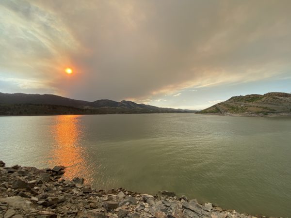
Photo by Steven Bonifazi.
The Cameron Peak Fire started 25 miles East of Walden and 15 miles Southwest of Red Feather Lakes on Thursday afternoon. It quickly grew to 1540 acres on August 13, then to 2,179 acres by the morning of August 14. Through the week, the fire has continued to grow, prompting officials to expand a mandatory evacuation boundary. At 9:00 am on August 20 Rocky Mountain Incident Management Team reported the size of the fire at 16,461 acres.
We have posted closure information with a current boundary map below.
The latest updates will continue to be posted at – https://northfortynews.com/cameronpeakfire
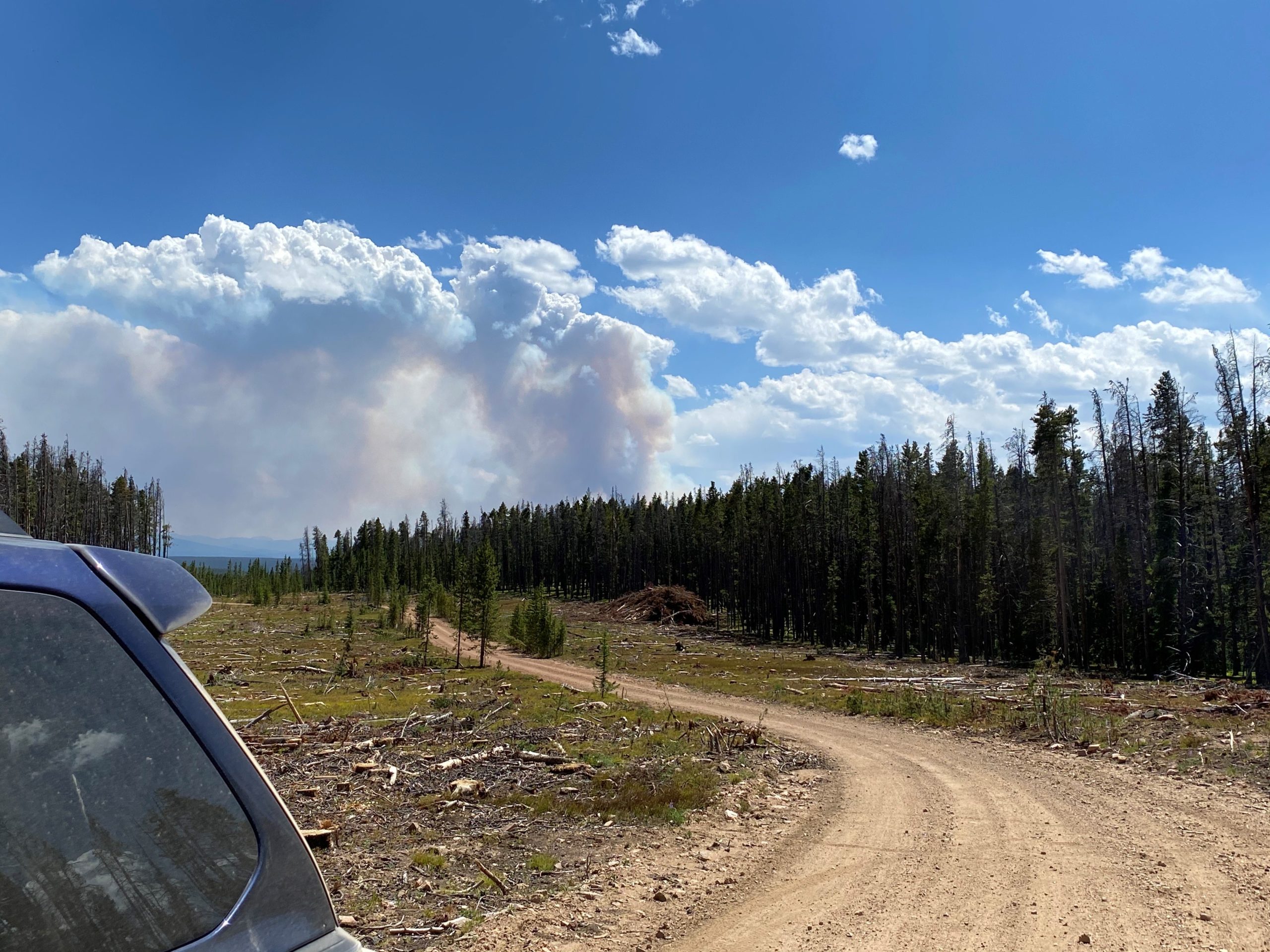
PHOTO COURTESY CANYON LAKES RANGER DISTRICT VIA TWITTER
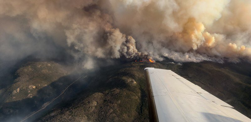
PHOTO COURTESY CANYON LAKES RANGER DISTRICT VIA TWITTER
Current Evacuations Map
Boundary Map Within the National Forest
August 14, 3:49 pm

The Forest Service closure order with specific closing information of forest roads, trails, and campgrounds, can be seen at: fseprd780832 (1)
Mandatory evacuations have been put into place. Please see details below for messages from Larimer County.
Official Updates
Northwest Incident Management Team 6
Shawn Sheldon, Incident Commander
Shane Theall, Deputy IC
Firefighters Complete Burnouts
10/13 Update at 9:21 am
Increased Containment on the Cameron Peak Fire Despite Wind
Current Situation: On Monday fire crews were successful completing a significant amount of containment line along the northern perimeter of the fire, bringing the total containment to 56%. As a result of meeting an incident objective of containment in the north, the northern administrative branches of the fire were combined to “A/D” to the west and “F/L/R” to the north. While the entire northern edge of the fire is now in containment, crews will continue to patrol and monitor the area. Firefighters near Comanche and Hourglass Reservoirs faced challenges due to extreme winds. There was isolated torching and the fire made a small wind-driven run to the east. While these afternoon winds prohibited safe direct attack on the fire, Monday saw little growth of the fire perimeter. Fire crews in the area of Sky Ranch Lutheran Camp and CSU Mountain Campus continued to make improvements to structure protection and continued mop up. In the areas of Pingree Park, Buckhorn and Monument Gulch, firefighters monitored and made improvements on structure protection. Along Long Draw Road and the Cache La Poudre Drainage, firefighters monitored and checked for new fire activity. At 3:22 p.m., Larimer County Sheriff’s Office lifted the voluntary evacuation status for Glacier View.
Today will likely bring more dry winds to the fire area, creating near critical fire weather. Firefighters will continue to patrol and work on structure protection improvements in Monument Gulch and along Buckhorn Road. Point protection and contingency planning will continue in the Sky Ranch Lutheran Camp, CSU Mountain Campus and Pingree Park areas. Aviation resources will continue to engage the fire when winds allow. Today will also be the final day for NW Team 6 on the Cameron Peak Fire. The Rocky Basin Type 1 team is transitioning in with Team 6 and will be taking over command of the fire at 7:00 a.m. on Wednesday, October 14th.
Weather Conditions: Expect high clouds on Tuesday. The forecast calls for highs of 45-55° F. Relative humidity is anticipated to be 15-25%. Winds on the ridgetop and mid-slope are forecast to be southwest at 20-30 mph with gusts to 45 mph. Gusts to 50 mph are expected after 6:00 p.m. Winds in the valleys and lower slopes will likely be southwest at 10-20 mph with gusts of 30-40 mph. Southwest winds will likely be 15-25 mph after 6:00 p.m.
10/12 Update at 9:43 am
Calmer Winds and Moisture Help Moderate Fire Activity
Current Situation: Sunday saw an increase in fire activity in the early morning hours before calming as much needed moisture moved into the area before noon. Crews monitored the hot spots and looked for new activity near Long Draw Road and the Cache La Poudre Drainage. In close coordination with Larimer County Sheriff’s Office Emergency Services, firefighters continued work in the Sky Ranch Lutheran Camp, CSU Mountain Campus and Pingree Park community. Firefighters continued to monitor in Monument Gulch east along Old Flowers Road. With new containment showing along the northeast fire line from Forest Service Road 333 Road to Bellaire Lake, firefighters continue mop up along the north firelines near the Killpecker tower moving towards the west.
While multiple helicopters were available today, weather conditions only allowed for one drop. Firefighters took advantage of calmer winds and moisture, securing and building new line ahead of expected dryer weather and increased winds Monday. Just before 2:00 p.m., the evacuation status for Highway 14 from Kelly Flats west to the Fish Hatchery was downgraded from mandatory to voluntary. Out of an abundance of caution, new closures were issued by the Arapaho and Roosevelt National Forests and Rocky Mountain National Park.
Today dry, windy weather is anticipated to return. Firefighters will continue to patrol and work on structure protection and removing fuels from around structures in Monument Gulch and Buckhorn Road. Point protection and contingency planning will continue in the Sky Ranch Lutheran Camp, CSU Mountain Campus and Pingree Park community. Mop up will continue along the north firelines where crews continue to get closure to containment, finding less heat every day.
Weather Conditions: Monday will see partly cloudy conditions. Forecast calls for highs of 40-50°F. Relative humidity is expected to be at 25-30%. Winds will shift from the southwest to the west with gusts of 35-40 mph. Dry, windy conditions will likely continue Tuesday with highs expected to be around 50°F. Winds are expected to be 30-45 mph, with gusts up to 55 mph.
10/11 Update at 9:50 am
Firefighters Continue Work Ahead of Approaching Cold Front
Current Situation: Saturday saw another day of active fire behavior and gusty winds ahead of a cold front expected to arrive today. Fire activity and smoke were seen in the south near RMNP and Joe Wright Reservoir. Air support continued to assess and monitor these areas throughout the day. Firefighters continued focused efforts at the CSU Mountain Campus and Pingree Park community. The fire remains to the north of the CSU Campus and west of Pingree Park Road. Fire behavior calmed in the overnight hours with slightly higher relative humidity. Crews monitored the CSU campus, Pingree Park, and Monument Gulch areas overnight. In addition to the ground support working on point protection, air operations were active dropping retardant and water drops on targets in the area to help slow fire spread. Mop up, reenforcing dozer lines, and structure protection continued on the north firelines and the Highway 14 corridor. Firefighters were able to secure firelines and add containment along the northeast line of the fire near Crystal Lakes, Red Feather, and Glacier View Meadows. Around noon evacuations were downgraded to voluntary evacuation for Crystal Lakes and Red Feather Lakes.
Today’s winds ahead of a cold front will likely increase fire activity in the early morning hours through the afternoon. Firefighters will continue point protection operations in the CSU Mountain Campus and Pingree Park community. Crews will patrol and monitor in the Monument Gulch community watching for any new fire spread. Firefighters will continue work on the north firelines and the Highway 14 corridor. Air support will continue to monitor the south firelines near Joe Wright Reservoir and RMNP. Active fire and wind will cause smoke to increase and be visible in several areas of the fire.
Weather Conditions: Sunday will see a cold front bringing increased clouds, winds, and very little moisture. The forecast calls for highs of 55-60°F. Relative humidity is expected to be medium at 35-40%. Winds are expected to shift throughout the day a with gusts of 45-55 mph. Monday should see cooler temperature with very windy conditions. Highs are expected to be around 45°F. Relative humidity is expected to drop to 15-25% with wind gusts up to 55 mph.
10/10 Update at 9:29 am
Firefighters Work Through Critical Weather to Protect Homes
Current Situation: Friday saw another day of critical fire weather and near Red Flag Warning conditions. Early morning activity pushed the fire out of the Comanche Peak Wilderness Area and toward the Colorado State University Mountain Campus. This prompted a mandatory evacuation for residents and business owners in the Monument Gulch, Pingree Park, and County Road 44H (the Buckhorn Road) to County Road 27 (Stove Prairie Road) before 8:00 a.m. A surge group of County and local firefighters and engines arrived early in the morning to assist with point protection and build firelines to slow fire spread, protecting the values at risk in the area. Extreme fire activity continued in this area throughout the day. Crews will remain on scene overnight to monitor fire behavior and extinguish any hotspots. Mop up, reenforcing dozer lines, and structure protection continued on the north firelines with a heavy focus on the northwest area near Crystal Lakes, Red Feather Lakes, and Glacier View Meadows. County partners and firefighters continued to monitor and mop up the southwest lines near Long Draw Road, and along the Highway 14 corridor near Sleeping Elephant. Aerial operations continued in multiple areas of the fire to slow fire spread as conditions allowed.
Today will be another near critical fire weather day after a sixth night with little moisture recovery for vegetation. The primary focus for today will be in the CSU Mountain Campus and Pingree Park community where extreme fire behavior is expected once again. An additional surge group with local and regional crews arrived Friday afternoon to assist with point protection. Firefighters will continue to focus on the north perimeter mopping up and securing firelines to increase containment protect the values at risk on the northeast side of the fire.
Weather Conditions: Saturday will see cooler temperaturesand higher humidity. Forecast calls for highs of 66-73°F. Relative humidity is expected to be medium at 15-20%. Winds will likely increase throughout the day a with gusts of 15-20 mph. A cold front is forecast to pass over the fire Sunday with highs expected to be around 60°F. Winds will likley be strongest Sunday with gusts up to 55 mph.
10/9 Update at 10:26 am
Hot, Dry Weather Causes Cameron Peak Fire to Grow
Current Situation: Thursday saw another day of record temperatures, low humidity, and active fire behavior, resulting in mandatory evacuations of Pingree Park, Monument Gulch, and Buckhorn Road to Stove Prairie Road this morning. The fire above Comanche Reservoir exhibited extreme behavior and is moving toward the east. A Red Flag Warning was in effect for the fire area from 11:00 a.m. to 7:00 p.m. Crews continued around the fire perimeter to secure the lines and increase containment, despite the difficult fire weather conditions. Engines and firefighters continued mop up, searching for and extinguishing heat in the Sleeping Elephant Mountain and Long Draw Road areas after successful aerial burnout operations on Wednesday. Work continued on the contingency line around the CSU Mountain Campus and neighboring homes. Fire activity picked up in several areas along the highway 14 corridor around 3:00 p.m. prompting firefighters to shift focus to structure protection. Crews remained in the area to monitor and defend areas at risk overnight. Aerial operations continued with water and retardant north of Kinikinik and near Comanche Reservoir.
Today fire behavior is already very active after a fifth night with low humidity and little moisture recovery for vegetation. Crews will continue to focus on building and securing firelines, as well as mopping up around the perimeter. Firefighters face another day of extreme fire behavior in isolated areas. Fire activity will likely increase in the afternoon with the potential for increased smoke pushing to the south.
Weather Conditions: Friday’s weather should see increasing cloud coverage in the afternoon with highs of 63-73°F. Relative humidity is expected to be low at 8-12%. Winds will likely increase throughout the day with gusts of 20-25 mph. Saturday highs are expected to be around 60°F with breezy conditions ahead of a strong cold front set to move in Sunday. Elevated fire weather conditions are anticipated through Saturday.
Temporary Flight Restrictions (TFR): It is illegal to operate a drone in the fire area. Wildfires are a No Drone Zone. If you fly, we can’t. Whenever a drone is spotted near the fire all aircraft are grounded until we are sure the drone is clear of the area. The use of drones is always prohibited in national parks. For more information please visit http://knowbeforeyoufly.org.
10/8 Update at 9:58 am
Current Situation: Wednesday firefighters continued containment work on the fire perimeter. This is a very large fire with over 240 miles of perimeter, so full containment will take time to complete and each new weather event will challenge portions of the line, requiring firefighters to revisit many areas. Mop up, searching for and extinguishing heat, was the primary activity for firefighters around the fire. A small spot fire was found outside the line in the northwest and was secured. To prevent increased fire activity from further threatening homes around Kinikinik, crews successfully completed a burnout operation on Sleeping Elephant Mountain using aerial ignition. Additional crews worked around the structures in the area to ensure no damage occurred from the burnout. Another burnout was performed at the southern end of Long Draw Road to create fireline that will be more easily defensible. This operation produced the very large column of smoke seen yesterday. On the northern edge crews worked on reinforcing the line west of Bellaire Lake. On the east side crews and engines continued mopping up around homes and structures at risk. More crews joined in the work on the contingency lines around the CSU Mountain Campus and area homes. Crews in Rocky Mountain National Park also worked on contingency lines there and monitoring the increased fire activity in the lower Cache La Poudre drainage near the northern park boundary.
Today a Local Red Flag Weather Warning is issued for the fire. Crews are prepared and have plans in place with the focus on holding and securing the lines. Vegetation remains critically dry with little overnight recovery of moisture for a fourth night in a row. Firefighters will likely face isolated areas of extreme fire behavior. Fire activity that gets established during the day may continue to be active overnight.
Weather Conditions: Thursday has a Local Red Flag Warning for the fire area from 10:00 a.m. to 7:00 p.m.Weather should be mostly sunny and warm with highs 70-75°F. Relative humidity is expected to be low at 7-11%. Winds are forecast to be shifting with gusts to 20 mph. Friday highs are expected to be around 70°F with increasing clouds. Elevated fire weather is anticipated through Friday.
10/7 Update at 9:57 am
Firefighters Mop Up Containment Lines
Current Situation: Tuesday firefighters focused on securing containment lines after the wind event. Mop up was the primary activity around the perimeter of the fire, as firefighters searched for heat along the line and extinguished it. Where the spot fire crossed the northern line near the 333A road, firefighters mopped up to secure the mechanical line. In surveying the perimeter, firefighters found a new spot fire outside the line on the northwest side and worked to get line around it, stopping the growth at a couple of acres. Crews and engines continued mopping up around homes and structures at risk both inside the burned area and outside of it. Two big smoke columns developed as interior pockets of unburned fuel increased in activity. Holding actions were needed in the area between Beaver Creek and Comanche Reservoir. The Long Draw burnout in the southwest corner of the fire appeared to be holding the fire as hoped. Crews in Rocky Mountain National Park and at the CSU Mountain Campus worked on developing contingency lines.
Today fire crews will hold and secure lines. Where possible, they will also work on extending containment. The tricky areas above Comanche Reservoir will probably require air support again in addition to the fire crews. Air support has been a huge asset on this fire, quieting active sections and allowing firefighters to safely work in close to the perimeter.Power company crews will be working to replace poles and restore power. With the fuels remaining critically dry, firefighters will continue to experience active and possibly extreme fire behavior. Fire activity that gets established during the day will likely continue overnight due to low humidity recovery.
Weather Conditions: Wednesday should be mostly sunny and warm with highs 70-75°F. Relative humidity is expected to be low at 7-11%. Winds are forecast to be shifting with gusts to 20 mph. Thursday highs are expected to be 65-75°F with increasing clouds. Elevated fire weather is anticipated through Friday.
10/6 Update at 9:36 am
Winds Tested the Containment Lines
Current Situation: Most of the containment lines held Monday during the Red Flag wind event. The fire spotted across the northern line near the 333A road and burned 50-70 acres. Firefighters aided by aviation resources and heavy equipment were able to get mechanical line around most of that spot fire with the last section tied into a wetland. Around the perimeter firefighters were challenged with spots and embers coming across the lines. They patrolled seeking out heat and extinguishing any found. Crews and engines worked around the homes and structures at risk defending them. One of the most active sections of the fire was along the Hwy 14 corridor where large islands of unburned fuel remained. The interior of these islands burned yesterday, putting up heavy smoke, and it is likely interior pockets will burn again today. Firefighters and engines defended the structures along that stretch from the defensive areas they created the past few days until they were ordered to leave for their safety. Large air tankers and helicopters worked with firefighters to hold the fire above Comanche Reservoir. Working off the Corral Creek Trail in the southwest corner of the fire, crews burned out about 40 acres to check further movement of the fire to the south. Crews in Rocky Mountain National Park worked on contingency lines but did not have much fire activity in that area.
Today, fire crews will secure and hold lines, mopping up where needed. Firefighters will utilize water on the new line around the spot to the north to strengthen it. Engines will patrol around homes mopping up and protecting them especially in the Elkhorn and Kinikinik areas. Efforts will continue to hold the fire at Long Draw and above Comanche Reservoir. While the winds will likely decrease, the fuels remain critically dry and firefighters will continue to experience active fire behavior.
Weather Conditions: Tuesday should be mostly sunny with highs 65-70°F. Relative humidity will is expected to be low at 8-13%. Winds are forecast to decrease to 10-15 mph with gusts to 20 mph. Wednesday highs are expected to be 65-70°F with increasing clouds. The relative humidity is anticipated to continue to be very dry with little overnight recovery.
10/4 Update at 10:17 am
Firefighters Prepare for a Challenge
Current Situation: Most lines held Sunday and during Monday’s early morning hours. The fire spotted across the northern line in at least one location – near the 333A road — and firefighters are attacking that spot this morning while holding mostly defensive positions around the rest of the fire. The Red Flag Warning continues through Monday until 7:00 p.m. The Fire Behavior Analyst predicts potentially extreme fire conditions with the expected weather and condition of forest fuels.
Today’s instructions to crews are to secure and hold lines, mop up where possible, and initiate defensive burnout operations if necessary. Top priority for aircraft if not restricted due to wind conditions is the north line followed by preventative drops to cool fire areas west-northwest of Comanche Reservoir. Engines and crews will be monitoring and defending structures at risk. The areas to the northeast of the fire will be heavily patrolled, as will the Highway 14 corridor.
Weather Conditions: The Red Flag Weather Warning that began Sunday at 9:00 p.m. will remain in effect until 7:00 p.m. Monday night. Monday should be mostly sunny with highs 62-70°F. Relative humidity will be low at 11% to 15%. Winds will shift direction but continue to blow through the day 30-40 mph with gusts to 50 mph possible. Valleys will mostly be sheltered from the winds in the morning. Tuesday is expected to be calmer with winds around 10 mph and gusts to 20 mph. Tuesday through Thursday will continue very dry with highs 65-70°F.
Crews worked around the perimeter on Sunday securing firelines in preparation for the predicted wind event. Fire activity increased slightly during the day burning pockets of fuel in the interior, along the perimeter west of Comanche Reservoir to Brown’s Lake, and in the southwest corner near Corral Creek. Aviation resources assisted crews in holding these areas and fire movement was minimal before nightfall. With the Red Flag Warning wind event expected overnight, some daytime firefighters were designated as a surge force and prepared to join those on the nightshift, if the need arose. The wind gusted to 46 mph and challenged the containment lines especially on the north and in the green space west of Comanche Reservoir. Surge firefighters were not needed overnight.
10/4 Update at 10:46 am
Firefighters Strengthen Containment
Current Situation: Saturday’s weather allowed firefighters to focus on reinforcing the fireline they created over the past several days and adding additional line. The small army of heavy machinery (5 bulldozers, 5 masticators, 5 feller-bunchers, 4 skidders, 2 water tenders, an excavator, a grader, and an engine) continued working the northern flank of the fire west of Bellaire Lake and firefighters strengthened that line by adding water and hose lays along that stretch. More heavy machinery is spread around the fire working on other strategic advances. Patrols around homes and structures at risk extinguished any remaining pockets of heat and prepared protection measures to be ready for any increased fire behavior. Local fire department crews are working beside the federal firefighters protecting these homes. Increased fire activity occurred in the Comanche Reservoir and Corral Creek areas where crews worked with aviation resources to quiet and contain fire movement. Aviation resources had to stop working by 5:00 p.m. because smoke limited visibility. Crews also worked to open road access to the area west of Comanche Reservoir to aid efforts in that area. Around the perimeter of the fire, firefighters walked the developed line checking for and extinguishing any spot fires threatening the line.
Today firefighters will continue adding water and hose lays to the northern perimeter of the fire. Crews and aviation will keep addressing the heat along the southern perimeter and throughout the fire. Additional burnouts may be done in the Sheep Creek and Corral Creek drainages, weather permitting. Engines and crews will keep monitoring structures at risk. Firefighters will remain alert as the day progresses to the predicted wind shift and increasing wind gusts that will build to 40 mph well after dark. These winds will challenge the crews working through the night.
Weather Conditions: Sunday is predicted to be sunny and noticeably warmer with highs 60-71°F. Winds are expected to start off light and increase in intensity as the direction shifts from the NW to the W. By 9:00 p.m. a Local Red Flag Weather Warning will go into effect and last until 7:00 p.m. on Monday. Wind associated with the incoming “Shallow Mountain Wave” could gust to 40 mph. Monday is predicted to have a high near 70°F with elevated fire weather conditions.
Temporary Flight Restrictions (TFR): It is illegal to operate a drone in the fire area. Wildfires are a No Drone Zone. If you fly, we can’t. Whenever a drone is spotted near the fire all aircraft are grounded until we are sure the drone is clear of the area. The use of drones is always prohibited in national parks. For more information please visithttp://knowbeforeyoufly.org.
10/3 Update at 10 am
Another Productive Day for Firefighters Increases Containment
Current Situation: Friday’s predicted Red Flag weather warning was moderated by the shade provided by the Mullen Fire’s drift smoke in the afternoon. The hard work of closing the nine-mile gap on the north side of the fire is progressing. Firefighters followed behind the heavy machinery with hoses and water, cooling heat and felling snags that might jeopardize the line. Crews and engines worked along the Hwy 14 corridor to extinguish any heat remaining around the homes. Between the fingers on the northeast side additional burnouts were done with precision to secure those houses and protect personal property. Mop-up and patrols continue around those and other values at risk both inside the burned area and adjacent to it. Hand crews worked in the difficult-to-access areas above Comanche Reservoir and by Corral Creek. Air support worked with buckets to protect those crews and knock down pockets of heat. Structure protection crews practiced their defensive plans for the CSU Mountain Campus and the Pingree Park homes. Firefighters are tying line together with natural features in Long Draw to prevent further movement to the south. On the northwest perimeter of the fire, firefighters walked the developed line checking for and extinguishing any spot fires in that area.
Today firefighters will continue securing the perimeter of the fire. The predicted variable winds will be light and peak burning hours will decrease to five hours allowing for continued success. Crews will provide structure protection around the values at risk. Firefighters hope to secure more line before the predicted increase in fire behavior tests it on Monday.
Weather Conditions: Saturday is predicted to be partly cloudy by afternoon and cooler with highs 53-63°F. Wind direction will vary by the area of the fire and should be light 9-13 mph with gusts to 25 mph. Sunday’s forecast is a little warmer with highs of 60-70°F and wind gusts to 25 mph. Monday is predicted to have elevated fire weather conditions with warm temperatures and increased wind.
10/2 Update at 10:43 am
Firefighters Make More Advances Toward Containment
Current Situation: Thursday’s good weather conditions and decreased fire behavior allowed firefighters to continue work directly on the fire perimeter. Heavy equipment made advances closing the nine-mile gap on the north side of the fire. Firefighters followed up with hoses and water, mopping up lines with water. Work on indirect contingency lines northeast of that stretch also continues to protect those subdivisions. Crews and engines worked in the burnout conducted near Kinikinik yesterday to extinguish any heat remaining around structures. Similar “search and destroy” heat missions were carried out on the northeast side burnout between those fingers of fire and around other values at risk. Hand crews worked from the trail system above Comanche Reservoir improving lines. Firefighters additionally burned out an area in front of the southern tip of the fire in the Long Draw. Aviation supplied important assistance to firefighters both in bucket work and reconnaissance.
Containment measures on the east side of the fire combined with decreased fire activity in that area allowed the Larimer County Sheriff to lift the voluntary evacuation order for County Roads 44H and 27 to Pennock Pass (more details on the NoCo Alert link to the right). To protect public safety in light of the Mullen Fire the Arapaho and Roosevelt National Forests on the Canyon Lakes District to the north (more details are available by following the link on the right).
Today firefighters will continue the diligent hard work that is building toward further extension and strengthening of firelines. Structure protection remains a high priority and crews will continue mop-up work around the values at risk. The dry fuels and afternoon winds may increase fire activity especially on the northeast side, but the cloud and smoke cover will likely moderate that behavior.
Weather Conditions: Friday is expected to be partly cloudy with highs of 57-69°F. Northwest winds are forecasted to be 9-13 mph with gusts up to 25 mph. Saturday is predicted to be partly cloudy with highs in the low 60s°F and wind gusts to 25 mph.
10/1 Update at 11 am
Hard Work Increases Containment
Current Situation: Wednesday’s good weather conditions and decreased fire behavior allowed firefighters to work directly on the fire perimeter. This work advanced containment to 30% as firefighters completed fireline in several locations. Heavy equipment worked in force to start closing the nine-mile gap on the north side of the fire. Burnouts were conducted near Kinikinik to further protect the structures at risk and remove fuels from the unburned island in the fire. On the northeast side another burnout was done to secure the area between those fingers of fire and prepare it for putting in direct fireline. Hand crews worked in unison with air support along the edge between Brown’s Lake and Comanche Reservoir. Crews also successfully attacked stretches in the Long Draw area and on the northwest side of the fire. Structure crews continue to work both day and night to secure values at risk patrolling, mopping up, and extinguishing spot fires. All around the fire, crews received solid aviation support with 11 helicopters running almost continual bucket drops to cool hotter areas and allow firefighters to work in close to the fire perimeter.
Today firefighters will build on yesterday’s successes working on further extension of firelines along the perimeter. Structure protection remains a high priority and crews will continue to work around the values at risk. Firefighters will need to stay alert as extremely dry fuels remain and shifting winds may bring changes in direction for fire and ember movement.
Weather Conditions: Thursday is expected to be mostly sunny with highs of 54-65°F. North-northwest winds are anticipated to shift to north-northeast winds after 1 p.m. and are forecasted to be 6-10 mph with gusts up to 22 mph. Friday is predicted to be partly cloudy and slightly warmer with wind gusts to 25 mph.
Temporary Flight Restrictions (TFR): It is illegal to operate a drone in the fire area. Wildfires are a No Drone Zone. If you fly, we can’t. Whenever a drone is spotted near the fire all aircraft are grounded until we are sure the drone is clear of the area. The use of drones is always prohibited in national parks. For more information please visithttp://knowbeforeyoufly.org.
9/30 Update at 10:30 am
Burning in the Interior of the Fire Continues
Current Situation: The weather warmed up yesterday and with that warming, fuel moistures dropped back to extremely dry. Fire activity increased in response and several smoke columns rose from unburned pockets of fuel and burnout operations in the fire’s interior. Crews worked on the west side of the unburned area along Hwy 14 burning out more fuels to reduce the risk of sustained fire runs developing. Firefighters also burned areas around structures to further protect values at risk. Crews reinforced the lines around the northeastern fingers of the fire, continuing to work on tying the two fingers together with fireline and securing the edge where Hwy 14 meets the Manhattan Road. Firefighters continue working around all structures at risk patrolling, mopping up, and extinguishing spot fires. The fire along the perimeter near Comanche Reservoir stayed active continuing to back along that slope. The smoke from the Mullen Fire to the northwest drifted over the Cameron Peak Fire and slightly cooled fire activity in the afternoon. About 100 new personnel arrived on the fire yesterday and will bolster crews all around the perimeter.
Today firefighters will work on further buffering and securing of the perimeter. Structure protection remains a high priority and there will be some additional burnouts to aid those efforts. Fire managers have identified a trail above Comanche Reservoir that will provide access and a place to do some burnouts to defend that side of the fire. Crews will be working on implementing that plan. Firefighters will need to be prepared for increased fire activity as the predicted weather will provide a longer period of burn potential (eight hours compared to Tuesday’s six hours).
Weather Conditions: Wednesday is expected to be warm and mostly sunny with highs of 56-66°F. Northwest winds are forecast to be 9-12 mph with gusts up to 25 mph. Thursday is anticipated to be slightly cooler in temperature with north winds gusting up to 25 mph.
Temporary Flight Restrictions (TFR): It is illegal to operate a drone in the fire area. Wildfires are a No Drone Zone. If you fly, we can’t. Whenever a drone is spotted near the fire all aircraft are grounded until we are sure the drone is clear of the area. The use of drones is always prohibited in national parks. For more information please visithttp://knowbeforeyoufly.org.
9/29 Update at 9:30 am
Firefighters Work on the Perimeter
Current Situation: The hard freeze on Sunday night helped keep the fire cool on Monday. Crews further reinforced the lines around the northeastern fingers of the fire. They were able to tie the two fingers together with fireline and worked on placing line around everything that crossed the Manhattan Road connecting it down to Hwy 14. Further west on Hwy 14, close to the Fish Hatchery, crews burned out fuels to lower the risk of that area flaring up. Firefighters also continued working around the structures at risk patrolling, mopping up, and extinguishing spot fires. With activity decreased throughout the fire further advances were made along the rest of the perimeter including near Comanche Reservoir where aircraft assisted by dropping retardant on the active spots. The southern edge of the fire, near the Long Draw Reservoir, remained fairly quiet yesterday.
Today firefighters will work on further buffering and securing of the perimeter. Structure protection will remain a high priority. Special attention will be given to some of the more inaccessible areas of the perimeter as the team formulates a strategy to address those areas. Firefighters will have to remain vigilant as the slightly increased fuel moisture will quickly return to very dry with the increased warm temperatures and sun.
The Northwest Incident Management Team 6 assumed authority over the Cameron Peak Fire this morning. The NW Team 6 worked closely with the outgoing Southwest Area Incident Management Team 3 to make the transition as smooth as possible and to ensure cohesive management of the fire. NW Team 6 thanks the Southwest Team for a good set up for success.
Weather Conditions: Tuesday is expected to be warmer and mostly sunny with highs of 57-68°F. Northwest winds are forecast to be 9-12 mph with gusts up to 25 mph. Wednesday is anticipated to be slightly cooler in temperature with northwest winds gusting up to 20 mph.
Temporary Flight Restrictions (TFR): It is illegal to operate a drone in the fire area. Wildfires are a No Drone Zone. If you fly, we can’t. Whenever a drone is spotted near the fire all aircraft are grounded until we are sure the drone is clear of the area. The use of drones is always prohibited in national parks. For more information please visit http://knowbeforeyoufly.org.
From Southwest Area Incident Management Team 3
9/28 Update at 9:44 am
A Shift in the Weather Allows Firefighters to Gain Ground
Current Situation: The winds continued yesterday but the gusts were not as powerful and their overall direction shifted to the northwest. This change in direction combined with a little moisture cooled fire activity and allowed firefighters to get an upper hand on the heads of the two northern fingers of the fire. Crews worked overnight Sunday and into Monday morning burning out fuel ahead of the fire in the fingers. This burnout allowed follow-up work to be done with bulldozers creating a fireline along this previously very active front. Last night crews built on that good work continuing to secure and mop up along the northeastern edge of the fire. With activity decreased throughout the fire further advances were made along the rest of the perimeter including the southern side of the fire. Power company crews worked yesterday evening to restore power to many areas that were affected by the outage. Night resources on the fire worked around structures protecting those at risk, patrolling, and extinguishing spot fires. Because of the low overnight temperatures, antifreeze was added to pumps and other equipment to protect them from freezing and ensure dependable service.
Firefighters plan to take advantage of the continued cooler temperatures and decreased winds today. Firefighting efforts will focus on further securing the fire perimeter and mopping up along the edge. The Pacific Northwest Incident Management Team 6 arrived and will be shadowing Southwest Area Incident Management Team 3 to gather intelligence and situational awareness. Transfer of command will occur tomorrow morning. This will be the final update from the Southwest Area Incident Management Team 3. We extend our appreciation to the Agency Administrators, Cooperators, and public for the outpour of gratitude and support.
Closures and Evacuations: For a full list of evacuations and road closures, visithttps://nocoalert.org. The Arapaho and Roosevelt National Forests fire closure area is available at https://inciweb.nwcg.gov/incident/map/6964/0/107171. Rocky Mountain National Park closures include trails, travel zones, and campsites in the northern part of the park. Trail Ridge Road (Hwy 34) is open. Old Fall River Road remains closed. For more information visit https://www.nps.gov/romo/learn/fire-information-and-regulations.htm
Weather Conditions: Monday will be mostly sunny and cool with highs 45-55°F. Northwest winds will be 9-12 mph with gusts up to 20 mph. Tuesday is expected to be noticeably warmer with highs near 65°F and wind gusts up to 25mph.
Fire Restrictions: The Canyon Lakes Ranger District has implemented Stage 2 fire restrictions, for more information visit:https://www.fs.usda.gov/Internet/FSE_DOCUMENTS/fseprd801392.pdf. Rocky Mountain National Park has implemented a complete fire ban and an area closure, for more information visit: https://www.nps.gov/romo/learn/fire-information-and-regulations.htm, Larimer County has implemented a fire ban until October 31 at noon, for more information visit https://tinyurl.com/y332jsoy. Also, the State of Colorado has implemented a statewide open fire ban until October 7.
9/27 Update at 9:18 am
Gusty Winds Continue to Push the Fire Northeast
Current Situation: The red flag weather conditions continued to challenge firefighters with extreme fire activity for a second day yesterday. Spotting from 50-60 mph wind gusts pushed the fire perimeter to the northeast. The most active areas of the fire are the two fingers north of Highway 14. One finger pushed past Bellaire Lake toward the 74E road, and the other finger burned east past the Shambhala Center along the 68C road corridor. Fire crews were able to protect the temple at Shambhala and continued use of sprinklers wetting down areas ahead of the fire along with point protection for other values at risk. Night resources continued defensive actions and point protection measures in the communities at risk. The southern side of the fire also remains active in the Comanche Reservoir and Long Draw areas but is burning back into itself limiting spread. The high winds grounded nearly all air resources yesterday. Power remains off in much of the northeast section of the fire for safety.
Cooler temperatures and decreasing winds today will create less havoc for firefighting efforts and be a welcome change after the past two difficult days. Crews and equipment will continue engaging the fire directly where there is a high probability of success and it is safe to do so. Firefighting efforts will focus heavily on protecting structures at risk.
The Pacific Northwest Incident Management Team 6 began arriving and will be shadowing Southwest Area Incident Management Team 3 to gather intelligence and situational awareness.
Closures and Evacuations: For a full list of evacuations and road closures, visithttps://nocoalert.org. The Arapaho and Roosevelt National Forests fire closure area is available at https://inciweb.nwcg.gov/incident/map/6964/0/107171. Rocky Mountain National Park closures include trails, travel zones, and campsites in the northern part of the park. Trail Ridge Road (Hwy 34) is open. Old Fall River Road remains closed. For more information visit https://www.nps.gov/romo/learn/fire-information-and-regulations.htm
Weather Conditions: Sunday morning winds are predicted to gust up to 25 mph but decrease by afternoon to 15 mph or less. The temperature will be cooler with a highs 40-50°F with a 30% chance of possible rain or snow predicted later in the day. Monday is expected to be cool with wind gusts up to 25mph.
9/26 Update at 10 am
Strong Winds Challenge Firefighters
Current Situation: The red flag weather conditions increased fire activity yesterday and expanded the fire perimeter to the northeast. The most active areas of the fire are north of Highway 14 between the “thumb” and the main fire and near Comanche Reservoir. On the north, winds pushed the fire approximately three miles east of Kinickinik across the Killpecker line and into the Seven Mile drainage. Crews started pump, hose, and sprinkler set ups are wetting down that fireline. Night resources were increased and worked on defensive actions to hold the fire there. Dozers opened up access to the 171 road system which is helping firefighters to engage that area. The fire was active in the Comanche Reservoir area but burned downhill and then back into itself limiting spread. While Rocky Mountain National Park and the Long Draw Road at the southern end of the fire are quieter, crews, engines, and air resources are working to minimize southernly movement. Airtankers (including a very large airtanker or VLAT) and helicopters assisted firefighters on the ground throughout the fire, but the gusty winds kept the helicopters from flying much of yesterday afternoon. Crews are also actively working on structure protection ahead of the advancing fire.
The Red flag weather warning is still in effect today and will continue to create challenging fire behavior conditions. Forecasted winds and severe turbulence will possibly hamper air operations. Crews and equipment will continue engaging the fire directly where there is a high probability of success and it is safe to do so.
Closures and Evacuations: For a full list of evacuations and road closures, visit https://nocoalert.org. The Arapaho and Roosevelt National Forests fire closure area is available at https://inciweb.nwcg.gov/incident/map/6964/0/107171. Rocky Mountain National Park closures include trails, travel zones, and campsites in the northern part of the park. Trail Ridge Road (Hwy 34) is open. Old Fall River Road remains closed. For more information visit https://www.nps.gov/romo/learn/fire-information-and-regulations.htm
Weather Conditions: The red flag weather warning continues in effect Saturday for elevations below 9000”. Saturday morning wind gusts are predicted to be up to 60 mph. Sunday, winds will be decreasing to 20 mph with possible rain or snow predicted later in the day.
Fire Restrictions: The Canyon Lakes Ranger District has implemented Stage 2 fire restrictions, for more information visit: https://www.fs.usda.gov/Internet/FSE_DOCUMENTS/fseprd801392.pdf. Rocky Mountain National Park has implemented a complete fire ban and an area closure, for more information visit: https://www.nps.gov/romo/learn/fire-information-and-regulations.htm, Larimer County has implemented a fire ban until October 31 at noon, for more information visit https://tinyurl.com/y332jsoy. Also, the State of Colorado has implemented a statewide open fire ban until October 7.
9/25 Update at 9:45 am
Red Flag Warning Today
Current Situation: The northern most portion of the fire continues to have the most activity. Helicopters and air tankers were used to assist ground crews who are extinguishing hot spots and building fire lines. Dozers opened up the 171 road system and connected line to the 198 road around the tip of the thumb. The fire was active in the Comanche Reservoir area, bucket work and retardant are all being used to minimize southernly movement. There is very little fire activity in Rocky Mountain National Park, and the Long Draw Road is being patrolled. A new smoke was spotted from the Grass Lakes area, aviation resources helped to stop the spread. Firefighters working at night are primarily strengthening fire lines and extinguishing any hot spots.
A Red flag weather warning is in effect today, which creates a “heads up” day for firefighters. Today, the “thumb” will continue to be the focus. A red flag warning could create extreme fire behavior. Forecasted high winds could potentially ground air resources. Crews and equipment will continue to go direct on the “thumb,” engaging where there is a high probability of success and it is safe to do so. Other crews and engines will continue improving the Manhattan, Deadman, and 171 road systems.
Closures and Evacuations: For a full list of evacuations and road closures, visit https://nocoalert.org. The Arapaho and Roosevelt National Forests fire closure area is available at https://inciweb.nwcg.gov/incident/map/6964/0/107171. Rocky Mountain National Park has implemented a variety of closures on trails, cross country zones and wilderness campsites in the northern part of Rocky Mountain National Park. Trail Ridge Road (Hwy 34) has reopened. Old Fall River Road remains closed. For more information visit https://www.nps.gov/romo/learn/fire-information-and-regulations.htm
Weather Conditions: Red flag weather warning will be in effect until Saturday evening. Before sunrise on Saturday morning, it is predicted that wind gusts may be up to 30 mph along the ridgelines.
Fire Restrictions: The Canyon Lakes Ranger District has implemented Stage 2 fire restrictions, for more information visit: https://www.fs.usda.gov/Internet/FSE_DOCUMENTS/fseprd801392.pdf. Rocky Mountain National Park has implemented a complete fire ban and an area closure, for more information visit: https://www.nps.gov/romo/learn/fire-information-and-regulations.htm, Larimer County has implemented a fire ban until October 31 at noon, for more information visit https://tinyurl.com/y332jsoy. Also, the State of Colorado has implemented a statewide open fire ban until October 7.
9/24 Update at 11 am
Containment Increases on the Western Edge
Current Situation: Yesterday firefighters continued to go direct on the active part of the fire. Firefighters are working to create fire lines on both north and south sides of the “thumb” using hand tools and bulldozers with help from air resources. Hotshot crews are working west of the Killpecker line to dig hand line to corral the rest of the northern perimeter. Burnout operations to secure Highway 14 corridor were completed. Containment increased to 27 percent which came from the western side of the fire from Joe Wright Reservoir north.
Today, dozers will work to connect the remaining line on the northern side of the “thumb” and open road systems to the south side of the thumb. Engines and crews will be removing fuels and extend additional hose lays on the Manhattan Road. East of Comanche Reservoir, crews will continue prepping the dozer line and monitoring the fire, using helicopter bucket drops if necessary. Chipping of brush removed from Glen Echo to Buckhorn will resume and the rest of the fire perimeter will be in mop-up and patrol status.
Closures and Evacuations: Voluntary evacuations were lifted for CR27 to CR44H/Pennock. Mandatory evacuation orders remain in effect for Red Feather Lakes and Crystal Lakes. Voluntary evacuation orders are also in place for Glacier View filings, the Lady Moon area, and Magic Sky Ranch area. For a full list of evacuations and road closures, visit https://nocoalert.org. The Arapaho and Roosevelt National Forests fire closure area is available at https://inciweb.nwcg.gov/incident/map/6964/0/107171. Rocky Mountain National Park has implemented a variety of closures on trails, cross country zones and wilderness campsites in the northern part of Rocky Mountain National Park. Trail Ridge Road (Hwy 34) has reopened. Old Fall River Road remains closed. For more information visit https://www.nps.gov/romo/learn/fire-information-and-regulations.htm
Weather Conditions: Temperatures will be unseasonably warm with low humidity levels and gusty winds up to 30 miles per hour. Winds will pick up overnight as a pressure system moves off to the east. A fire weather watch will be in effect today, tomorrow it will be upgraded to red flag warning.
Fire Restrictions: The Canyon Lakes Ranger District has implemented Stage 2 fire restrictions, for more information visit: https://www.fs.usda.gov/Internet/FSE_DOCUMENTS/fseprd801392.pdf. Rocky Mountain National Park has implemented a complete fire ban and an area closure, for more information visit: https://www.nps.gov/romo/learn/fire-information-and-regulations.htm, Larimer County has implemented a fire ban until October 31 at noon, for more information visit https://tinyurl.com/y332jsoy. Also, the State of Colorado has implemented a statewide open fire ban until October 7.
Temporary Flight Restrictions (TFR): With the increase in fire activity the TFR expanded approximately five miles to the northeast. It is illegal to operate a drone in the fire area. Wildfires are a No Drone Zone. If you fly, we can’t. Whenever a drone is spotted near the fire all aircraft are grounded until we can be sure the drone is clear of the area. The use of drones is always prohibited in national parks. For more information please visit http://knowbeforeyoufly.org.
For More Information:
Public Information: (970) 541-1008, 7 a.m. to 8 p.m.
Media Inquiries: (970) 541-0563
JIC Info Center: (970) 980-2500, 8 a.m. to 5 p.m.
InciWeb: https://inciweb.nwcg.gov/incident/6964/
Facebook: https://www.facebook.com/CameronPeakFire
Interactive StoryMap: https://arcg.is/1ayXeD0
Smoke Update: https://tinyurl.com/y2duao6r
YouTube: https://tinyurl.com/cameronpeakfire
Cameron Peak Fire Statistics:
Size: 104,791 acres
Containment: 27%
Total Personnel: 835
Location:25 mi E of Walden;
15 mi SW of Red Feather Lakes, CO Reported: August 13
Cause: Under investigation
9/23 Update at 10 am
Additional Fire Resources Have Arrived
Current Situation: Last night firefighters used heavy equipment to continue building line near the 517 road. Working during the nighttime allows firefighters to work in cooler temperatures with less wind. Nighttime burnout operations were also conducted in the Highway 14 corridor west of the fire station 2. Burning allowed firefighters to ease the fire down to the highway. Today, additional fire resources have arrived, including two additional hotshot crews who are building direct line on the northern portion of the “thumb.”
Firefighters are using hand tools, heavy equipment, and aerial resources to flank the fire, making progress towards the head. Helicopters and air tankers will be used throughout the day to drop water and retardant. Structure protection groups and surge forces will continue to be in the Crystal Lakes and Red Feather Lakes areas. Mop-up, patrol, and chipping activities are occurring in other areas of the fire.
Despite multiple challenges, firefighters are making progress. Additional containment was added to the perimeter on the southeast corner near Buckhorn. Elevated fire weather conditions this week continue to present hazardous conditions because of potential outflow winds in the afternoon.
The Cameron Peak Fire Joint Information Center (JIC) is open from 8 a.m. to 5 p.m. at 970–980-2500 to answer all questions about evacuations and road closures.
Closures and Evacuations: Mandatory evacuation orders remain in effect for Red Feather Lakes and Crystal Lakes. Voluntary evacuation orders are also in place for Glacier View filings, the Lady Moon area, and Magic Sky Ranch area. For a full list of evacuations and road closures, visit https://nocoalert.org. The Arapaho and Roosevelt National Forests fire closure area is available at https://inciweb.nwcg.gov/incident/map/6964/0/107171. Rocky Mountain National Park has implemented a variety of closures on trails, cross country zones and wilderness campsites in the northern part of Rocky Mountain National Park. Trail Ridge Road (Hwy 34) has reopened. Old Fall River Road remains closed. For more information visit https://www.nps.gov/romo/learn/fire-information-and-regulations.htm
Weather Conditions: The temperature for the next few days will hover around the mid-60s with humidity in the teens. Turning cloudy and a little cooler with a chance of showers and storms with gusty outflow winds.
Fire Restrictions: The Canyon Lakes Ranger District has implemented Stage 2 fire restrictions, for more information visit: https://www.fs.usda.gov/Internet/FSE_DOCUMENTS/fseprd801392.pdf. Rocky Mountain National Park has implemented a complete fire ban and an area closure, for more information visit: https://www.nps.gov/romo/learn/fire-information-and-regulations.htm, Larimer County has implemented a fire ban until October 31 at noon, for more information visit https://tinyurl.com/y332jsoy. Also, the State of Colorado has implemented a statewide open fire ban until October 7.
Temporary Flight Restrictions (TFR): With the increase in fire activity the TFR expanded approximately five miles to the northeast. It is illegal to operate a drone in the fire area. Wildfires are a No Drone Zone. If you fly, we can’t. Whenever a drone is spotted near the fire all aircraft are grounded until we can be sure the drone is clear of the area. The use of drones is always prohibited in national parks. For more information please visit http://knowbeforeyoufly.org.
9/22 Update at 10 am
Firefighters Working Day and Night
Current Situation: Firefighters are working day and night shifts on the Cameron Peak Fire. Because the fire has burned into more favorable terrain, large air tankers will continue to drop retardant to slow advancement. Yesterday, large air tankers dropped retardant to flank the fire and prepare for night shift. Dozers and heavy equipment built line into the night along the flanks of the head near the 517 road. Working during the night buys time as cooler temperatures and less wind moderate fire behavior. The strategy is to pinch off the head of the fire with direct lines on the flanks.
Today, the area west of the Manhattan Road will remain the most active. The plan is to continue to work with aerial resources, crews, and heavy equipment to reinforce the right and left flank lines making progress towards the head. Structure protection groups and surge forces in Crystal Lakes and Red Feather Lakes will continue to be ready if needed. Mop-up and patrol will be happening in most other areas of the fire.
The elevated fire weather conditions this week continue to present hazardous conditions because of potential outflow winds in the afternoon. Although some rain is predicted, the chances of the rain over the fire area remain low.
The Cameron Peak Fire Joint Information Center (JIC) is open from 8 a.m. to 5 p.m. at 970-980-2500 to answer all questions about evacuations and road closures.
Closures and Evacuations: Mandatory evacuation orders remain in effect for Red Feather Lakes and Crystal Lakes. Voluntary evacuation orders are also in place for Glacier View filings, the Lady Moon area, and Magic Sky Ranch area.For a full list of evacuations and road closures, visit https://nocoalert.org. The Arapaho and Roosevelt National Forests fire closure area is available at: https://inciweb.nwcg.gov/incident/map/6964/0/107171. Rocky Mountain National Park has implemented a variety of closures on trails, cross country zones and wilderness campsites in the northern part of Rocky Mountain National Park. Trail Ridge Road (Hwy 34) has reopened. Old Fall River Road remains closed. For more information visit https://www.nps.gov/romo/learn/fire-information-and-regulations.htm
Weather & Fuel Conditions: The temperature for the next few days will hover around the mid-60s with humidity in the teens. Turning cloudy and a little cooler with a chance of showers and storms with gusty outflow winds.
Fire Restrictions: The Canyon Lakes Ranger District has implemented Stage 2 fire restrictions, for more information visit: https://www.fs.usda.gov/Internet/FSE_DOCUMENTS/fseprd801392.pdf. Rocky Mountain National Park has implemented a complete fire ban and an area closure, for more information visit:https://www.nps.gov/romo/learn/fire-information-and-regulations.htm, Larimer County has implemented a fire ban until October 31 at noon, for more information visit: https://tinyurl.com/y332jsoy. Also, the State of Colorado has implemented a statewide open fire ban until October 7.
Temporary Flight Restrictions (TFR): With the increase in fire activity the TFR expanded approximately five miles to the northeast. It is illegal to operate a drone in the fire area. Wildfires are a No Drone Zone. If you fly, we can’t. Whenever a drone is spotted near the fire all aircraft are grounded until we can be sure the drone is clear of the area. For more information please visit http://knowbeforeyoufly.org.
9/21 Update at 10 am
Fire Activity Increases Again Due to High Winds
Current Situation: A combination of 35 miles per hour winds, heavy dead fuels and steep terrain caused the fire to make a run early yesterday afternoon and spread to the northeast from “thumb” past the Killpecker line. Spotting occurred up to ½ mile ahead of the fire. The increased fire activity caused our firefighters to retreat to their safety zones for approximately 45 minutes. Additional resources were ordered, and the head of the fire was worked with air tankers and heavy helicopters. Crews bedded down during the day to prepare for night operations which included going direct where possible off the 517 road and preparing for a possible burnout operation should the need arise. A surge force of 15 engines and will arrive for support today of day operations. Pumps, water, hose and sprinklers were already in place along existing contingency fire lines.
Today, the fire has burned into flatter terrain, which will give firefighters a better chance to go direct and engage the fire along the fire edge. This landscape also provides conditions favorable in the use of large airtankers. Helicopters and single engine air tankers (SEATs) will drop water and fire retardant to take heat out of the fire to reduce advancement. The indirect lines along the Deadman and Manhattan Roads were developed in preparation for this type of event. Firefighters and heavy equipment (such as bulldozers and masticators) will be used strategically where we can safely engage the fire using direct and indirect actions. The northern, southern, western, and southeastern parts of the fire are expected to remain less active.
The Cameron Peak Fire Joint Information Center (JIC) is open from 8 a.m. to 10 p.m. at (970) 980-2500 to answer all questions about evacuations and road closures.
Closures and Evacuations: Two additional mandatory evacuation orders have been issued for Red Feather and Crystal Lakes. Additional voluntary evacuation orders were issued for Glacier View filings, the Lady Moon area, and Magic Sky Ranch area. For a full list of evacuations and road closures, visit https://nocoalert.org. The Arapaho and Roosevelt National Forests fire closure area is available at: https://inciweb.nwcg.gov/incident/map/6964/0/107171. Rocky Mountain National Park has implemented a variety of closures on trails, cross country zones and wilderness campsites in the northern part of Rocky Mountain National Park. Trail Ridge Road (Hwy 34) has reopened. Old Fall River Road remains closed. For more information visit https://www.nps.gov/romo/learn/fire-information-and-regulations.htm
Weather & Fuel Conditions: Winds will shift to the southwest for tomorrow as a storm system moves through the area. The temperature for the next few days will remain in the 60s with humidity in the teens.
Fire Restrictions: The Canyon Lakes Ranger District has implemented Stage 2 fire restrictions, for more information visit: https://www.fs.usda.gov/Internet/FSE_DOCUMENTS/fseprd801392.pdf. Rocky Mountain National Park has implemented a complete fire ban and an area closure, for more information visit:https://www.nps.gov/romo/learn/fire-information-and-regulations.htm, Larimer County has implemented a fire ban, for more information visit: https://tinyurl.com/y332jsoy. Also, the State of Colorado has implemented a statewide open fire ban until October 7.
Temporary Flight Restrictions: It is illegal to operate a drone in the fire area. Wildfires are a No Drone Zone. If you fly, we can’t. Whenever a drone is spotted near the fire all aircraft are grounded until we can be sure the drone is clear of the area. For more information please visit http://knowbeforeyoufly.org.
| Cameron Peak Fire Statistics:
Size: 104,157 acres Containment: 15% Total Personnel: 779 Location:25 mi E of Walden; 15 mi SW of Red Feather Lakes, CO Reported: August 13 Cause: Under investigation |
9/20 Update at 10 am
Winds Will Test Firelines as Storms Move Through
Current Situation: Fire managers were prepared for a busy day yesterday with the arrival of a storm system bringing gusty wind conditions from 15-30 mph. Winds promoted fire activity resulting in the Highway 14 corridor experiencing greater fire behavior. The bulk of resources were working on the Green Mountain area at the west end of Highway 14 (“the thumb”) which continues to present challenges. Air support in the form of helicopters and single engine air tankers (SEATs) were instrumental in keeping the fire at bay allowing time to expand direct and indirect fire lines. Crews sustained progress on the primary direct line of “the thumb” where several miles remain. Progress continued on indirect fire line along the 517 road which would serve as a second line of defense. Work continued on the contingency line from Deadman Road to Manhattan Road. Other existing firelines were patrolled with mop-up, and in some cases, helicopter water drops were made when vegetation near the fireline began to smoke and burn. Glen Haven and Estes Park communities remained secure.
Today, firefighters will add depth and expand fire lines around the 237 mile perimeter. Windy conditions and possible thunderstorms will serve as a test of existing firelines. These storms are not expected to bring much moisture over the fire area. Resources will patrol all sides of the fire to ensure existing lines are uncompromised, but the majority of resources will work the north and northwest sides.
Closures and Evacuations: Both mandatory and voluntary evacuations continue in the fire area. For a full list of evacuations and road closures, please visit https://nocoalert.org for more information. The Arapaho and Roosevelt National Forests closure around the fire can be found at https://inciweb.nwcg.gov/incident/map/6964/0/107171. Rocky Mountain National Park has implemented a variety of closures on trails, cross country zones and wilderness campsites in the northern part of Rocky Mountain National Park. Trail Ridge Road (Hwy 34) has reopened. Old Fall River Road remains closed. For more information visit https://www.nps.gov/romo/learn/fire-information-and-regulations.htm
Weather & Fuel Conditions: Winds will shift to the southwest for tomorrow as a storm system moves through the area. The temperatures for the next few days will remain in the 60s with humidity in the teens.
Fire Restrictions: The Canyon Lakes Ranger District is under Stage 2 fire restrictions. Please visithttps://www.fs.usda.gov/Internet/FSE_DOCUMENTS/fseprd801392.pdf for more information. Rocky Mountain National Park has implemented a complete fire ban and an area closure. For information please see https://www.nps.gov/romo/learn/fire-information-and-regulations.htm, Larimer County also has a fire ban in place through September 18, 2020. More information is available at https://tinyurl.com/y332jsoy. A statewide open fire ban is also in effect for the State of Colorado through October 7.
Temporary Flight Restrictions: It is illegal to operate a drone in the fire area. Wildfires are a No Drone Zone. If you fly, we can’t. Whenever a drone is spotted near the fire all aircraft are grounded until we can be sure the drone is clear of the area. For more information, visit http://knowbeforeyoufly.org.
9/19 Update at 10 am
Fire Activity Mirrors Yesterday
Current Situation: Yesterday’s operations included firefighters and heavy equipment continuing to work on indirect fire line and fuels reduction on the north side in the Crystal Lakes, Red Feather, and Glacier View subdivisions and on the southeastern and southern side in the communities of Estes Park and Glen Haven. Fire conditions and operational activities were largely unchanged from the last few days. As predicted, the Green Ridge area along Highway 14 (“the thumb”) was active and firefighters worked in conjunction with helicopters to connect the line. Unfortunately, work was limited to morning hours before fire activity posed too much risk to firefighters. In this area, firefighters are opening existing spur roads in the hopes of accelerating progress by improving access while mitigating some of the risks. Crews continued with patrol and mop-up on containment lines near Pingree Park Road, Long Draw Road and Buckhorn Road towards Comanche Reservoir and on the west side.
Today, firefighters will contend with a storm system moving in to the area that will include breezy conditions, thunderstorm activity, and possible dry lightning. Winds will be from the southwest and increasing on Sunday. As weather and fire activity allows, firefighters will continue building direct fire lines where it is safe, monitoring existing lines, and continue with contingency preparations around communities and subdivisions in proximity to the fire.
Closures and Evacuations: Both mandatory and voluntary evacuations continue around the fire area. For a full list of evacuations and road closures, please visit https://nocoalert.org for more information. The footprint of the Arapaho and Roosevelt National Forests closure around the fire was reduced along the eastern and southern boundary and can be found at https://inciweb.nwcg.gov/incident/map/6964/0/107171. Rocky Mountain National Park has implemented a variety of closures on trails, cross country zones and wilderness campsites in the northern part of Rocky Mountain National Park. Trail Ridge Road (Hwy 34) has reopened. Old Fall River Road remains closed. For more information visit https://www.nps.gov/romo/learn/fire-information-and-regulations.htm
Weather & Fuel Conditions: A high pressure system will continue in place through Saturday. The temperatures for the next few days will drop to the 60s with humidity remaining in the teens. Winds will shift to the southeast for tomorrow and to the southwest for the rest of the week. By the weekend a storm system will move in from the south and possibly bring thunderstorms to the area.
Fire Restrictions: The Canyon Lakes Ranger District is under Stage 2 fire restrictions. Please visithttps://www.fs.usda.gov/Internet/FSE_DOCUMENTS/fseprd801392.pdf for more information. Rocky Mountain National Park has implemented a complete fire ban and an area closure. For information please see https://www.nps.gov/romo/learn/fire-information-and-regulations.htm, Larimer County also has a fire ban in place through September 18, 2020. More information is available at https://tinyurl.com/y332jsoy. A statewide open fire ban is also in effect for the State of Colorado through October 7.
Temporary Flight Restrictions: It is illegal to operate a drone in the fire area. Wildfires are a No Drone Zone. If you fly, we can’t. Whenever a drone is spotted near the fire all aircraft are grounded until we can be sure the drone is clear of the area. For more information, visit http://knowbeforeyoufly.org.
9/18 Update at 10 am
Containment Grows, Fire Activity Unchanged
Current Situation: Yesterday, containment increased to 15% due to successfully connecting fire line on the east side along the Pingree Park Road. The fire perimeter continued to remain unchanged despite the very smokey conditions. In all sections of the fire, fire activity mirrored the past few days with the Green Ridge area along Highway 14 (“the thumb”) being the most active and heavily supported with helicopters. Progress on this section of line was made although it continues to be slow-going due to the distance needed to connect lines and additional hazards posed to firefighter safety. Construction of the contingency indirect lines and structure protection in the Crystal Lakes, Red Feather, and Glacier View subdivisions also continued. The sections of line along Highway 14, Pingree Park Road, Long Draw Road and Buckhorn Road to Comanche Reservoir remained stable allowing extra firefighting resources to focus on other areas of the fire. This included Estes Park and Glen Haven with structure assessment and indirect fire line construction.
Today’s weather will exemplify a typical September day in the Rocky Mountains with temperatures around 70 degrees, low humidity and mild winds. These conditions will result in smoke being settled and visible in the communities around the fire area. Both fire behavior and firefighting efforts are expected to be nearly identical to yesterday. Firefighters will continue constructing fire lines with the goal of tying fire lines together on the perimeter to prevent fire growth and protect subdivisions and communities. The northwestern corner is expected to be the most active with multiple firefighting crews supported by helicopters continuing to connect fire line as conditions allow. Additional firefighting crews will be arriving to aid in the overarching goal of expanding containment while keeping the fire at its current footprint.
Closures and Evacuations: Voluntary evacuations were lifted for the Stratton park area; Mandatory evacuations were downgraded to voluntary for the following areas: Highway 14 from Stove Prairie Landing west to Kelly Flats, and County Road 44H from Pennock Pass to County Road 27, for a full list of evacuations and road closures, please visit https://nocoalert.org for more information. Information about the Arapaho and Roosevelt National Forests closure around the fire can be found at https://inciweb.nwcg.gov/map6964. Rocky Mountain National Park has implemented a variety of closures on trails, cross country zones and wilderness campsites in the northern part of Rocky Mountain National Park. Trail Ridge Road (Hwy 34) has reopened. Old Fall River Road remains closed. For more information visit https://www.nps.gov/romo/learn/fire-information-and-regulations.htm
Weather & Fuel Conditions: A high pressure system will continue in place until Saturday. The temperatures for the next few days will drop to the 60s with humidity remaining in the teens. Winds will shift to the southeast for tomorrow and to the southwest for the rest of the week. By the weekend a storm system will move in from the south and possibly bring thunderstorms to the area.
Fire Restrictions: The Canyon Lakes Ranger District is under Stage 2 fire restrictions. Please visithttps://www.fs.usda.gov/Internet/FSE_DOCUMENTS/fseprd801392.pdf for more information. Rocky Mountain National Park has implemented a complete fire ban and an area closure. For information please see https://www.nps.gov/romo/learn/fire-information-and-regulations.htm, Larimer County also has a fire ban in place through September 18, 2020. More information is available at https://tinyurl.com/y332jsoy. A statewide open fire ban is also in effect for the State of Colorado through October 7.
Temporary Flight Restrictions: It is illegal to operate a drone in the fire area. Wildfires are a No Drone Zone. If you fly, we can’t. Whenever a drone is spotted near the fire all aircraft are grounded until we can be sure the drone is clear of the area. For more information, visit http://knowbeforeyoufly.org.
9/17 Update at 10 am
Dave Gesser, Southwest Area Team 3 Incident Commander
Higher Humidity Results in Lessened Fire Activity
Current Situation: The Green Ridge area along Highway 14 (“the thumb”) was the most active section of the fire yesterday. Firefighters supported by helicopters made some progress on this section of line, however steep slopes, beetle-killed trees, and access present increased hazards to firefighters. In the Crystal Lakes, Red Feather, and Glacier View subdivisions the contingency line was also strengthened by locating additional resources to enhance structure protection and continue vegetation removal. On the northeastern, eastern, and southeastern perimeters; Highway 14, Pingree Park Road, Long Draw Road and Buckhorn Road to Comanche Reservoir respectively, lines remained secure. In the areas of Estes Park and Glen Haven, fire managers refined plans to conduct structure protection and also worked to build indirect lines around communities, should they be needed. Overall, fire activity was lessened due to higher humidity in the afternoon.
Today, firefighters will continue constructing direct and indirect fire lines and implementing structure protection. Established firefighting tactics will continue with resources working on all sides of the fire and the bulk of resources located on the northwestern and northern sides where fire is the most active and winds are pushing the fire. Fire activity will remain elevated with the dry conditions, warm temperatures, and low humidity. This weekend fire perimeters will once again be tested with a thunderstorm expected to bring gusty erratic winds although an increase in humidity, lower temperatures, and possible rain are expected to prevent spread and diminish fire activity.
Closures and Evacuations: For a full list of evacuations and road closures, please visit https://nocoalert.org for more information. The Arapaho and Roosevelt National Forests has implemented a closure around the fire; a map of the closure area can be found at https://inciweb.nwcg.gov/map6964. Rocky Mountain National Park has implemented a variety of closures on trails, cross country zones and wilderness campsites in the northern part of Rocky Mountain National Park. Trail Ridge Road (Hwy 34) has reopened and is now open across the park. For more specific information on these closures and a map, visit https://www.nps.gov/romo/learn/fire-information-and-regulations.htm
Weather & Fuel Conditions: A high pressure system will continue in place until Saturday. The temperatures for the next few days will drop to the 60s with humidity remaining in the teens. Winds will shift to the southeast for tomorrow and to the southwest for the rest of the week. By the weekend a storm system will move in from the south and possibly bring thunderstorms to the area.
Fire Restrictions: The Canyon Lakes Ranger District is under Stage 2 fire restrictions. Please visithttps://www.fs.usda.gov/Internet/FSE_DOCUMENTS/fseprd801392.pdf for more information. Rocky Mountain National Park has implemented a complete fire ban and an area closure. For information please see https://www.nps.gov/romo/learn/fire-information-and-regulations.htm, Larimer County also has a fire ban in place through September 18, 2020. More information is available at https://tinyurl.com/y332jsoy. A statewide open fire ban is also in effect for the State of Colorado through October 7.
Temporary Flight Restrictions: It is illegal to operate a drone in the fire area. Wildfires are a No Drone Zone. If you fly, we can’t. Whenever a drone is spotted near the fire all aircraft are grounded until we can be sure the drone is clear of the area. For more information, visit http://knowbeforeyoufly.org.
9/16 Update at 10 am
Containment Increases
Current Situation: Yesterday, firefighters established containment in the section of fire just south of Highway 14 from east of Glen Echo and west of the Pingree Park Road. Containment efforts are ongoing along Highway 14, Pingree Park Road, Long Draw Road and the Buckhorn Road to Comanche Reservoir. The fire flared up in the Green Ridge area along Highway 14 (“the thumb”) under the increased winds. Five heavy helicopters worked to moderate fire activity so crews could continue to make progress on multiple sections of line. Firefighters used heavy equipment and crews to continue contingency line construction and structure protection efforts in the Crystal Lakes, Red Feather, and Glacier View subdivisions.
Today and over the next several days, fire activity is expected to increase due to drying fuels, warm temperatures, and low humidity. Firefighters will continue working in and around communities in proximity to the fire’s perimeter doing structure protection and indirect line construction. Direct line construction along Buckhorn Road to Comanche Reservoir, Pingree Park Road, Long Draw Road, and Highway 14 will be ongoing. More firefighters will be shifted to “the thumb” and other areas of the perimeter to build direct and indirect fire line. Secured lines will be monitored to ensure the perimeter remains uncompromised.
Closures and Evacuations: The voluntary evacuation for Glacier View was lifted yesterday. For a full list of evacuations and road closures, please visit https://nocoalert.org for more information. The Arapaho and Roosevelt National Forests has implemented a closure around the fire; a map of the closure area can be found at https://inciweb.nwcg.gov/map6964. Rocky Mountain National Park has implemented a variety of closures on trails, cross country zones and wilderness campsites in the northern part of Rocky Mountain National Park. Trail Ridge Road (Hwy 34) has reopened and is now open across the park. For more specific information on these closures and a map, visit https://www.nps.gov/romo/learn/fire-information-and-regulations.htm
Weather & Fuel Conditions: A high pressure system will continue in place until Saturday. The temperatures for the next few days will drop to the 60s with humidity remaining in the teens. Winds will shift to the southeast for tomorrow and to the southwest for the rest of the week. By the weekend a storm system will move in from the south and possibly bring thunderstorms to the area.
Fire Restrictions: The Canyon Lakes Ranger District is under Stage 2 fire restrictions. Please visithttps://www.fs.usda.gov/Internet/FSE_DOCUMENTS/fseprd801392.pdf for more information. Rocky Mountain National Park has implemented a complete fire ban and an area closure. For information please see https://www.nps.gov/romo/learn/fire-information-and-regulations.htm, Larimer County also has a fire ban in place through September 18, 2020. More information is available at https://tinyurl.com/y332jsoy. A statewide open fire ban is also in effect for the State of Colorado through October 7.
Temporary Flight Restrictions: It is illegal to operate a drone in the fire area. Wildfires are a No Drone Zone. If you fly, we can’t. Whenever a drone is spotted near the fire all aircraft are grounded until we can be sure the drone is clear of the area. For more information, visit http://knowbeforeyoufly.org.
Cameron Peak Fire Statistics:
Size: 102,596 acres
Containment: 8%
Total Personnel: 1032
Location: 25 mi E of Walden; 15 mi SW of Red Feather Lakes, CO
Reported: August 13
Cause: Under investigation
9/15 Update at 10 am
Dave Gesser, Southwest Area Team 3 Incident Commander
Firefighters Closing Gaps Despite Challenging Conditions
Current Situation: During the past 24 hours, good progress was made on direct fire lines along the Buckhorn Road to Comanche Reservoir, Pingree Park Road, Highway 14 and the section of fire above Highway 14 (the Thumb) despite the rugged terrain and distance required for line construction. Firefighters also continued construction of indirect fire line and structure protection measures near the Crystal Lakes, Red Feather, and Glacier View subdivisions to protect these communities, should the fire move in that direction where there is unburned fuel. Helicopter operations focused on hot spots in the Thumb that was very active and in Rocky Mountain National Park where some flare ups occurred. Fire officials from Estes Park, Glen Haven and surrounding communities met to refine the last several days planning efforts and began developing implementation strategies for work in these areas.
Today, a multipronged approach will continue on the western, northern, and eastern perimeters as fire managers seek to construct a boundary around the fire to box it in. Extra resources will be located along the Buckhorn Road and Comanche Lake section of fire line to prevent perimeter growth from the anticipated northwesterly wind event. Air operations will continue supporting ground crews as needed, focusing on the most active areas of the fire where hot spots have been observed and fire activity is picking up. In the coming days, once firefighters are able to secure existing fire lines and connect them together, containment will increase.
Closures and Evacuations:Today the voluntary evacuation for Glacier View was lifted. There are both mandatory and voluntary evacuations in place throughout the area. For a full list of evacuations and road closures, please visithttps://nocoalert.orgfor more information. The Arapaho & Roosevelt National Forest has implemented a closure around the fire; a map of the closure area can be found athttps://inciweb.nwcg.gov/map6964. Rocky Mountain National Park has implemented a variety of closures on trails, cross country zones and wilderness campsites in the northern part of Rocky Mountain National Park. Trail Ridge Road (Hwy 34) has reopened and is now open across the park. For more specific information on these closures and a map, visithttps://www.nps.gov/romo/learn/fire-information-and-regulations.htm
Weather & Fuel Conditions:A high pressure system will remain in place throughout the week and the temperatures will remain in the 70s with humidity in the teens. Tomorrow will bring a change in the winds with gusts from the northwest up to 25 mph. The wind will be a good test of the establish firelines and mop up efforts to see where additional work needs to be completed and what sections of the line are holding. By the weekend a storm system will move in from the south and possibly bringing thunderstorms to the area.
Fire Restrictions:The Canyon Lakes Ranger District is under Stage 2 fire restrictions. Please visithttps://www.fs.usda.gov/Internet/FSE_DOCUMENTS/fseprd801392.pdffor more information. Rocky Mountain National Park has implemented a complete fire ban and an area closure. For information please seehttps://www.nps.gov/romo/learn/fire-information-and-regulations.htm Larimer County also has a fire ban in place through September 18, 2020. More information is available athttps://tinyurl.com/y332jsoy. A statewide open fire ban is also in effect for the State of Colorado through October 7.
9/14 Update at 10 am
Fire Activity Picking Up
Current Situation: With warm temperatures, low humidity and a sunny day the snow continued to melt rapidly, and the fire activity became more noticeable. Conditions remained favorable allowing firefighters to mop-up and construct direct firelines along Buckhorn Road to Comanche Reservoir, Pingree Park Road and Highway 14. Structure protection and indirect fireline construction occurred near the Crystal Lakes, Red Feather, and Glacier View subdivisions. This strategy will continue for the next several weeks as the fire perimeter is approximately 237 miles covering rough country with steep slopes, downed logs, trees and snags. Fire managers were successful in identifying the future fireline location in the Green Ridge area referred to as “the thumb” and resources began constructing direct line in the area. Aided by firefighters on the ground, helicopters with water drops were utilized in the area to put out hot spots. Planning and structure assessments continued for Estes Park, Glen Haven and surrounding communities.
Today, firefighters will focus direct line construction and mop up along Buckhorn Road and Comanche Lake section of the line in anticipation of the arrival of a northwesterly wind predicted for Tuesday. Work will continue on other sections of the fire, but surge forces will be focused in on the Buckhorn/Pingree Park area.
Closures and Evacuations: There are both mandatory and voluntary evacuations in place throughout the area. For a full list of evacuations and road closures, please visit https://nocoalert.org for more information. The Roosevelt National Forest has implemented a closure around the fire; a map of the closure area can be found at https://inciweb.nwcg.gov/map6964. Rocky Mountain National Park has implemented the following closures: A number of trails, cross country zones and wilderness campsites are closed in the northern part of Rocky Mountain National Park. Trail Ridge Road (Hwy 34) has reopened and is now open across the park. For more specific information on these closures and a map, visit https://www.nps.gov/romo/learn/fire-information-and-regulations.htm
Weather & Fuel Conditions: A high pressure system has settled over the region bringing with it warm temperatures in the 60s-70s and humidities in the teens. Winds will be light and variable on Monday, but Tuesday will see breezier conditions out of the northwest. This weather pattern is expected to persist to the weekend when the area is expected to experience another round of thunderstorms.
Fire Restrictions: The Canyon Lakes Ranger District is under Stage 2 fire restrictions. Please visithttps://www.fs.usda.gov/Internet/FSE_DOCUMENTS/fseprd801392.pdf for more information. Rocky Mountain National Park has implemented a complete fire ban and an area closure. For information please seehttps://www.nps.gov/romo/learn/fire-information-and-regulations.htm Larimer County also has a fire ban in place through September 18, 2020. More information is available at https://tinyurl.com/y332jsoy. A statewide open fire ban is also in effect for the State of Colorado through October 7.
Temporary Flight Restrictions: A Temporary Flight Restriction is in place over the Cameron Peak Fire. Wildfires are a No Drone Zone. If you fly, we can’t. Whenever a drone is spotted near the fire all aircraft are grounded until we can be sure the drone is clear of the area. For more information, visit http://knowbeforeyoufly.org.
Cameron Peak Fire Statistics:
Size: 102,596 acres
Containment: 4%
Total Personnel: 1054
Location: 25 mi E of Walden; 15 mi SW of Redfeather Lakes, CO
Reported: August 13
Cause: Under investigation
9/13 Update at 10 am
Melting Snow Provides Opportunities for Direct Attack
Current Situation: No perimeter growth was experienced yesterday due to remaining snow and moisture. These conditions allowed fire managers to utilize firefighters in lower elevations along the Buckhorn Road, Pingree Park Road and Highway 14 to hold the fire perimeter and build direct fire line tying into control features such as roads, rock outcroppings, and water features. As a precautionary measure, firefighting resources also worked on structure protection and indirect fire line in Crystal Lakes, Red Feather, and Glacier View subdivisions. In Estes Park and surrounding communities, the fire chief worked with managers of the Southwest Area Incident Management Team 3 to assess structures and establish a defensible plan.
Today, weather will be typical of mid-September with highs in the 60s and sunny which will melt snow. Fire activity will still be minimal, allowing firefighters to continue building direct fire line on the west, north and east sides of the fire edge. Line construction on the alternate containment lines is ongoing as well as scouting options for direct line construction opportunities in the Green Ridge area. Steep slopes, heavy fuel loading, and standing dead trees present increased complexity and hazards to firefighters. As lower elevation fire line is established and maintained, crews will follow receding snow into higher elevations employing the same tactics by using surge resources for line construction.
Closures and Evacuations: There are both mandatory and voluntary evacuations in place throughout the area. For a full list of evacuations and road closures, please visit https://nocoalert.org for more information. The Roosevelt NF has implemented a closure around the fire; a map of the closure area can be found at https://go.usa.gov/xGgxt. Rocky Mountain National Park has implemented the following closures: A number of trails, cross country zones and wilderness campsites are closed in the northern part of Rocky Mountain National Park. Trail Ridge Road (Hwy 34) reopened yesterday and is now open across the park. For more specific information on these closures and a map, visit https://go.usa.gov/xGWXf.
Weather & Fuel Conditions: Sunday will be sunny and warmer with maximum temperatures 55-65 degrees. High pressure will build over the Rockies and persist through the weekend and the upcoming week. Temperatures will warm back towards near normal today and above normal for next week. The high pressure will result in mostly light to moderate slope-driven winds through the week. Mostly sunny skies are expected for much of the week ahead.
Fire Restrictions: The Canyon Lakes Ranger District is under Stage 2 fire restrictions. Please visit https://go.usa.gov/xGCfTto learn more. Rocky Mountain National Park has implemented a complete fire ban and an area closure. For information please see https://go.usa.gov/xGCfb. Larimer County also has a fire ban in place through September 18, 2020. More information is available at https://tinyurl.com/y332jsoy. A statewide open fire ban is also in effect for the State of Colorado through October 7.
Temporary Flight Restrictions: A Temporary Flight Restriction is in place over the Cameron Peak Fire. Wildfires are a No Drone Zone. If you fly, we can’t. Whenever a drone is spotted near the fire all aircraft are grounded until we can be sure the drone is clear of the area. For more information, visit http://knowbeforeyoufly.org.
9/12 Update at 10 am
Current Situation: Fire activity remained minimal on the fire yesterday. However, an infrared flight conducted yesterday afternoon, showed a significant number of hot spots within the fire that could flare up in the days to come. Crews continue to surge resources and focus on building direct line along the fire’s edge in the Buckhorn and Pingree Park area, along Highway 14, and mopping up hot spots. The portion of the fire in Rocky Mountain National Park received another 6 inches of snow on Friday which allowed crews to focus on other areas of the fire.
Today, crews will continue to build direct line along Highway 14, the north end of Pingree Park Road and the Buckhorn Road while looking for hot spots to extinguish along the fire’s edge. Fire Officials are still considering the best and safest action to engage the fire north of Highway 14. They are proceeding with the completion of the Killpecker line and looking to utilize this line to box in the northern finger of the fire. Crews will also be working on contingency lines in the Crystal Lakes and Red Feather Lakes areas.
Firefighter and public safety continued to be the top priority as firefighters contend with slippery roads and slopes, rolling debris, and fire weakened trees. The week ahead is expected to be increasing hot and dry with smoke and flames becoming more visible.
Southwest Area Incident management Team 3 assumed command of the Cameron Peak Fire today as Rocky Mountain Team Black takes some much deserved rest and the Portland NIMO team heads to the Pacific Northwest to assist in firefighting efforts there. Incident Commander, Dave Gesser stated: “I commend the Rocky Mountain Team Black and Portland NIMO Team for the quality work and a smooth transition. We continue to build on their efforts, with a keen eye on safety for our firefighters and the community, in all that we do.”
Closures and Evacuations: There are both mandatory and voluntary evacuations in place throughout the area. For a full list of evacuations, both mandatory and voluntary, as well as road closures, please visit https://nocoalert.org for more information. The Roosevelt NF has implemented a closure around the fire; a map of the closure area can be found at https://go.usa.gov/xGgxt Rocky Mountain National Park has implemented the following closures: Trail Ridge Road at Rainbow Curve on the east side and Colorado River Trailhead on the west side. The closure was initially put in place on Sunday afternoon due to safety concerns tied to the potential of heavy smoke and low visibility on this high elevation road. The closure has remained in place due to drifted snow and significant ice. It is unknown when Trail Ridge Road will reopen. This closure includes access to vehicles, bicycles and pedestrians. Old Fall River Road is also closed until further notice. A number of trails, cross country zones and wilderness campsites are closed in the northern part of Rocky Mountain National Park. For more specific information on these closures and a map, visit https://go.usa.gov/xGWXf.
Weather & Fuel Conditions: High pressure will build over the Rockies and persist through the weekend and most of the upcoming week. Temperatures will warm back towards near normal today and above normal for next week. The high pressure will result in mostly light to moderate slope-driven winds through the week. Mostly sunny skies are expected for much of the week ahead.
Fire Restrictions: The Canyon Lakes Ranger District is under Stage 2 fire restrictions. Please visit https://go.usa.gov/xGCfT to learn more. Rocky Mountain National Park has implemented a complete fire ban and an area closure. For information please see https://go.usa.gov/xGCfb. Larimer County also has a fire ban in place through September 18, 2020. More information is available at https://tinyurl.com/y332jsoy. A statewide open fire ban is also in effect for the State of Colorado through October 7.
Temporary Flight Restrictions: A Temporary Flight Restriction is in place over the Cameron Peak Fire. Wildfires are a No Drone Zone. If you fly, we can’t. Whenever a drone is spotted near the fire all aircraft are grounded until we can be sure the drone is clear of the area. For more information, visit http://knowbeforeyoufly.org.
From the Rocky Mountain Incident Management Team
9/11 Update at 10 am
Current Situation:Yesterday, fire behavior continued to be minimal with pockets of isolated heat remaining in some areas of the fire. This minimal activity allowed firefighters to “mop-up” areas of heat along accessible roadways, reinforcing existing fire lines, and constructing direct fire line where feasible. The mop up operations include cutting up and extinguishing larger fuels such as smoldering logs and stumps that can hold pockets of heat for long periods of time. Progress was made along Highway 14, Pingree Park Road, and Buckhorn Road as mop-up continued around structures. Firefighter and public safety continued to be the top priority as many of the secondary unpaved roads were icy early in the day. Many roads continued to be impassable due to downed trees, powerlines, and rockslides which firefighters and agency partners are working to clear to give utilities and assessment crews access. Weather patterns remained favorable for containment with the soil and fuels still saturated from the storm earlier this week and additional overnight moisture received in the form of rain and snow on some parts of the fire. While the wet and snowy conditions are very favorable for minimal fire activity and spread, it does present added safety hazards to firefighters working on steep slopes that are now slippery and snow covered.
Crews will again be working in areas that are accessible. As conditions improve firefighters will be able to access additional locations to continue mop up and containment actions along the fire perimeter to reduce threats from smoldering fuels and open fire edge. Firefighters will also continue to strengthen protection measures around homes and other values at risk.
At 6:00 a.m. on September 12, Southwest Area Incident Management Team 3 will assume command of the fire. The Portland NIMO team and Rocky Mountain Team Black are rotating off of the incident to prepare for their next assignments.
Closures and Evacuations:There are both mandatory and voluntary evacuations in place throughout the area. For a full list of evacuations, both mandatory and voluntary, as well as road closures, please visit https://nocoalert.org for more information. The Roosevelt NF has implemented a closure around the fire; a map of the closure area can be found at https://go.usa.gov/xGgxt Rocky Mountain National Park has implemented the following closures: Trail Ridge Road at Rainbow Curve on the east side and Colorado River Trailhead on the west side. The closure was initially put in place on Sunday afternoon due to safety concerns tied to the potential of heavy smoke and low visibility on this high elevation road. The closure has remained in place due to drifted snow and significant ice. It is unknown when Trail Ridge Road will reopen. This closure includes access to vehicles, bicycles and pedestrians. Old Fall River Road is also closed until further notice. A number of trails, cross country zones and wilderness campsites are closed in the northern part of Rocky Mountain National Park. For more specific information on these closures and a map, visit https://go.usa.gov/xGWXf.
Weather & Fuel Conditions:Light snow showers will linger across the area through early this afternoon before coming to an end and skies begin to clear. Less than half an inch of additional snow accumulation is expected. It will be a windy day today with strong west winds of gusts to 40 mph. Look for clear skies tonight and Saturday with much lighter winds Saturday. Mostly sunny skies through the extended forecast with temperatures rising back into the 70s. Fire Restrictions: The Canyon Lakes Ranger District is under Stage 2 fire restrictions. Please visit https://go.usa.gov/xGCfT to learn more. Rocky Mountain National Park has implemented a complete fire ban and an area closure. For information please see https://go.usa.gov/xGCfb. Larimer County also has a fire ban in place through September 18, 2020. More information is available at https://tinyurl.com/y332jsoy. A statewide open fire ban is also in effect for the State of Colorado through October 7.
Temporary Flight Restrictions: A Temporary Flight Restriction is in place over the Cameron Peak Fire. Wildfires are a No Drone Zone. If you fly, we can’t. Whenever a drone is spotted near the fire all aircraft are grounded until we can be sure the drone is clear of the area. For more information, visit http://knowbeforeyoufly.org.
9/10 Update at 10 am
Access to the Cameron Peak Fire Difficult; Crews Increase and Go Direct
NORTH ZONE – Current Situation: Crews will be working in all divisions constructing control line, mopping up around properties, and continuing protection efforts along Highway 14, Pingree Park Road, and the Buckhorn Road, including Monument Gulch. Crews will be mopping up to remove heat from areas of the fire near values at risk in these areas to reduce the chances of these spots becoming more active. Direct line construction will be taking place on the south, east, and north flanks in places where there are opportunities for success. Indirect line construction will resume between the fire and the Glacier View, Red Feather Lakes, and Crystal Lakes communities. Fire activity will again be diminished today due to low temperatures and precipitation. 1,200 personnel are now assigned to the Cameron Peak Fire, an increase of about 300 firefighters from just a few days ago.
Closures and Evacuations: There are both mandatory and voluntary evacuations in place throughout the area. For a full list of evacuations, both mandatory and voluntary, as well as road closures, please visithttps://nocoalert.org for more information. The Roosevelt NF has implemented a closure around the fire; a map of that closure area can be found at https://go.usa.gov/xGgxt.
SOUTH ZONE – Current Situation: Due to the snowstorm that moved into the area on Tuesday morning, the Southwest Area Incident Management Team continued to focus their attention on strategic planning including expanding knowledge of values at risk with some scouting for fire line placement in lower elevations. Road conditions and access continue to be a limitation. When roads become passable and it is safe for firefighters to successfully engage, crews will resume building fire line, providing point protection and structure mitigation. The snow has made an impact on the fire with some places not holding much heat; however larger fuels are still holding heat due to their density. The fire will become active as the days begin to warm, the winds increase, and the humidity drops later this week and smoke will be increasingly more visible. However, fire crews will be taking advantage of the cooler temperatures and moisture over the next few days starting in the lower elevations by building direct fire line with the goal of containing the fire at its current footprint. Planning with agency partners will continue to account for ongoing changing fire and weather conditions.
Closures and Evacuations: Rocky Mountain National Park has implemented the following closures: Trail Ridge Road at Rainbow Curve on the east side and Colorado River Trailhead on the west side. The closure was initially put in place on Sunday afternoon due to safety concerns tied to the potential of heavy smoke and low visibility on this high elevation road. The closure has remained in place due to drifted snow and significant ice. It is unknown when Trail Ridge Road will reopen. This closure includes access to vehicles, bicycles and pedestrians. Old Fall River Road is also closed until further notice. A number of trails, cross country zones and wilderness campsites are closed in the northern part of Rocky Mountain National Park. For more specific information on these closures and a map, visit https://go.usa.gov/xGWXf.
There are voluntary evacuations for the areas of the Glen Haven Retreat, the town of Glen Haven, and Storm Mountain. Please visit https://nocoalert.org for more information.
Weather & Fuel Conditions: It will be slightly warmer today with a chance of light snow showers early, transitioning over to light rain showers in the afternoon. A few snow showers will continue through tonight with little to no snow accumulation. Winds will generally be light through tonight. A front moving through the area tomorrow will bring an increase in winds and a chance for some rain or snow showers. A gradual warming trend will continue each day becoming a little drier and warmer with abundant sunshine beginning this weekend.
Fire Restrictions: The Canyon Lakes Ranger District is under Stage 2 fire restrictions. Please visithttps://go.usa.gov/xGCfT to learn more. Rocky Mountain National Park has implemented a complete fire ban and an area closure. For information please see https://go.usa.gov/xGCfb. Larimer County also has a fire ban in place through September 18, 2020. More information is available at https://tinyurl.com/y332jsoy. A statewide open fire ban is also in effect for the State of Colorado.
Temporary Flight Restrictions: A Temporary Flight Restriction is in place over the Cameron Peak Fire. Wildfires are a No Drone Zone. If you fly, we can’t. Whenever a drone is spotted near the fire all aircraft are grounded until we can be sure the drone is clear of the area. For more information, visithttp://knowbeforeyoufly.org.
Cameron Peak Fire Statistics:
Size: 102,596 acres
Containment: 4%
Total Personnel: 1,200
Location: 25 mi E of Walden; 15 mi SW of Redfeather Lakes, CO
Reported: August 13
Cause: Under investigation
Joint Information Center: 970-980-2500
09/09 Update at 11:30 am
Snow Slows Cameron Peak Fire on Tuesday; Additional Resources Arrive
NORTH ZONE – Current Situation: The predicted cold front moved into the area bringing with it high humidity, precipitation and a north-east wind which abruptly stopped the eastward progress of the fire. Precipitation in the form of snow blanketed the fire area with an accumulation of 8-14 inches of heavy, wet snow which made travel difficult off of main roads. Fire activity will be diminished today due to low temperatures and precipitation.
Crews took advantage of this much needed relief to evaluate the new perimeter of the fire for opportunities to construct direct line to contain the fire and hold it to its current footprint. North Zone firefighters are assessing opportunities to take an offensive stance on the northern and eastern sides of the fire to include Green Ridge, Highway 14, Pingree Park Road and Buckhorn Road areas. On Monday, the fire moved into more favorable terrain and the lighter fuels found within the High Park burn scar which will allow crews to take a more direct approach. Additionally, as more containment is achieved on other Colorado fires, more resources are arriving to assist with fireline construction, monitoring, and mop up operations.
The current weather conditions have tempered fire behavior, but the area will experience a gradual warming and drying trend toward the end of the week with sunny skies and temperatures in the 70s. Heat is expected to persist in heavy logs and under tree canopies. As the weather turns warmer and drier, fire activity is expected to pick up again later in the week.
Closures and Evacuations: There are both mandatory and voluntary evacuations in place throughout the area. For a full list of evacuations, both mandatory and voluntary, as well as road closures, please visit https://nocoalert.org for more information. The Roosevelt NF has implemented a closure around the fire; a map of that closure area can be found at https://go.usa.gov/xGgxt
SOUTH ZONE – Current Situation: Fire activity was minimal due to the snowy weather conditions which allowed for enhanced operational planning with personnel from Rocky Mountain National Park, Estes Valley Fire Chief, Estes Park Police Chief, and Larimer County Sheriff. Planning efforts were focused around identifying decision points for values at risk within the South Zone of Cameron Peak Fire including Rocky Mountain National Park, Estes Park, and other adjacent communities.
Today, fire officials are expecting significantly reduced fire activity due to the fuel saturation. Additional crews will be arriving in preparation for resuming suppression activities as this weather pattern diminishes and warmer drier conditions return.
Closures and Evacuations: Rocky Mountain National Park has implemented the following closures: Trail Ridge Road at Rainbow Curve on the east side and Colorado River Trailhead on the west side. It is unknown when Trail Ridge Road will reopen. This closure includes access to vehicles, bicycles and pedestrians. Old Fall River Road is also closed until further notice. Additional trail closures implemented include The Chapin Pass Trail off of Old Fall River Road,
The North Fork Trail, The North Boundary Trail, and The Stormy Peaks Trail in the northeast area of the park and sixteen additional wilderness campsites in these areas. For more specific information on these closures and a map, visit https://go.usa.gov/xGWXf.
Larimer County Sheriff has issued voluntary evacuations for the areas of the Glen Haven Retreat, the town of Glen Haven, and Storm Mountain. More information can be found at https://nocoalert.org.
Weather & Fuel Conditions: Today’s forecast calls for cold temperatures and overcast skies with a few light snow showers through the afternoon with wind chills in the teens at times. Winds will be light and variable with 100% RH recovery. A gradual warming trend will continue each day becoming a little drier and warmer with abundant sunshine returning by the weekend and continuing into next week.
Fire Restrictions: The Canyon Lakes Ranger District is under Stage 2 fire restrictions. Please visit https://go.usa.gov/xGCfT to learn more. Rocky Mountain National Park has implemented a complete fire ban and an area closure. For information please see https://go.usa.gov/xGCfb. Larimer County also has a fire ban in place through
September 18, 2020. More information is available at https://tinyurl.com/y332jsoy. A statewide open fire ban is also in effect for the State of Colorado.
Temporary Flight Restrictions: A Temporary Flight Restriction is in place over the Cameron Peak Fire. Wildfires are a No Drone Zone. If you fly, we can’t. Whenever a drone is spotted near the fire all aircraft are grounded until we can be sure the drone is clear of the area. For more information, visit http://knowbeforeyoufly.org.
9/8 Update at 1:12 pm
Cameron Peak Fire surpasses 100k acres; cold front expected to slow fire activity
Current Situation: Low humidity, high temperatures, and high winds combined to produce extreme fire behavior on Monday pushing the Cameron Peak Fire to 102,596 acres. Early in the day, the Cameron Peak Fire moved across the indirect lines at Pingree Park continued eastward. The winds that were predicted for the day picked up early driving the fire and grounding aircraft. All resources were in a defensive posture throughout the day with most efforts focused on structure protection in areas expected to be impacted by the fire and strengthening indirect lines. An additional 50 engines were ordered for structure protection groups; those engines arrived throughout the day and were assigned to protection duties in the Pingree Park, Buckhorn, and Stove Prairie Road areas as well as Highway 14.
The situation in those areas evolved rapidly as the fire crossed the Pingree Park Road to the Buckhorn Road and moved north to Highway 14. Towards the end of the day, the finger of the fire that had been stalled out in Green Ridge north of Highway 14, moved northeast towards Kinikinik reaching and crossing the Roaring Creek drainage. The rapid changing fire situation resulted in the Larimer County Sheriff’s Office issuing multiple changes in evacuation orders within the surrounding communities as the fire moved past predetermined management action points.
Yesterday, the Type 2 Southwest Area Incident Management Team #3 (IMT), under Incident Commander Dave Gesser, traveled to the Cameron Peak Fire. As of 6 am today, the team has assumed command of the South Zone of the Cameron Peak Fire. They will focus on the portion of the fire within Rocky Mountain National Park. The team is working with RMNP, Estes Valley Fire Chief, Estes Park Police Chief, and Larimer County Sheriff to develop their operations plan for the upcoming days. The team will develop a plan to provide for firefighter and public safety while working to protect values at risk. They will also look at opportunities to directly engage the fire if they can do so safely should it continue to move through the National Park.
Today crews will be taking advantage of the cold temperatures and snow to assess the effects of the fire, monitor and suppress hot spots, and plan additional control lines in anticipation of temperatures warming and fuels drying in the coming week. Structure assessments will be ongoing as responders can gain access to the areas impacted by the fire. Notifications of property damage will be made by the Larimer County Sheriff’s Office as losses are confirmed.
Weather & Fuel Conditions: A cold front has moved into the area overnight bringing cold temperatures and precipitation. The weather is expected to remain cold with rain and snow over the fire area for the next several days. The area will begin to warm by Friday as the precipitation will taper off and the fuels will begin to dry.
Closures and Evacuations: As of the time of this update mandatory evacuations are still in effect for: Lady Moon, Red Feather Highlands, Red Feather Lakes, Crystal Lakes, CR27 to Big Bear Rd, Rist Canyon Rd, Hwy 14 from Gateway to Stove Prairie Park, South of Deadman Road to Hwy 14 to the junction of 103 Rd and 190 Rd south, portions of the Rawah Wilderness and Neota Wilderness, and Road 156. Voluntary evacuations are still in effect for: Glen Haven, Storm Mountain, CR27 to Masonville, Buckskin Heights, and Laramie River Road from the junction of Laramie River Road and 190 Road north. This list is not comprehensive so please visit https://nocoalert.org for more information on evacuation areas and road closures. The Roosevelt NF has implemented a closure around the fire; a map of that closure area can be found at https://go.usa.gov/xGgxt. Rocky Mountain NP also has closures in effect; those can be found at https://go.usa.gov/xGgx6.
Fire Restrictions: The Canyon Lakes Ranger District is under Stage 2 fire restrictions. Please visithttps://go.usa.gov/xGCfT to learn more. Rocky Mountain National Park has implemented a complete fire ban and an area closure. For information please see https://go.usa.gov/xGCfb. Larimer County also has a fire ban in place through September 18, 2020. More information is available at https://tinyurl.com/y332jsoy. A statewide open fire ban is also in effect for the State of Colorado.
Temporary Flight Restrictions: A Temporary Flight Restriction is in place over the Cameron Peak Fire. Wildfires are a No Drone Zone. If you fly, we can’t. Whenever a drone is spotted near the fire all aircraft are grounded until we can be sure the drone is clear of the area. For more information, visithttp://knowbeforeyoufly.org.
9/4 Update at 10 am
Critical Fire Weather Watch – Fire Activity and Smoke to Increase
Current Situation: Fire activity intensified on Thursday under Red Flag Warning Conditions, increasing acreage to 23,903. Containment remains at 6%. Residents and visitors to the area over the Labor Day weekend should expect to see considerable smoke from unburned fuels.
The fire was most active Thursday on Green Ridge in the Highway 14 corridor, along Peterson Lake on Long Draw Road, and on the northwestern perimeter of the fire in the Rawah Wilderness. Small-scale burn out operations were conducted along Green Ridge as part of ongoing structure protection. Air operations provided support to firefighters on the ground by making water drops on hot spots. Line construction and brush clearing continued on indirect line closer toward the fire with watershed protection and a reduced fire “footprint” in mind. Completion is now estimated at 50% on Killpecker line and 60% on the Comanche Wilderness line. Crews estimate two days left of work on the Neota Wilderness line. Resource Advisors provide guidance during line construction in Wilderness to protect natural, cultural, and other resources on wildland fires.
Active fire behavior and increased smoke is expected again today under warm temperatures, sunny skies, and low relative humidity. The fire is expected to make runs on Green Ridge, south of Sleeping Elephant Mountain, and the upper South Fork of the Poudre River areas. Crews will continue to monitor these areas and conduct burn out operations as needed under favorable conditions to protect structures. Chippers will work on the Manhattan Road and Pingree Park Road to reinforce line and remove fuels and debris using chippers and skidders. As crews complete indirect line, they will join structure protection efforts along Highway 14. Structure mitigation with landowner permission and defense planning will continue in Crystal Lakes, Redfeather Lakes, Glacier View and the surrounding areas.
Weather & Fuel Conditions: The fire area is under a Fire Weather Watch Saturday through Monday. Winds will be mostly light and variable today with minimum relative humidity dropping to around 10%. The combination of warm temperatures, sunny skies, and low relative humidity will increase fire activity. Fire activity will continue to be fuels and terrain driven. Saturday will be the hottest and driest day this weekend with minimum relative humidity possibly as low as single digits.
Closures and Evacuations: Colorado Highway 14 is closed from Rustic to Gould. Larimer County adjusted evacuations for certain areas on Thursday, however other areas remain on mandatory evacuation orders. More information on evacuation areas and road closures can be found athttps://www.larimer.org/cameron-peak-fire. The Roosevelt National Forest has implemented a closure around the fire; a map of that closure area can be found at https://go.usa.gov/xGgxt. Rocky Mountain National Park also has closures in effect; those can be found at https://go.usa.gov/xGgx6.
Fire Restrictions: The Canyon Lakes Ranger District is under Stage 2 fire restrictions. Please visithttps://go.usa.gov/xGCfT to learn more. Rocky Mountain National Park has implemented a complete fire ban and an area closure. For information please see https://go.usa.gov/xGCfb. Larimer County also has a fire ban in place through September 18, 2020. More information is available at https://tinyurl.com/y332jsoy. A statewide open fire ban is also in effect for the State of Colorado.
Temporary Flight Restrictions: A Temporary Flight Restriction is in place over the Cameron Peak Fire. Wildfires are a No Drone Zone. If you fly, we can’t. Whenever a drone is spotted near the fire all aircraft are grounded until we can be sure the drone is clear of the area. For more information, visit http://knowbeforeyoufly.org.
9/3 Update at 4:30 pm
COVID POSITIVE INDIVIDUAL HAD OTHER CONTACTS
A firefighter on the Cameron Peak Fire with COVID-19 symptoms tested positive on September 1. However, before being quarantined, the firefighter had contact with other people, mostly from his crew, in one of the fire’s forward operating bases (FOBs) but likely not as many as first thought due to safety protocols. A forward operating base is a smaller camp for firefighters where they live, eat and sleep, away from the main Incident Command Post. FOBs have been used on this fire as a COVID-19 mitigation, to reduce the number of people living in a single space. The FOB was locked down and secured Wednesday night under the authority of the Larimer County Department of Health and Environment due to the potential exposure of 184 personnel to the positive individual. Today, however, there is reasonable belief that only 25 people had direct contact and nine others had possible contact.
The positive individual had just arrived at the FOB for the night when he felt ill and it was only those who went to help him that were directly exposed. It’s possible that some of the 25 were not in contact long enough to be considered exposed per county guidelines. Fire medical personnel, with the support of the Larimer County Department of Health and Environment, is determining who meets the county guidelines for isolation or quarantine. There has been no close contact between the individuals with positive cases and the local community.
The Colorado National Guard Rapid Response team has been deployed to conduct testing. Those who test positive will be relocated and isolated per the county’s guidelines. Those who may have been exposed will be tested, relocated and quarantined. Negative tests will be repeated until the county’s guidelines are met and they can be released from quarantine. Those in the FOB determined to have had no contact with the individual will have testing available to them. During the 24-hour waiting period for results, those people will be in “working quarantine” and will continue to work on the fire in small groups using all safe practices. If their tests come back negative, those individuals will be put back on the fireline.
Incident Commander Bea Day explains, “We have a responsibility to this community and to other states to ensure that our people are healthy before we send them home. We know that keeping anyone isolated or quarantined won’t be popular, but it’s the right thing to do. It’s due to the exceptionally good social distancing, mask wearing and hand washing practices at the FOB, that this wasn’t worse.”
All individuals who will be in quarantine or isolation will be cared for by the Cameron Peak Fire. They will have daily check-ins from medical personnel and have food and toiletry items delivered and any other needs taken care of by the Cameron Peak Fire.
Cleaning and sterilization of the FOB will be done after all effected individuals have left so the base will be operational again, hopefully soon. The COVID-19 mitigation efforts that have been in place will remain in place at all FOBs and the Incident Command Post.
Since the Cameron Peak Fire began on August 13, more than 850 different individuals from more than 35 states have worked on the fire. Of these, four have tested positive for COVID-19. The first three cases were identified over a week ago, with the fourth case being confirmed yesterday.
9/3 Update at 10 am
Red Flag Warning in Effect Today; Increased Fire Activity Expected
Community Meeting Planned Today: Please join us on Facebook for a Virtual Community Meeting today, September 3, 2020, at 7:30 p.m. Representatives from the Incident Management Team as well as cooperating agencies, including the Larimer County Sheriff’s Office, will provide updates and answer your questions about the Cameron Peak Fire.
Current Situation: Fire behavior increased on Wednesday as fuels dried and winds increased, and the acreage is now at 23,137 acres. Containment remains at 6%.
On Wednesday, visible smoke columns rose from monitored hotspots on the fire perimeter as weather conditions aligned to rekindle fire activity. The fire was most active on the northeastern perimeter as the fire flanked along Green Ridge – crews were on site monitoring the fire and ensuring the safety of nearby structures. Crews monitored fire activity and patrolled Highway 14, Laramie River Road taking structure protection actions as needed. Structure groups assigned to the communities northeast of the fire continued to assess and formulate plans for additional resources should the fire begin to threaten the area. Crews completed about 40% of the line south of Deadman Road toward the Killpecker Tower. The surge crew assigned to the fire continued to build handline south from Crown Point Road into the Comanche Peak Wilderness, and that line is now estimated at 50% completion. Crews also worked to construct indirect line from Cameron Pass through the Neota Wilderness; that line is estimated at 70% complete.
Today, crews will monitor fire activity along the fire’s perimeter and provide point protection and structure mitigation as needed. Structure mitigation with landowner permission and defense planning will continue in Crystal Lakes, Redfeather Lakes, Glacier View and the surrounding areas. Efforts to complete indirect line to connect areas of minimal fuel in the Comanche Peak Wilderness and Neota Wilderness will continue. Construction of the Killpecker line from Deadman road south to Highway 14 will continue today.
Weather & Fuel Conditions: A Red Flag Warning is in effect today from 10:00 a.m. to 7:00 p.m. The Red Flag Warning is the result of dry, warm, and windy conditions that will combine to increase fire activity. As fuels continue to dry, active fire behavior and increased smoke is expected today. Relative humidity will continue to drop into single digits by the weekend resulting in the continuation of critical fire weather.
Closures and Evacuations:Colorado Highway 14 is closed from Rustic to Gould. Larimer County has mandatory evacuation orders in place near the fire. More information on evacuation areas and road closures can be found at https://www.larimer.org/cameron-peak-fire. The Roosevelt National Forest has implemented a closure around the fire; a map of that closure area can be found at https://go.usa.gov/xGgxt. Rocky Mountain National Park also has closures in effect; those can be found at https://go.usa.gov/xGgx6.
Fire Restrictions: The Canyon Lakes Ranger District is under Stage 2 fire restrictions. Please visit https://go.usa.gov/xGCfT to learn more. Rocky Mountain National Park has implemented a complete fire ban and an area closure. For information please see https://go.usa.gov/xGCfb. Larimer County also has a fire ban in place through September 18, 2020. More information is available at https://tinyurl.com/y332jsoy. A statewide open fire ban is also in effect for the State of Colorado.
Temporary Flight Restrictions: A Temporary Flight Restriction is in place over the Cameron Peak Fire. Wildfires are a No Drone Zone. If you fly, we can’t. Whenever a drone is spotted near the fire all aircraft are grounded until we can be sure the drone is clear of the area. For more information, visit http://knowbeforeyoufly.org.
9/2 Update at 10 am
Portland National Incident Management Organization
Bea Day, NIMO Incident Commander
Rocky Mountain Incident Management Team Black
Troy Hagan, Team Black Incident Commander
Indirect Line Construction Continues As Warm, Dry Weather Returns
Current Situation: Fire behavior was minimal on Tuesday. The fire grew by 15 acres and is now 23,037 acres according to an overnight mapping flight. Containment increased to 6% due to better mapping of the western edge of the fire.
On Tuesday, crews continued monitoring and continued prep of structures within the fire area on Highway 14, Manhattan Road, Deadman Road, Laramie River Road, Pingree Park Road, Long Draw Road, and other areas surrounding the fire perimeter. As crews completed indirect line to protect surrounding communities, they have shifted to areas closer to the fire perimeter to begin construction on additional indirect lines. The surge group began building indirect line from Crown Point Road toward the Comanche Peak Wilderness. Crews also began construction on indirect line from Cameron Pass through the Neota Wilderness.
Today, crews will continue to monitor and patrol structures that have been prepped over the past weeks. Structure prep and assessments will continue in communities northeast of the fire and along Buckhorn Road. Crews and heavy equipment will continue to improve indirect lines established over the past few days. Heavy equipment will be used to construct line north of the Crown Point Road. The surge group will continue their efforts to build line south from the Crown Point Road to connect to natural features in the Comanche Peak Wilderness. Crews on the southwest side of the fire will scout for opportunities to construct lines in the Coral Creek area northwest of the Rocky Mountain National Park boundary and will monitor structure protection that is in place along the western portions of Highway 14 and Long Draw corridors.
Weather & Fuel Conditions: West winds are expected to increase over the fire area Wednesday afternoon at 15-25 mph with gusts to around 30 mph. As dry and warm conditions settle over the fire area through the weekend, fuels will dry, and fire activity is expected to increase.
Closures and Evacuations: Colorado Highway 14 is closed from Rustic to Gould. There is heavy fire traffic through the Poudre Canyon as crews access the fire area. Yesterday, Larimer County lifted the voluntary evacuation orders near the fire; mandatory evacuation orders remain in place. The Roosevelt National Forest has implemented a closure around the fire; a map of that closure area can be found at https://go.usa.gov/xGgxt. Rocky Mountain National Park also has closures in effect; those can be found at https://go.usa.gov/xGgx6.
Fire Restrictions: The Canyon Lakes Ranger District is under Stage 2 fire restrictions. Please visit https://go.usa.gov/xGCfT to learn more. Rocky Mountain National Park has implemented a complete fire ban and an area closure. For information please see https://go.usa.gov/xGCfb.
Temporary Flight Restrictions: A Temporary Flight Restriction is in place over the Cameron Peak Fire. Wildfires are a No Drone Zone. If you fly, we can’t. Whenever a drone is spotted near the fire all aircraft are grounded until we can be sure the drone is clear of the area. For more information, visithttp://knowbeforeyoufly.org.
9/1 Update at 10 am
Portland National Incident Management Organization
Bea Day, NIMO Incident Commander
Rocky Mountain Incident Management Team Black
Troy Hagan, Team Black Incident Commander
Containment Grows to 5%, Aided by Natural Features and Rains
Current Situation: Recent precipitation and cool temperatures continued to quell fire movement with acres holding steady at 23,022. The fire is now 5% contained after a reconnaissance flight on Monday that found that a section of the western boundary of the fire stopped in sparse fuels along a ridgeline. Fire managers are confident that this section of fire edge is contained.
On Monday, crews continued building and reinforcing indirect lines to protect the communities surrounding the fire area, continuing structure assessments in Crystal Lakes, Redfeather Lakes, and Glacier View communities. Other crews scouted locations to establish interior lines south of Deadman Road, focusing efforts on the area around the 517 Road. Surge forces identified and assessed a route from Crown Point Road to connect ridges and meadows in the Comanche Peak Wilderness and began constructing line outside of the Wilderness. Heavy equipment continued moving to Crown Point Road and should begin line construction today. Structure groups continue to patrol the fire area to monitor fire activity and implement structure protection measures as needed. Crews along the Laramie River Road and across the north side of the fire continued monitoring structures along the Laramie River corridor and cleaning up the indirect lines that connect Laramie River and Deadman roads.
On Tuesday, structure crews will be working their way west to east along Buckhorn Road to assess and implement structure protection measures. Equipment and crews will continue doing line prep using the Crown Point Road, removing vegetation and snags so crews can begin working north towards the Laramie River Road. Other crews will continue work building line south from the Crown Point Road towards the Comanche Peak Wilderness to connect natural features in higher elevations. On the southeast finger of the fire, crews working along Long Draw Road have received approval to construct line into the Neota Wilderness to Highway 14 and will begin that line construction today. Firefighters working in wilderness will be taking special consideration to reduce impact on the wilderness area.
Weather & Fuel Conditions: The fire area received rain overnight, which will continue to minimize fire activity today. While temperatures are expected to be cooler today, a drying and warming trend is forecasted to last into the weekend. Mostly clear skies and dropping relative humidity levels will start on Wednesday and are expected to dry heavy fuels that are holding heat. An increase in winds and drop in relative humidity are predicted to increase fire activity and smoke production today.
Closures and Evacuations: Yesterday, Colorado Department of Transportation moved their road closure on Highway 14 west to Rustic. Highway 14 is closed from Rustic to Gould. There is heavy fire traffic through the Poudre Canyon as crews access the fire area. Yesterday, Larimer County lifted the voluntary evacuation orders near the fire; mandatory evacuation orders remain in place. The Roosevelt National Forest has implemented a large closure area around the fire; a map of that closure area can be found at https://go.usa.gov/xGgxt. Rocky Mountain National Park also has closures in effect; those can be found at https://go.usa.gov/xGgx6.
Fire Restrictions: The Canyon Lakes Ranger District is under Stage 2 fire restrictions. Please visit https://go.usa.gov/xGCfT to learn more. Rocky Mountain National Park has implemented a complete fire ban and an area closure. For information please seehttps://go.usa.gov/xGCfb.
Temporary Flight Restrictions: A Temporary Flight Restriction is in place over the Cameron Peak Fire. Wildfires are a No Drone Zone. If you fly, we can’t. Whenever a drone is spotted near the fire all aircraft are grounded until we can be sure the drone is clear of the area. For more information, visit http://knowbeforeyoufly.org.
8/31 Update at 10 am
Portland National Incident Management Organization
Bea Day, NIMO Incident Commander
Rocky Mountain Incident Management Team Black
Troy Hagan, Team Black Incident Commander
Fire Activity Remains Light; Surge Forces Begin Work Off Of Crown Point Road
Current Situation: Previous days’ precipitation and increased relative humidity limited fire growth with acreage increasing to 23,022 on Sunday.
On Sunday, crews completed indirect lines to protect communities to the northeast of the fire area – work on structure protection in these communities will continue today. Crews continued to patrol and monitor structures along the Laramie River Road and have nearly completed lines that will connect from Laramie River Road to the Deadman Road. Regional surge forces, four crews including two hotshot crews, arrived on the incident and will be building indirect line in closer proximity to the fire. These crews scouted and located areas where indirect line can be constructed from Crown Point Road into high elevation areas in and along the Comanche Peak Wilderness where natural fuel breaks occur. Firefighters in the surge force will establish spike camps in the area they work in to reduce travel time and exposure to other crews. These surge crews are on loan from the Rocky Mountain Coordination Center and will assist on the Cameron Peak Fire for several days, then move on to other high priority assignments in the Rocky Mountain Region.
Today, heavy equipment will continue relocating from the Deadman Road area north of the fire towards Crown Point Road today as part of a shift in resources to the south in closer proximity to the fire perimeter. Surge forces will begin working on constructing line south from the Crown Point Road that was scouted yesterday. Other crews will continue monitoring along Highway 14, Pingree Park Road, Long Draw Road, and on the structures south of the Colorado State University Mountain Campus, as well as all other areas around the fire. Resources will also begin staging along the southern perimeter of the fire near Rocky Mountain National Park and the Neota Wilderness to inhibit potential southern progression of the fire if activity increases.
Weather & Fuel Conditions: Precipitation from previous days and relative humidity levels around 20% kept fire activity minimal even as peak wind gusts reached as high as 45 mph on Sunday. Dry weather is expected through this morning with an increase in rain chances in the afternoon accompanied by increasing winds. Today, westerly winds are forecast to be 12-18 mph with gusts up to 35 mph on ridgetops this afternoon. The cooler weather forecast for today and Tuesday ends on Wednesday as a warming and drying trend is predicted through at least Friday. Increasing winds and dropping relative humidity levels are expected to increase fire activity in the coming days.
Closures and Evacuations:Colorado Highway 14 is closed from Kelly Flats Campground to Gould. There is heavy fire traffic through the Poudre Canyon as crews access the fire area. Yesterday, Larimer County lifted the voluntary evacuation orders near the fire; mandatory evacuation orders remain in place. The Arapaho and Roosevelt National Forests have implemented a large closure area around the fire; a map of that closure area can be found athttps://go.usa.gov/xGgxt. Rocky Mountain National Park also has closures in effect; those can be found at https://go.usa.gov/xGgx6.
Fire Restrictions: The Canyon Lakes Ranger District is under Stage 2 fire restrictions. Please visithttps://go.usa.gov/xGCfT to learn more. Rocky Mountain National Park has implemented a complete fire ban and an area closure. For information please see https://go.usa.gov/xGCfb.
Temporary Flight Restrictions: A Temporary Flight Restriction is in place over the Cameron Peak Fire. Wildfires are a No Drone Zone. If you fly, we can’t. Whenever a drone is spotted near the fire all aircraft are grounded until we can be sure the drone is clear of the area. For more information, visithttp://knowbeforeyoufly.org.
8/29 Update at 10 am
Current Situation: The Cameron Peak Fire had minimal fire activity on Friday and is now at 23,007 acres.
The fire area received a ¼ in of rain on Friday, which moderated fire activity. Fire crews finished structure assessments along the 103 Road from Stub Creek to Four Corners. Personnel continue to prep the hand line and dozer line north of Deadman Road. Work on the Manhattan Road is complete, and crews are scouting the area for locations to build additional fire line. Structure protection measures have been completed on structures along the Pingree Park Road from the CSU Mountain Campus to Highway 14. The dozer line from Crown Point Road through Dadd Gulch has been completed.
Today, some fire resources that have completed their work along the 103 Road will be working in and around the Crystal Lakes, Red Feather Lakes, and Glacier View communities. These personnel will be assessing and mitigating structures in those areas as a precaution. Work will continue along the Deadman Road. This prep work is expected to be completed in the next few days. Crews are scouting out terrain where fire line could be placed along the Comanche Peak Wilderness boundary. Crews continue working along the Crown Point Rd to widen the roadway and assessing areas for additional fire line. Assessment work will continue on the southern end of the fire to connect fire lines to the high elevations of Rocky Mountain National Park where the fuel type changes and becomes less available to burn.
Weather & Fuel Conditions: Weather conditions for today continue to bring the chances for more widespread showers and thunderstorms. Conditions are expected to remain similar as they were on Friday. There is a high probability of wetting rains on the fire area. High temperatures will be expected in the mid 70’s with a relative humidity of around 30%. This will increase our chances of seeing minimal fire behavior again today. Easterly winds are expected to be 10-15 mph. Conditions are expected to change for Sunday and will be a “heads up” day for firefighters. Gusty, westerly winds are expected to reach up to 35 mph as a cold front continues to move through the area.
Closures and Evacuations: Colorado Highway 14 is closed from Kelly Flats to Gould. There is heavy fire traffic through the Poudre Canyon as crews access the fire area. Larimer County has implemented mandatory and voluntary evacuation orders around the fire area and the Arapaho and Roosevelt National Forests have implemented a large closure area around the fire.
Fire Restrictions: The Canyon Lakes Ranger District is under Stage 2 fire restrictions. Please visithttps://go.usa.gov/xGCfT to learn more. Rocky Mountain National Park has implemented a complete fire ban and an area closure. For information please see https://go.usa.gov/xGCfb.
Temporary Flight Restrictions: A Temporary Flight Restriction is in place over the Cameron Peak Fire. Wildfires are a No Drone Zone. If you fly, we can’t. Whenever a drone is spotted near the fire all aircraft are grounded until we can be sure the drone is clear of the area. For more information, visithttp://knowbeforeyoufly.org.
8/28 Update at 10 am
Fire Crews Continue to Prepare and Protect Structures on the Cameron Peak Fire
Current Situation: The Cameron Peak Fire had minimal growth on Thursday and is now 22,971 acres. No structures, facilities, or infrastructure have been damaged.
On Thursday, crews continued to construct indirect lines and protect values at risk in the fire area. Crews are working indirectly due to the steep, rugged terrain. Public and firefighter safety remain a top priority for fire personnel. Structure protection crews placed structure mitigation measures on the 103 Road up to Stub Creek. Work was also completed on the Deadman and Manhattan Roads down to Highway 14. Those roads have been improved as fuel breaks by removing fuels from the roadsides over the past week. Structure protection work has also been completed along the Pingree Park Road.
Today, crews will be working to complete structure protection measures from Stub Creek to Four Corners. Structure mitigation will continue from the fish hatchery to the east on Highway 14 towards Poudre Canyon Fire Protection District Station 2. Heavy equipment will continue to be used to complete indirect fire line north of Deadman Road. Cleaning and widening of Crown Point Road will continue to Dadd Gulch. Crews will be assessing the Cameron Pass area and Pingree Park Road for strategies that will tie the indirect fire lines into the high elevations of Rocky Mountain National Park.
Weather & Fuel Conditions: A weather disturbance will bring higher relative humidity and cooler temperatures, and showers or thunderstorms in the afternoon and evening. High temperatures will be in the mid 70’s with relative humidity of 25-30%. Upslope winds are be expected in the morning but will shift to the east by afternoon. Thunderstorms may bring gusty or erratic winds to the fire area.
Closures and Evacuations: Colorado Highway 14 is closed from Kelly Flats to Gould. There is heavy fire traffic through the Poudre Canyon as crews access the fire area. Larimer County has implemented mandatory and voluntary evacuation orders around the fire area and the Arapaho and Roosevelt National Forests have implemented a large closure area around the fire.
Fire Restrictions: The Canyon Lakes Ranger District is under Stage 2 fire restrictions. Please visit https://go.usa.gov/xGCfT to learn more. Rocky Mountain National Park has implemented a complete fire ban and an area closure. For information please see https://go.usa.gov/xGCfb.
Temporary Flight Restrictions: A Temporary Flight Restriction is in place over the Cameron Peak Fire. Wildfires are a No Drone Zone. If you fly, we can’t. Whenever a drone is spotted near the fire all aircraft are grounded until we can be sure the drone is clear of the area. For more information, visit http://knowbeforeyoufly.org.
8/27 Update at 10 am
Cameron Peak Fire Activity Decreases on Wednesday, Expected to Increase
Current Situation: The Cameron Peak Fire grew to 22,845 acres today and remains in a full suppression strategy. No structures, facilities, or infrastructure have been damaged. The fire growth was slower yesterday due to an increase in humidity associated with scattered showers and thunderstorms over the area. The rain showers in surrounding areas, including Fort Collins, received yesterday did not produce measurable precipitation over the fire. Although the increased moisture tempered fire activity on Wednesday, vegetation is expected to become more receptive and the fire is expected to become more active today.
Given the fire behavior, steep terrain and a high percentage of dead and dying trees near the fire, ground crews are not able to directly access the fire’s edge safely to perform direct suppression actions. Work continued from previous days, with work on indirect lines and structure protection. Equipment and hand crews continued building indirect fire line and improving roads in areas to the north and east of the fire down to Crown Point Road. Structure prep was completed on structures along Highway 14 to the fish hatchery and will continue that work towards Poudre Canyon Fire Protection District Station 2 today. Aircraft was again essential in assisting ground crews and monitoring the fire.
Today, crews will continue with structure assessments and preparation as well as laying hose lines and sprinkler systems. Crews will monitor yesterday’s firing operations and mop up where necessary. As weather permits, firefighters will continue conducting firing operations to remove fuels between the fire’s edge and values at risk. Heavy equipment and hand crews will continue improving roadways and building fuel breaks along the northern, eastern and southeastern portions of the fire area. Assessments will continue in the steep terrain on the southern portion of the fire to tie control operations to natural features.
Weather & Fuel Conditions: Weather today includes temperatures similar to yesterday, up to 75 degrees above 9000’ elevation and 80 degrees below. Relative humidity can be expected to drop to 25% above 9000’ elevation and 20% below. There is a chance for afternoon thunderstorms with gusty, erratic winds up to 40 mph.
Closures and Evacuations:Colorado Highway 14 is closed from Kelly Flats to Gould. There is heavy fire traffic through the Poudre Canyon as crews access the fire area. Larimer County has implemented mandatory and voluntary evacuation orders around the fire area and the Arapaho and Roosevelt National Forests have implemented a large closure area around the fire.
Fire Restrictions: The Canyon Lakes Ranger District is under Stage 2 fire restrictions. Please visit https://www.fs.usda.gov/Internet/FSE_DOCUMENTS/fseprd781358.pdf to learn more. Rocky Mountain National Park has implemented a complete fire ban and an area closure. For information see https://www.nps.gov/romo/learn/fire-information-and-regulations.htm
Temporary Flight Restrictions: A Temporary Flight Restriction is in place over the Cameron Peak Fire. Wildfires are a No Drone Zone. If you fly, we can’t. Whenever a drone is spotted near the fire all aircraft are grounded until we can be sure the drone is clear of the area. For more information, visit http://knowbeforeyoufly.org.
Cameron Peak Fire Statistics:
Size: 22,845 acres
Containment: 0%
Total Personnel: 706
Location: 25 mi E of Walden; 15 mi SW of Redfeather Lakes, CO
Reported: August 13
Cause: Under investigation
8/25 Update at 10 am
Summary: The Cameron Peak Fire is a full suppression fire which grew to 21,017 acres Monday. No structures, facilities, or infrastructure have been damaged.
With another day of hot, dry, and windy conditions yesterday, there was moderate fire activity along Highway 14 with movement to the north. Crews continued fire line creation in the Sage Meadows area, working to connect Laramie River Rd to Deadman Rd. Additional heavy equipment has been shifted to that area of the fire to help remove vegetation. The structure protection group burned around structures north of Highway 14 to protect them from the approaching fire.
The forecasted weather for today is for temperatures in the upper 70’s with relative humidity at 15-25%. Light and variable winds are predicted. There is an increased chance of thunderstorms today.
Today, structure protection crews will continue monitoring structures where burn operations were previously conducted to ensure the structures are secure. Crews will continue to burn around any structures near the edge of the fire. These firing operations removed unburnt fuels between the edge of the main fire and structures, which is one of the tactics being implemented to protect structures.
Masticators will continue to be used in multiple locations to remove vegetation from roadways and assist in the creation of fuel breaks. Hotshot crews and heavy equipment are working to complete dozer line in Dadd Gulch west of Pingree Park Rd.
8/24 Update at 9:30 am
The Cameron Peak Fire is a full suppression fire which grew to 20,118 acres Sunday. No structures or facilities have been damaged.
The fire remained active on Sunday due to hot, dry, and windy conditions. The southeast area of the fire continued to have the most activity as it moved south of Peterson Lake. The fire also progressed north of the West Fork Tunnel area.
Yesterday, crews conducted successful firing operations around the West Fork Tunnel, structures in the Tunnel area, and structures in the vicinity of the Barnes Meadow Reservoir. These firing operations removed unburnt fuels between the edge of the main fire and structures, which is one of the tactics being implemented to protect structures.
Weather for today will continue to be sunny, hot, and dry. Temperatures will be in the upper 70s to lower 80s with northwest winds of 5 – 10 mph. Relative humidity will be higher at 12-18%. Chances for thunderstorms and scattered rain showers will increase throughout this week.
Today, personnel will continue to work along Pingree Park Road. Dozer line construction will continue to be established along the ridgeline from Dadd Gulch north to Highway 14; this is being done to add an additional fire line to protect structures to the east. Structure protection efforts will continue throughout the area as crews continue to assess new strategies to slow the spread of the fire.
Closures
Colorado Highway 14 is closed from Kelly Flats to Gould. Larimer County has implemented mandatory and voluntary evacuation orders, and the Arapaho Roosevelt National Forest has implemented a closure area around the fire. The Canyon Lakes Ranger District is under Stage 2 fire restrictions. Visithttps://www.fs.usda.gov/Internet/FSE_DOCUMENTS/fseprd781358.pdfto learn more. Rocky Mountain National Park has implemented a complete fire ban and an area closure. For information seehttps://www.nps.gov/romo/learn/fire-information-and-regulations.htm.
08/21 Update at 10:30 am
The Cameron Peak fire grew to 16,602 acres Thursday and remains a full suppression fire. No structures or facilities have been damaged, and no firefighter injuries have been reported.
The southwest corner of the fire received a slight amount of moisture yesterday, which is expected to help moderate fire behavior in the Cameron Pass and Long Draw Road areas.
Forecasters are calling for sunny skies today with temperatures in the upper 70s to lower 80s and northwesterly winds of 10 to 15 mph, gusting to 20 mph in the afternoon. Relative humidity will be 10 – 15%.
The fire has burned to timberline in areas of the Rawah Wilderness. Fire managers are monitoring fire behavior there to verify that fire will not continue burning into high alpine vegetation.
Heavy equipment and hand crews continue to widen road corridors working west to east from the 103 road to Crystal Lakes and Red Feather Lakes. Preparations along the Manhattan Road are largely complete. Work progresses in the Pingree Park area where crews are clearing vegetation along existing trails and roads to connect with alpine areas that are expected to limit further spread of the fire. As this indirect control line construction continues, crews are also exploring additional opportunities for potential control lines closer to the fire.
Closures
Colorado Highway 14 is closed from Rustic to Gould. There is heavy fire traffic through the Poudre Canyon as crews access the fire area.
Larimer County has implemented mandatory and voluntary evacuation orders around the fire area and the forest has implemented a large closure area around the fire. The Canyon Lakes Ranger District is under Stage 2 fire restrictions. Visit https://www.fs.usda.gov/Internet/FSE_DOCUMENTS/fseprd781358.pdf to learn more. Rocky Mountain National Park has implemented a complete fire ban and an area closure. For information see https://www.nps.gov/romo/learn/fire-information-and-regulations.htm
8/20 Update at 9:00 am
The Cameron Peak Fire grew to 16,461 acres yesterday, and a small amount of rain fell over the fire temporarily lessening fire activity. The Cameron Peak Fire remains a full suppression fire. No structures or facilities have been damaged, and no firefighter injuries have been reported.
Most of Wednesday’s fire spread occurred on the south and west sides of the fire area. In the Rawah Wilderness, the fire burned into timberline, a natural barrier that is expected to limit further growth.
Another fire weather watch has been issued for today due to predicted dry thunderstorms and gusty winds. Over the fire area, temperatures will be in the upper 70s with northwesterly winds of 10 to 20 mph. Relative humidity will be 20 to 30%.
Heavy equipment work continues across the north end of the fire area as well as down Manhattan Road and Pingree Park Road. Hand crews are working in conjunction with heavy equipment to clean up and prepare roads to act as fuel breaks. Structure protection work is continuing as crews move into affected communities farther from the fire. Fire managers are looking for ways to connect man-made control lines with natural barriers in the Joe Wright Reservoir and Long Draw Road area. They are also assessing opportunities to construct additional fire line closer to the fire, giving firefighters multiple options for future containment considering a variety of possible scenarios.
Closures
Colorado Highway 14 is closed from Rustic to Gould. There is heavy fire traffic through the Poudre Canyon as crews access the fire area.
Larimer County has implemented mandatory and voluntary evacuation orders around the fire area, and a Forest closure remains in effect. The Canyon Lakes Ranger District is under Stage 2 fire restrictions. Visithttps://www.fs.usda.gov/Internet/FSE_DOCUMENTS/fseprd781358.pdfto learn more. Rocky Mountain National Park has implemented a complete fire ban and an area closure. For information see https://www.nps.gov/romo/learn/fire-information-and-regulations.htm.
8/19 Update at 10 am
The Cameron Peak fire grew to 15,738 acres yesterday and remains a full suppression fire. No structures or facilities have been damaged, and no firefighter injuries have been reported.
Winds out of the north pushed the fire southward, starting multiple spot fires near Joe Wright Reservoir south of Highway 14 west of Long Draw Road on Tuesday. Hand crews, along with support from aerial assets worked to try to contain these. Strong afternoon winds shut down aerial operations, and the spot fires became established.
A fire weather watch has been issued for today, with predicted dry thunderstorms and associated gusty winds. Temperatures will be in the upper 70s with northwesterly winds of 10 to 20 mph. Relative humidity will be higher, at 20 to 30%.
Today, crews will continue to build upon yesterday’s progress by assessing structures along the Laramie River Road, Pingree Park Road, Highway 14, and in the Red Feather and Crystal lakes areas. Crews will continue to remove brush near structures and set up pumps, hoses, and sprinklers where most effective. Fuel break construction is continuing across the north and south ends of the fire area where crews and heavy equipment are improving upon existing fuel breaks and connecting them into features on the land, such as meadows. Fire managers are assessing stream features to the south of Joe Wright Reservoir, which they hope to utilize to slow the spread of the fire
Click here for full report, map and link to resources.
8/18 Update at 9:00 am
Summary: The Cameron Peak Fire grew to 14,018 acres yesterday. The most significant growth occurred along the west and southwest flanks of the fire, in the Rawah Wilderness and near Cameron Pass, where crews contained multiple spot fires across Highway 14 and Long Draw Road. No structures or facilities have been damaged. Managers’ objective is full suppression of this fire.
The weather over the fire today is expected to be similar to yesterday, with highs in the upper 70s. Winds will be out of the north at 5 to 15 mph, with 15 to 20% relative humidity. Isolated dry thunderstorms are possible in the afternoon.
Structure protection work continues throughout the affected area, with crews cutting out brush and other vegetation that is close to homes and other buildings, and setting up hose, pumps and sprinklers where needed. A variety of heavy equipment is being used to remove fuels along roads to connect with existing fuel breaks across the north end of the fire area. If conditions are favorable, crews will conduct burnout operations along the north side of Highway 14, to establish an anchor point from which containment can begin to be secured.
Fire managers are engaging with Colorado State University and Rocky Mountain National Park, identifying features and opportunities for placement of potential containment lines along the south end of the fire area.
Go to https://m.facebook.com/pg/CameronPeakFire/posts/?ref=page_internal&mt_nav=0 for the latest update on the fire
8/17 Update at 9:30 am
Summary: The Cameron Peak Fire has grown to 13,305 acres. No structures or facilities have been damaged. Crews have made good progress on preparing around structures throughout the area surrounding this full suppression fire. They have several more days of work ahead removing fuels and placing hoses, pumps, and sprinklers. Today’s weather is expected to have highs in the mid-70s to 80 degrees. Winds will be out of the northeast at 5 to 15 mph, with a relative humidity of 10 to 20%.
In the Long Draw area, crews completed some burnout operations to the east of Long Draw Road to reduce available fuels and potential for spotting to the west under easterly winds. If conditions are favorable, additional burnout operations will be conducted today on the north side of Highway 14, to keep pace with a finger of fire pushing to the southwest.
Crews are continuing to remove fuels along roads west of Crystal Lakes and Red Feather Lakes. The distance of these preparations from the existing fire front allows time for crews to complete preparation activities before the fire reaches this area. Once complete, these preparations will allow for burnout operations to the west before the fire advances toward those communities. Fuels and terrain between planned containment lines and the fire are too hazardous for firefighters to work.
For more information: Go to https://inciweb.nwcg.gov/incident/6964/ and NOCO alerts https://nocoalert.org/
From Larimer County:
http://nocoalert.com
9/20 Update at 3:45 pm
This is the Larimer County Sheriff’s Office with an emergency message. Cameron Peak fire officials have ordered voluntary evacuations for Glacier View filings, the Lady Moon area, and Magic Sky Ranch area. Residents and business occupants should evacuate if they are concerned for their safety, feel they need additional time to exit the area, or have health conditions that may be aggravated by this incident. You are encouraged to move livestock and pets out of the area and to prepare for mandatory evacuations. Anyone needing assistance with sheltering, please go to Cache La Poudre Middle School, 3515 W CR54G. For updates, text the word LCEVAC to 888777 from your cell phone. We will communicate information to that key word as needed. Please do not call 9-1-1 unless you are in danger. Thank you.
9/20 Update at 3:15 pm
From NOCO Alerts
-This is the Larimer County Sheriff’s Office with an emergency message. Cameron Peak fire officials have ordered mandatory evacuations for Red Feather and Crystal Lakes for residents and business occupants in the area due to immediate and imminent danger. This will also include the Manhattan Road down to Highway 14 and Shambhala Center areas. Evacuate the area immediately and as quickly as possible. Do not delay leaving to gather belongings or make efforts to protect your home or business. Evacuating immediately not only supports your safety, but also allows emergency crews better access to the area. Anyone needing assistance with sheltering, please go to Cache La Poudre Middle School, 3515 W CR54G. For updates, text the word LCEVAC to 888777 from your cell phone. We will communicate information to that key word as needed. Please do not call 9-1-1 unless you are in danger. Thank you.
9/17 Update at 9 am
From NOCO Alerts
– This is the Larimer County Sheriff’s Office with updated information on two evacuation areas. Cameron Peak fire officials have downgraded the evacuation status from mandatory to voluntary for the following notification areas: Highway 14 from Stove Prairie Landing west to Kelly Flats, and County Road 44H from Pennock Pass to County Road 27. Voluntary evacuations will remain in place for those areas until further notice. Please be sure to have proper identification to show residency in those areas. We ask that you use caution when driving through the area, as emergency crews are still present. To view a map of these changes, please visit nocoalert.org. Please do not call 9-1-1 unless you are in danger. Thank you.
– This is the Larimer County Sheriff’s Office with updated information for the Stratton Park area. The Cameron Peak fire officials have lifted the voluntary evacuations for Stove Prairie Landing south along County Road 27 to County Road 44H and east to include Stratton Park. We ask that you use caution when driving through the area, as emergency crews will still be present. To view a map of these changes, please visit nocoalert.org. Please do not call 9-1-1 unless you are in danger. Thank you.
09/09 Update at 2:25
Update from NOCO Alerts – Damage assessment teams plan to start assessing structures on Hwy 14 tomorrow & then Monument Gulch area the days following – if they can gain access. Downed power lines, trees, & other hazards are making it difficult & dangerous to access the area.
LCSO – Wildfire Madatory Evacuations ordered Long Draw
2020-08-14 19:19:12 MDT
This is the Larimer County Sheriff’s Office with an emergency message. Fire officials have ordered the area of Long Draw Reservoir, which was previously under voluntary evacuations, to move to mandatory evacuations due to fire activity. Evacuate the area immediately and as quickly as possible. When leaving the Long Draw area, you must travel west to Gould. Eastbound traffic will not be allowed for safety reasons. For updates, text the word LCEVAC to 888777 from your cell phone. We will communicate information to that key word as needed. Please do not call 9-1-1 unless you are in danger. Thank you.
8/21 at 2:30 pm
This is the Larimer County Sheriff’s Office with an emergency message. The Cameron Peak Fire activity has increased in the area south of Highway 14 toward Crown Point, the Pingree Park Road and County Road 44H area. Mandatory Evacuations have been ordered for residents and businesses in the area, up to and including Pennock Pass on County Road 44H due to immediate and imminent danger. Evacuate the area immediately and as quickly as possible. Do not delay leaving to gather belongings or make efforts to protect your home or business. Evacuating immediately not only supports your safety, but also allows emergency crews better access to the area. For updates, text the word LCEVAC to 888777 from your cell phone. We will communicate information to that key word as needed. Please do not call 9-1-1 unless you are in danger.
8/14 at 7:19 pm
Fire officials have ordered the area of Long Draw Reservoir, which was previously under voluntary evacuations, to move to mandatory evautations due to fire activity. Evacuate the area immediately and as quickly as possible. When leaving the Long Draw area, you must travel west to Gould.
8/14 at 3:34 pm
The mandatory evacuation area has expanded, please see https://nocoalert.org for updated boundary. The following roads are closed: Hwy 14 between Rustic and Gould, CR 103 (Laramie River Valley Rd) between Hwy 14 and Deadman Rd (Four Corners), Deadman Rd between CR 103 and CR73C (Red Feather SW), Manhattan Rd between Rustic and Boy Scout Ranch Rd, and Pingree Park south and west of Crown Point.
8/13 at 6:04 pm
Residents and business occupants south of County Road 86 (Deadman Road) from County Road 103 east to County Road 73C and south to Highway 14 are under a mandatory evacuation. Evacuate the area immediately and as quickly as possible. County Road 103 is closed south of County Road 86, so if you use County Road 103, you must go north to Wyoming. Traveling east, you may use County Road 74E from 86. Those on Highway 14 must travel east. Evacuating immediately not only supports your safety, but also allows emergency crews better access to the area
From Incident Command:
(https://inciweb.nwcg.gov/incident/6964/)
8/26 Update at 11 am
Cameron Peak Fire Transitions Command; Work Continues Current Situation: The Portland National Incident Management Organization (NIMO) Team and Rocky Mountain Team Black assumed command of the Cameron Peak Fire at 6 a.m. this morning. An overnight infrared mapping flight was canceled due to weather, keeping the acreage on maps unchanged. The fire remains in a full suppression strategy. No structures, facilities, or infrastructure have been damaged.
On Tuesday, the structure protection group conducted a firing operation from Highway 14 toward the northeast flank of the fire. This increased the area in the “black” between the fire and the highway. Structure fire crews continued preparing structures along the north, east and south sides of the fire. Heavy equipment and hand crews improved roads and dozer lines on the south side of Crystal Lake and Red Feather communities and south along the Manhattan Road crossing Highway 14 south to Crown Point Road. Air support assisted firefighters where needed near structures and on the more active portions of the fire.
Today, fire crews will continue with structure assessments and preparation with removal of vegetation and laying hose and sprinkler systems. They will monitor yesterday’s firing operations and extinguish any hot embers to ensure structures are secure. As weather permits, they will continue to use fire to remove unburned natural fuels between the edge of the main fire and structures. Heavy equipment and hand crews will continue to remove vegetation, improve roadways and build fire lines to be used as fuel breaks along the northern, eastern and southeastern portions of the fire area. Assessments continue in the steep terrain on the southern portion of the fire to tie control operations to natural features in areas above the tree line.
Weather & Fuel Conditions: On Wednesday, temperatures are expected to be 75-80 degrees with relative humidity 15- 20% below 9,000’ and 20-25% at higher elevations. Ridgetop winds will be out of the west at 10-15 mph There is a 60% chance of thunderstorms in the afternoon that may bring gusty, erratic winds up to 40 mph in the afternoon.
LewstoneFire Update from NOCO alerts 8/26/20 9am – The Lewstone Fire transitioned to a type 4 incident under LCSO Emergency Services command last night at midnight. The fire is contained, and today ground crews will be performing mop-up on the fire. Unless the situation changes, there will be fewer updates regarding this fire.
Click here to get full report and for maps.
8/21 Update at 5 pm
Due to hot, sunny, windy weather, fire activity has increased on the south end of the Cameron Peak Fire. While we know the fire has grown this afternoon, at this point we do not know exactly how much. The Larimer County Sheriff’s Office issued the following emergency message at 2:32 p.m. today: “The Cameron Peak Fire activity has increased in the area south of Highway 14 toward Crown Point, the Pingree Park Road and County Road 44H area. Mandatory Evacuations have been ordered for residents and businesses in the area, up to and including Pennock Pass on County Road 44H due to immediate and imminent danger. Evacuate the area immediately and as quickly as possible. Do not delay leaving to gather belongings or make efforts to protect your home or business. Evacuating immediately not only supports your safety, but also allows emergency crews better access to the area. For updates, text the word LCEVAC to 888777 from your cell phone.”
Trigger points are identified early in an incident. If one of these trigger post is approached, evacuations may be implemented. Evacuation trigger points are designated in locations between active fire areas and values at risk, such as residences and commercial properties. Their placement is designed to alert people of the need to safely leave with sufficient time to evacuate the area. For more information about specific evacuation areas, visit the Larimer County Sheriff’s Office website at https://www.larimer.org/cameron-peak-fire.
8/18 Update at 7:30pm
Firing operations along the Long Draw Road were completed and successful. Plans are to continue burning fuels along Highway 14 from Joe Wright Reservoir toward the junction of Highway 14 and Long Draw Road. Operations personnel are reporting minimal growth of the fire today with only isolated pockets of burning. The fire has not made it to the West Branch Tunnel area.
Go to https://inciweb.nwcg.gov/incident/article/6964/53383/ for report.
8/17 Update at 12:39 pm
The Cameron Peak Fire has grown to 13,305 acres. No structures or facilities have been damaged. Crews have made good progress on preparing around structures throughout the area surrounding this full suppression fire. They have several more days of work ahead removing fuels and placing hoses, pumps, and sprinklers. Today’s weather is expected to have highs in the mid-70s to 80 degrees. Winds will be out of the northeast at 5 to 15 mph, with relative humidity of 10 to 20%. In the Long Draw area, crews completed some burnout operations to the east of Long Draw Road to reduce available fuels and potential for spotting to the west under easterly winds. If conditions are favorable, additional burnout operations will be conducted today on the north side of Highway 14, to keep pace with a finger of fire pushing to the southwest. Crews are continuing to remove fuels along roads west of Crystal Lakes and Red Feather Lakes. The distance of these preparations from the existing fire front allows time for crews to complete preparation activities before the fire reaches this area. Once complete, these preparations will allow for burnout operations to the west before the fire advances toward those communities. Fuels and terrain between planned containment lines and the fire are too hazardous for firefighters to work. Colorado Highway 14 is closed from Rustic to Gould. There is heavy fire traffic through the Poudre Canyon as crews access the fire area. Larimer County has implemented mandatory and voluntary evacuation orders around the fire area, and a Forest closure remains in effect. The Forest has also elevated fire restrictions to Stage 2. Visit https://www.fs.usda.gov/Internet/FSE_DOCUMENTS/fseprd781358.pdf to learn more.
8/14 Update at 10 a.m.
The fire is now 2,179 acres in size. We are flying the fire to get a better size up. Firefighters are being assisted by several helicopters and preparing for the arrival of additional resources and the Type 2 Team. Highway 14 remains closed from Rustic to Gould. For the latest evacuation and road closure information visit: https://nocoalert.org/. We expect to have a closure order in place soon so continue to check back before heading out this weekend.
8/14 Update at 8 a.m.
Fire Managers will be putting a closure order in place this morning for #CameronPeakFire area that will affect camping and hiking activities. Please continue to check the latest information before you head out for your weekend plans.8/13 Evening Update
The #CameronPeakFire located 25 miles east of Walden and 15 miles southwest of Red Feather Lakes near Cameron Pass is now 1540 acres and under the management of a Type 3 Incident Command Team. A Type 2 Incident Command Team has been ordered. Approximately forty firefighters continue to focus their fire suppression efforts on public and firefighter safety and assessing values at risk. The fire continues to be very active. Follow @LarimerSheriff for the latest evacuation and road closure information, or you can text LCEVAC to 888777 for evacuation updates.
Emergency managers are coordinating evacuations in the area and conducting assessments of facilities and construction supplies stored in the area.
Please remember that fire restrictions are still in place on the Arapaho and Roosevelt National Forests and Pawnee National Grassland. For the fire restriction information visit:
https://www.fs.usda.gov/alerts/arp/alerts-notices/?aid=57718
From the United States Department of Agriculture Forest Service:
Closure Area for Cameron Peak Fire Shrinks Slightly: Campgrounds Remain Closed
Fort Collins, Colo., September 18, 2020 – Due to the increased containment and decrease in fire activity on some parts of the Cameron Peak Fire burning in the northwest portion of Larimer County on the Canyon Lakes Ranger District of the Roosevelt National Forest, some areas previously closed are opening. The general area now closed is all National Forest System lands west of County Road 67J and County Road 27; east of the Colorado State Forest State Park; south of County Road 80C; and north of Rocky Mountain Park (see map). Details of the updated closure and a map are available on our website.
This closure impacts numerous recreation sites, including many trails, trailheads, and Forest Service Roads; a number of boating and fishing sites; and some picnic sites. These are listed on our website. All campgrounds both inside and outside of the closure area remain closed. Trails in the Red Feather Lakes area remain closed; however, trails in the lower Poudre Canyon are opening.
This closure is in place for public safety and to support firefighting efforts. These areas are very popular with recreationists but also, in many cases, remote. Roads and trails are greatly interconnected. If evacuations are necessary, it can be difficult to reach people and can take emergency responders a great deal of time to make sure everyone is out safely.
If you need ideas on other locations to recreate, please check our website or check with one of your other local land management agencies for opportunities. It is also important to know that the entire Arapaho and Roosevelt National Forests and Pawnee National Grassland is under Stage 2 Fire Restrictions. A portion of Highway 14 remains closed. Check the latest with the Colorado Department of Transportation. There are also some closures adjacent to our closure within the State Forest State Park.
Rocky Mountain National Park has implemented temporary closures in the more remote northern area of the park due to the Cameron Peak Fire. The closure impacts numerous trails and wilderness campsites. Old Fall River Road will be closed until further notice. Check their website at www.nps.gov/romo/index.htm for details.
If you are looking for information on the Cameron Peak Fire, please check inciweb. Larimer County Sheriff’s Office is your source for evacuation information.
Heres the link to this reports webpage –> https://www.fs.usda.gov/detail/arp/news-events/?cid=FSEPRD807186
(https://www.fs.usda.gov/detail/arp/news-events/?cid=FSEPRD780852)
8/14 Update at 2 p.m.
Portion of the Roosevelt National Forest Closed Due to Cameron Peak Fire
Due to the Cameron Peak Fire burning in the northwest portion of Larimer County on the Canyon Lakes Ranger District of the Roosevelt National Forest, a portion of the Forest is closed. The area closed is all National Forest System lands west of County Roads 69 and 63E, east of the Colorado State Forest, south of County Road 80 C and north of Rocky Mountain Park. A map of the closed area is available at https://www.fs.usda.gov/Internet/FSE_DOCUMENTS/fseprd780833.pdfand details of the closure are available at https://www.fs.usda.gov/Internet/FSE_DOCUMENTS/fseprd780832.pdf. This closure is in place for public safety and to support firefighting efforts.
This closure has impacts on numerous recreation sites, including many trails and trailheads. A number of boating and fishing sites are closed, including Chambers Lake. Picnic Sites closed include Bellaire Lake, Bennett Creek, Cameron Pass, Chambers Lake, Fish Creek and Tunnel.
Campgrounds closed include:
Aspen Glen
Bellaire Lake
Big Bend
Big South
Browns Park
Chambers Lake
Grandview
Jacks Gulch
Long Draw
North Fork
Sleeping Elephant
Tom Bennett
Tunnel
8/14 Update at 7:05 p.m.
The Cameron Pass Fire, burning in northwest Larimer County in the Roosevelt National Forest, is estimated to have grown to 4,600 acres today. Firefighters were assisted by several helicopters that made strategic water drops on the fire. A Type 2 Incident Management Team (IMT) will take over management of the fire tomorrow morning in close coordination with local resources. This afternoon the fire spotted to the south side of Highway 14. That spot is estimated at approximately 100 acres.
Please continue to check https://inciweb.nwcg.gov/incident/6964/ for the latest updates and a map of the fire from earlier today. There is an area closure impacting access and recreation in the area. This information is also available at the link above.
8/15 Update at 12 p.m.
https://www.larimer.org/spotlights/2020/08/14/air-quality-advisory-issued-larimer-county
Rocky Mountain Incident Management Blue Team assumed command of the Cameron Peak fire at 6:00 this morning. The fire ignited on the afternoon of August 13 north of Highway 14 near Cameron Pass and Chambers Lake. It is burning in heavy timber stands over rugged terrain. A spot fire ignited and became established south of Colorado Highway 14. Yesterday, crews worked on structure protection and scouting to identify indirect containment features. Today, ground crews will continue to identify and protect values at risk and opportunities for containment with support from four Type 1 helicopters and one Type 3 helicopter. They will also work with county and local officials to continue evacuating people from evacuation zones. Hot, dry, and breezy weather is expected to continue in the next several days, which is likely to drive further fire growth.Closures and EvacuationsColorado Highway 14 is closed from Rustic to Gould. Larimer County has implemented mandatory and voluntary evacuation orders around the fire area. For the latest evacuation information or text LCEVAC to 888777 for evacuation updates. Learn more about evacuations and road closures, or sign up for emergency alerts at: https://nocoalert.org/The Arapaho and Roosevelt National Forest has implemented an area closure that is affecting recreation and access into the area. Fire restrictions are also in effect on the Forest.
Cameron Peak Fire Map 8-15-2020
As of Saturday, August 8 at 12:08 p.m., “all evacuation orders, and road closures are still in place. See https://nocoalert.org for details. Fire danger remains extremely high. Avoid the fire area. The USFS has provided a video update for fire information available at https://t.co/o9TVm0RhVg”
From the Coalition for the Poudre River Watershed
8/17 Update at 11:30 a.m.
Cameron Peak Fire Resources
Incident Information System Inciweb: https://inciweb.nwcg.gov/incident/6964/
Fire Information for Resource Management System: FIRMS
National Fire Situational Awareness – Shows measured fire radiative power (fire intensity) for MODIS fire detections within the last 6, 12 and 24 hours: maps.nwcg.gov
Larimer County Resources:
Text LCEVAC to 888777 – text updates on evacuation
Visit http://nocoalert.org latest emergency info & evacuation maps
US Forest Service:
In addition to Inciweb, follow US Forest Service (@usfsclrd) on twitter and Facebook
Cameron Peak Wildfire Facebook Page:
A Facebook page specific to the Cameron Fire was created over the weekend. Join in at 5:30 pm every day for live updates on the fire. Follow the page by clicking here.
Support Northern Colorado Journalism
Show your support for North Forty News by helping us produce more content. It's a kind and simple gesture that will help us continue to bring more content to you.
BONUS - Donors get a link in their receipt to sign up for our once-per-week instant text messaging alert. Get your e-copy of North Forty News the moment it is released!
Click to Donate
1 Trackback / Pingback
Comments are closed.