

by Blaine Howerton | North Forty News
Recent rain and high water levels have led to minor flooding in Fort Collins.
On June 4, nearly an inch of rain fell at Fort Collins airport at about 6 pm.
North Forty News Photographer Monica Jones took these photos on June 4th at about noon, heading North on Link Lane.


There were no reported closures or significant damage to these businesses.
Significant flooding was also reported in East Fort Collins, stranding hotel guests and damaging cars.
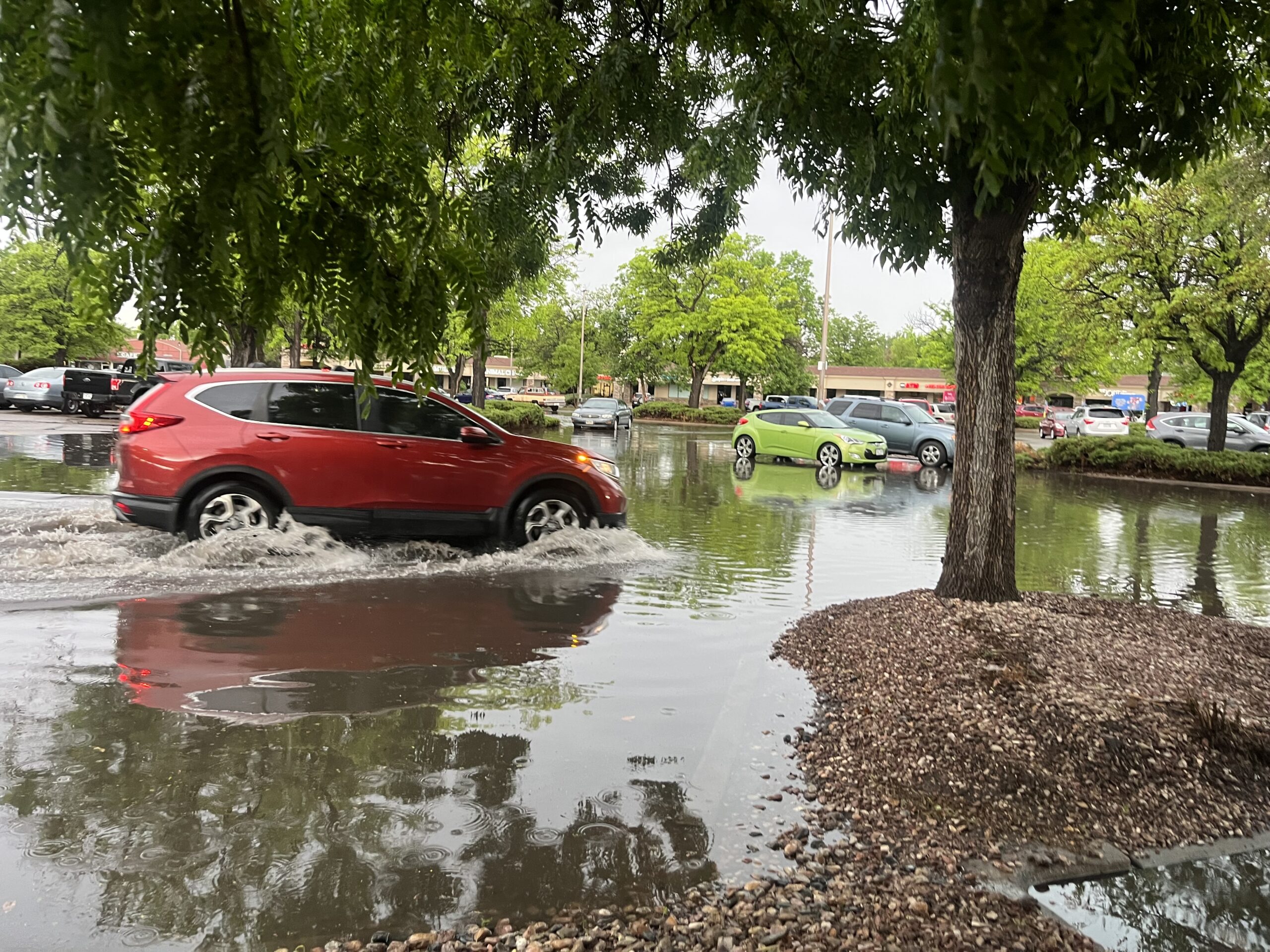
On June 5, cars in the King Soopers parking lot at Taft and Elizabeth were driving through at least 6 inches of standing water.
According to the National Weather Service, .66 inches of rain fell on June 5 at Fort Collins Airport. The historical average is 4.80.
On June 4, 1.27 inches of rain fell, still below the historical average of 4.80 inches.
Even the slightest rain can lead to flooding because of high water levels.
At noon on June 6, NOCO Alert.com sent out the following message for Western Larimer County (in the mountains):
The NWS has issued a Flash Flood Warning for Western Larimer County until 4:00 PM MDT. Locations include Kinikinik, Rustic, gulches along Highway 14 near and above Rustic, and Pingree Hill.
Rock slides and debris flows are likely from this rainfall. Drivers should be alert for rocks, mud, or flood waters on roadways. Move to higher ground now. Act quickly to protect your life.
Text LCFLOODS to 888777 for updates. Visit www.nocoalert.org to see a map of the affected areas.
Trails in various places along the Poudre River are closed due to high water, especially under overpasses.
Residents in the Western Mountains and burn areas remain on high alert.
In Livermore, the North Fork of the Poudre River is running high but not overflowing.
The 10-day extended forecast in Livermore calls for evening rain and thundershowers every night, with the heaviest rain predicted on Sunday.
Throughout Northern Colorado, extreme caution should be used around all rivers. Flash Flooding is common, especially while they are running high.
Sign up for the latest alerts, including National Weather Service and Emergency notices in your area at nocoalert.org.