

The National Weather Service has issued a winter storm WARNING for areas in Northern Colorado, including Fort Collins, Red Feather Lakes, Wellington, Loveland, Windsor and Greeley.
Accumulations of 3-5 inches along the I25 corridor are expected to start this evening and continue into early Monday morning.
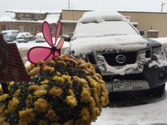
There will be mild weather today, making it an excellent time to prepare for winter’s return tomorrow. Check car tires and ensure your emergency kits, flashlights, blankets, ice scrapers, windshield washer, hoses, and water features are prepared for a freeze.
Snow will develop over the mountains and higher foothills, with rain developing and spreading south during the evening in lower elevations.
Here is the update from the National Weather Service:
…SEASON`S FIRST ACCUMULATING SNOW EXPECTED FOR THE I-25 CORRIDOR…
.A strong cold front and upper level storm system will move into
the area this evening. Temperatures will drop rapidly with the
passage of the cold front. Snow will develop over the mountains
and higher foothills, with rain developing and spreading south during
the evening in lower elevations. Temperatures will turn cold
enough for rain to change over to snow across most of the I-25
Corridor towards the midnight hour and then across the eastern
plains late Sunday night into early Monday morning.
The mild weather today would make an excellent time to prepare
for winter`s return. Check car tires and ensure your emergency
kits, flashlights, blankets, ice scrapers etc. are in place and
all ready to go. Drain outdoor sprinkler systems to protect them
from the well below freezing temperatures expected by Monday
night.
…WINTER STORM WARNING IN EFFECT FROM MIDNIGHT TONIGHT TO 3 PM
MDT MONDAY…
* WHAT…Heavy snow expected. Some secondary roads and bridges and
overpasses may become snow or slush covered. Plan on slow and
hazardous travel conditions, including during the morning
commute on Monday. Total snow accumulations of 4 to 7 inches are
expected, heaviest amounts near the foothills.
* WHERE…Fort Collins, Boulder, Denver and Castle Rock.
* WHEN…Midnight to 3 PM Monday.
* ADDITIONAL DETAILS…Scattered power outages may occur due to
heavy wet snow accumulating on trees still bearing their leaves.
PRECAUTIONARY/PREPAREDNESS ACTIONS…
A Winter Storm Warning for snow means severe winter weather
conditions are expected. If you must travel, keep an extra
flashlight, food and water in your vehicle in case of an
emergency. The latest road conditions for the state you are
calling from can be obtained by calling 5 1 1.
Hazardous Weather Outlook
...WINTER STORM WARNING FOR THE FRONT RANGE MOUNTAINS...
FOOTHILLS...AND I-25 URBAN CORRIDOR...
...WINTER WEATHER ADVISORIES FOR ADJACENT PORTIONS OF THE
NORTHEAST COLORADO PLAINS AND HIGH MOUNTAIN VALLEYS...

This hazardous weather outlook is for northeast and north central
Colorado.

.DAY ONE...Today and Tonight

An abrupt change in the weather will occur as a strong cold front
sweeps across the area early this evening. Winds will gust up to
40-50 mph with the front. Then, upslope conditions will develop
with snow spreading across the mountains and rain and snow
spreading across northeast Colorado. Several inches of snow are
expected in the mountains by sunrise, with a few inches falling
along the I-25 Urban Corridor, and up to 2 inches on the eastern
plains. Temperatures will be cold enough for roads to become snow
covered in the mountains and foothills, while in lower elevations
some slush and snow may also accumulate on roads by the Monday
morning commute, with secondary roads, bridges, and overpasses
being the most prone. Travel starting late tonight and continuing
through the Monday morning commute may be slow and hazardous.

.DAYS TWO THROUGH SEVEN...Monday through Saturday

The winter storm will remain centered over Colorado Monday
morning with gusty winds and moderate snow continuing in the
mountains and over northeast Colorado. High temperatures will
only be in the mid and upper 30s across the plains Monday
afternoon as up to a couple inches of additional snow fall. The
upper level storm system is expected to move out of the region
Monday afternoon and evening, with snowfall ending and skies
clearing out. The mostly clear skies Monday night and early
Tuesday will allow temperatures to drop to the lower 20s across
northeast Colorado. A Freeze Warning will be in effect across
northeast Colorado Monday night and Tuesday morning. Residents
should complete their winterization procedures by Sunday evening.

From Tuesday afternoon through Saturday, high pressure and warmer
west winds aloft will bring Indian Summer back to the region.

Stay tuned to the National Weather Service or your local news
media for the latest details on the upcoming winter storm.

Source - http://weather.gov
Support Northern Colorado Journalism
Show your support for North Forty News by helping us produce more content. It's a kind and simple gesture that will help us continue to bring more content to you.
BONUS - Donors get a link in their receipt to sign up for our once-per-week instant text messaging alert. Get your e-copy of North Forty News the moment it is released!
Click to Donate