

The Colorado Department of Transportation is advising travelers that hazardous driving conditions may be encountered across several regions because of a spring snowstorm advancing through the state. Heavy snow is expected through Tuesday. I-70, I-25 and foothill regions can expect snow accumulations that may impact travel from western Colorado through the central mountain and across the Front Range. Snow totals will vary greatly depending on elevation and storm track. Commercial traffic can expect chain laws to be enforced, passenger vehicles can expect traction laws in place along high mountain corridors. High winds are likely.
TRAVEL IMPACTS ACROSS THE STATE:
Travelers will encounter unsettled weather and swift-changing road conditions when traveling through all regions of Colorado.
METRO DENVER: Below 6,000 ft. elevation, snowfall accumulation should be limited. Denver and north across the Fort Collins area could see several inches of snow by Tuesday morning. Travelers along I-25 in northern Colorado should be prepared for slick spots late this evening into Tuesday morning. Drivers should be prepared for slower travel times for the morning rush hour.
I-70 MOUNTAIN CORRIDOR: The National Weather Service has a Winter Storm Warning in effect on the I-70 Mountain Corridor through Tuesday with heavy snow likely on Vail and Loveland Passes. Other high elevation areas will be affected – expect chain and traction laws with safety closures possible. Delays on Monday are expected to be connected to weather conditions rather than volume, which is predicted to be moderate. The heaviest snowfall is forecast for Monday night.
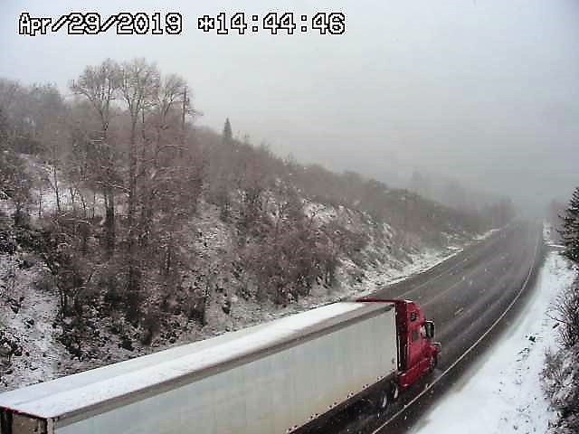
NORTHWEST COLORADO: A hazardous weather outlook has been issued for much of western
Colorado. Snow will accumulate mainly above 8500 feet with the heaviest accumulation above 10,000 feet. High mountain passes will be impacted by a few to several inches of snow accumulation with lighter accumulations and wet roads affecting other lower elevation roadways through the mountains.
SOUTHWEST & SOUTH-CENTRAL COLORADO: A Winter Weather Advisory is in effect until 6:00 p.m. Tuesday. Total snow accumulations of 8 to 14 inches are expected at 9000 ft. and above. Snow will cause travel difficulties. Expect snow-covered roads and limited visibility. Heavy rains are expected at times in lower elevations which could cause localized flash flooding especially the 416 Fire and Spring Fire burn scar areas.
SOUTHEAST COLORADO: Hazardous weather outlook for portions of central, east-central and southeast Colorado. Snow may be heavy at times over the mountains above 10,000 feet, with snow accumulations of 10 to 20 inches expected across the Eastern Sawatch and Mosquito Ranges, Pikes Peak, Palmer Divide, Northern Sangre de Cristo Mountains. Heavy rains are expected at times in lower elevations which could cause localized flash flooding especially the Spring Fire burn scar areas.
NORTHEAST COLORADO:
Hazardous weather outlook is for the northeast and north central Colorado. Winter Storm Warning for the mountains and foothills this afternoon into Tuesday. Winter Weather Advisory for High Park, Eastern Larimer and Northern Weld from noon today until Tuesday morning.
KNOW BEFORE YOU GO
Travelers are urged to “know before you go.” Gather information about weather forecasts and anticipated travel impacts and current road conditions prior to hitting the road. CDOT resources include:
-
Road conditions and travel information: www.COtrip.org
-
Sign up for project or travel alerts: bit.ly/COalerts
-
See scheduled lane closures: codot.gov/travel/scheduled-
lane-closures.html -
Connect with us on social media: Twitter @coloradodot and Facebook facebook.com/coloradodot
WHOLE SYSTEM―WHOLE SAFETY
To heighten safety awareness, CDOT recently announced its Whole System Whole Safety initiative. This project takes a systematic statewide approach to safety combining the benefits of CDOT’s programs that address driving behavior, our built environment and the organization’s operations. The goal is to improve the safety of Colorado’s transportation network by reducing the rate and severity of crashes and improving safety conditions for those traveling by all transportation modes. The program has one simple mission – to get everyone home safely.
ABOUT CDOT
CDOT has approximately 3,000 employees located throughout Colorado, and manages more than 23,000 lane miles of highway and 3,429 bridges. CDOT also manages grant partnerships with a range of other agencies, including metropolitan planning organizations, local governments, and airports, and administers Bustang, the state-owned and operated inter-regional express service. Gov. Jared Polis has charged CDOT to further build on the state’s inter-modal mobility options.