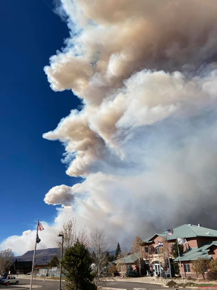
At approximately 10 am on October 20, the East Troublesome Fire was reported at 125,602 acres. At around noon, Larimer County ordered mandatory evacuations of portions of Estes Park.
The East Troublesome Fire started on October 14 at 4:00 pm north of Parshall, Colorado. This fire was burning at an elevation of 9,500 ft., in sage and grass on south-facing slopes in a portion of the Arapaho National Forest managed by the Medicine Bow-Routt National Forests near the Parks Ranger District and Sulphur Ranger District. The fire moved East quickly through the Grand Lake area and Rocky Mountain National Park.
Rocky Mountain National Park is closed.

There have been unconfirmed reports to North Forty News that structures in the Estes Park area are burning.
A video on Facebook showed cars lined up all the way down Highway 34 from Estes Park.
From NOCO Alert on 10/22 at 12:30 pm:
This is the Larimer County Sheriff’s Office with an emergency message. The East Troublesome Fire officials have ordered Mandatory evacuations for Estes Park with the following boundaries: north border of Fall River Road, south border of Highway 36, west border of Elm Road, and the east border of Wonderview. Mandatory Evacuations have been ordered for residents and business occupants in the area due to immediate and imminent danger. Evacuate the area immediately and as quickly as possible. Do not delay leaving to gather belongings or make efforts to protect your home or business. Evacuating immediately not only supports your safety but also allows emergency crews better access to the area. For questions about the evacuations, please call the Joint Information Center at 970-980-2500. For text updates, text the word TFIRE to 888777 from your cell phone. We will communicate information to that keyword as needed. To view a map of the evacuation areas, please visit nocoalert.org. Please do not call 9-1-1 unless you are in danger. Thank you.
Evacuation Map
From NOCO Alert on 10/22 at 12:18 pm:
This is the Larimer County Sheriff’s Office with upgraded evacuation information. The East Troublesome Fire officials have ordered mandatory evacuations for the western part of Rocky Mountain National Park and much of the west side of the Estes Park area. This area includes the Rocky Mountain National Park west entrance, Moraine Park, Estes Park Campground, the southern part of Highway 7 north to Marys Lake, Peak View Drive including the Aerial Tramway and north to include Deer Ridge. Mandatory Evacuation has been ordered for residents and business occupants in the area due to immediate and imminent danger. Evacuate the area immediately and as quickly as possible. Do not delay leaving to gather belongings or make efforts to protect your home or business. Evacuating immediately not only supports your safety but also allows emergency crews better access to the area. For questions about the evacuations, please call the Joint Information Center at 970-980-2500. For text updates, text the word TFIRE to 888777 from your cell phone. We will communicate information to that keyword as needed. To view a map of the evacuation areas, please visit nocoalert.org. Please do not call 9-1-1 unless you are in danger. Thank you.
From NOCO Alert on 10/22 at 11:43 am:
This is the Larimer County Sheriff’s Office with an emergency message. The East Troublesome Fire officials have ordered voluntary evacuations for the western part of Rocky Mountain National Park and much of the west side of the Estes Park area. This area includes the Rocky Mountain National Park west entrance, Moraine Park, Estes Park Campground, the southern part of Highway 7 north to Marys Lake, Peak View Drive including the Aerial Tramway and north to include Deer Ridge. Voluntary evacuations are advised for residents and business occupants if they are concerned for their safety, feel they need additional time to exit the area or have health conditions that may be aggravated by this incident. You are encouraged to move livestock and pets out of the area and to prepare for mandatory evacuations. Please use Highway 34 eastbound to leave the area. For questions about the evacuations, please call the Joint Information Center at 970-980-2500. For text updates, text the word TFIRE to 888777 from your cell phone. We will communicate information to that keyword as needed. To view a map of the evacuation areas, please visit nocoalert.org. Please do not call 9-1-1 unless you are in danger. Thank you.
Support Northern Colorado Journalism
Show your support for North Forty News by helping us produce more content. It's a kind and simple gesture that will help us continue to bring more content to you.
BONUS - Donors get a link in their receipt to sign up for our once-per-week instant text messaging alert. Get your e-copy of North Forty News the moment it is released!
Click to Donate


