

Blaine Howerton
As spring break looks for schools, Northern Colorado is bracing for what could be the biggest snowstorm in nearly 10 years. Weather forecasters are predicting what could be the heaviest snow in 9 years.
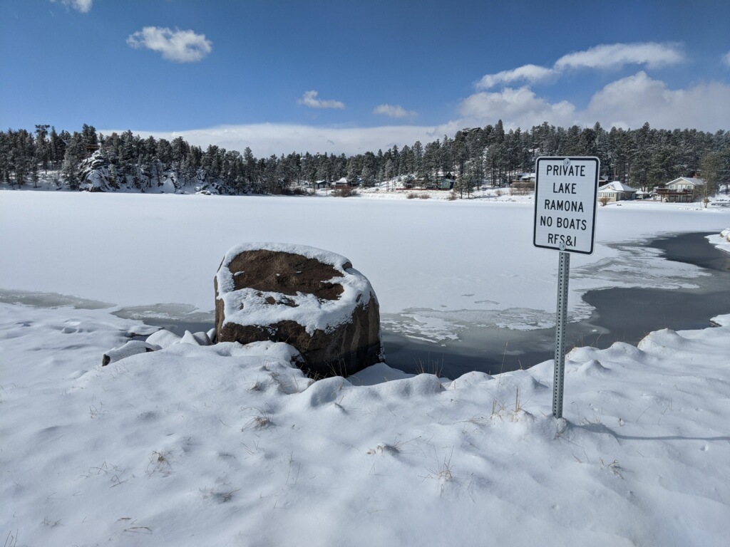
Overnight, about an inch of snow fell in red feather lakes, covering Lake Ramona. In Fort Collins, a drizzle covered streets and parking lots.

What does this mean for the weekend?
The national weather service reports that more than 3 ft of snow will fall in certain areas in the Northern Colorado mountains. The snow will begin on Friday and continue through the weekend.
Accumulation will be heaviest in the mountains east of the divide, with the heaviest snow in the southern mountains near Pueblo.
A winter weather advisory has been issued by the National Weather Service and is as follows:
“HEAVY SNOW ON TRACK FOR NORTHEAST COLORADO THIS WEEKEND…
This hazardous weather outlook is for northeast and north-central Colorado.
DAY ONE…Today and Tonight
Rain and snow across northern Colorado early this morning will lift northeast of the state. Roads may be slick in places early this morning, especially towards the Wyoming border. Additional snow showers are expected in the mountains through early evening. The stronger showers could produce a quick inch or two of snow and
create slippery conditions. Gusty downslope winds develop east of the mountains this afternoon with gusts to 40 mph, mainly along and south of Interstate 70. Critical fire weather conditions are expected across Lincoln county and to the south and east, where it will be very dry in addition to the gusty winds.
DAYS TWO THROUGH SEVEN…Thursday through Tuesday
Snow showers will be possible in the mountains and foothills Thursday and Thursday night with light accumulations. Snow showers will be more widespread on Friday, but accumulations will still be light and more confined to the mountains and foothills.
A significant storm system is still on track to bring widespread snowfall to northeast Colorado Friday night through the weekend. Snowfall amounts across the urban corridor and foothills will be between 1 to 3 feet, with potentially higher amounts in the northern foothills. Snowfall amounts will be much lighter west of the Continental Divide. There remains a high degree of uncertainty regarding snow amounts across the eastern plains, especially farther south. Travel across the urban corridor and foothills may become nearly impossible Saturday evening through much of Sunday. According to the National Weather Service, the snow will wind down late Sunday night and into Monday,” according to the National Weather Service.
For more information regarding the National Weather Service and the winter weather advisory, visit https://forecast.weather.gov/showsigwx.php?warnzone=COZ037&warncounty=COC093&firewxzone=COZ214&local_place1=3%20Miles%20SSW%20Wilkerson%20Pass%20CO&product1=Hazardous+Weather+Outlook&lat=39&lon=-105.55#.YEj9XS1h1hE.