

By Blaine Howerton | NorthFortyNews.com
If you’ve been holding off on packing away the snow boots — good call. Today (Sunday, April 13), a spring cold front is sweeping across Northern Colorado, bringing with it a chilly reminder that winter isn’t quite ready to let go in our foothills and higher elevations.
As I checked the latest data from the National Weather Service and CSU’s weather station, one thing stood out: 2 to 4 inches of snow is likely this afternoon and evening in places like Red Feather Lakes, Bellvue, and Livermore. That’s no small amount for mid-April, and it could cause slick roads and limited visibility for those traveling in or out of the mountains.

Here in Fort Collins, Loveland, Windsor, and surrounding towns, rain is expected to develop later today. By nightfall, we might even see some of that precipitation mix with snow, especially in the northern neighborhoods or if heavier bands move through. Winds will be steady from the east, gusting up to 20 mph, and temperatures will top out near 57°F before dropping to around 33°F tonight.
Tomorrow (Monday) should bring a bit of relief. The forecast looks clear and calm, with sunny skies and highs near 60°F. Then on Tuesday, we get a taste of spring again with sunshine and a high around 72°F. If you’re itching to get into the garden or hit the trails, Tuesday’s the day to do it.
Still, let’s not underestimate today’s system. According to the Hazardous Weather Outlook from NOAA, snow accumulation could lead to slushy and snow-covered roads in the foothills, especially under stronger snow bands. If you’re headed west or north this afternoon, drive cautiously and consider delaying travel.
3-Day Weather Forecast for Northern Colorado
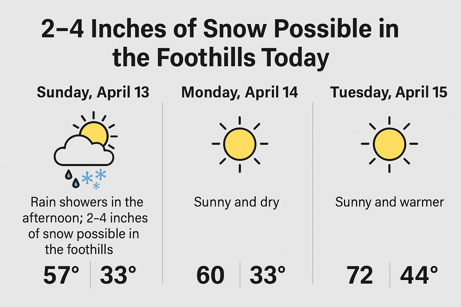
Sunday, April 13:
A cold front has rolled into Northern Colorado, and with it comes a chance for 2–4 inches of snow in the foothills and mountain communities like Red Feather Lakes, Bellvue, and Livermore. In Fort Collins, Loveland, Windsor, and Wellington, rain showers are expected this afternoon and evening, with temperatures peaking around 57°F. Winds from the east at 10–20 mph will make it feel cooler. Late tonight, some lower elevations may see a mix of rain and snow, especially under heavier precipitation bands. Low: 33°F.
Monday, April 14:
Skies will clear across the region, bringing a return to dry and sunny conditions. High temperatures will reach the low 60s, and wind will be light. Expect a crisp overnight low around 33°F. A calm, comfortable spring day across all of Northern Colorado.
Tuesday, April 15:
Spring warmth continues with sunshine and highs reaching 72°F. This will be the nicest day of the stretch — perfect for outdoor activity. Overnight will be partly cloudy with lows dipping to around 44°F.
Hazardous Weather Outlook
From the National Weather Service:
- 2–4 inches of snow expected in mountain and foothill zones today, especially under snow bands.
- Precipitation will begin as rain at lower elevations, with snow mixing in tonight.
- Watch for slick, snow-covered roads in elevated areas.
- After today, the region will see dry and calm weather through midweek.
Read the full outlook here:
👉 NOAA Hazardous Weather Outlook